
Constraining the Spatial Distribution of Snowpack Properties of the Kahiltna Glacier and Begguya Plateau in Denali National Park, Alaska, USA
Expedition Location: Denali National Park, Alaska
Expedition Dates: June 8, 2023 – July 14, 2023
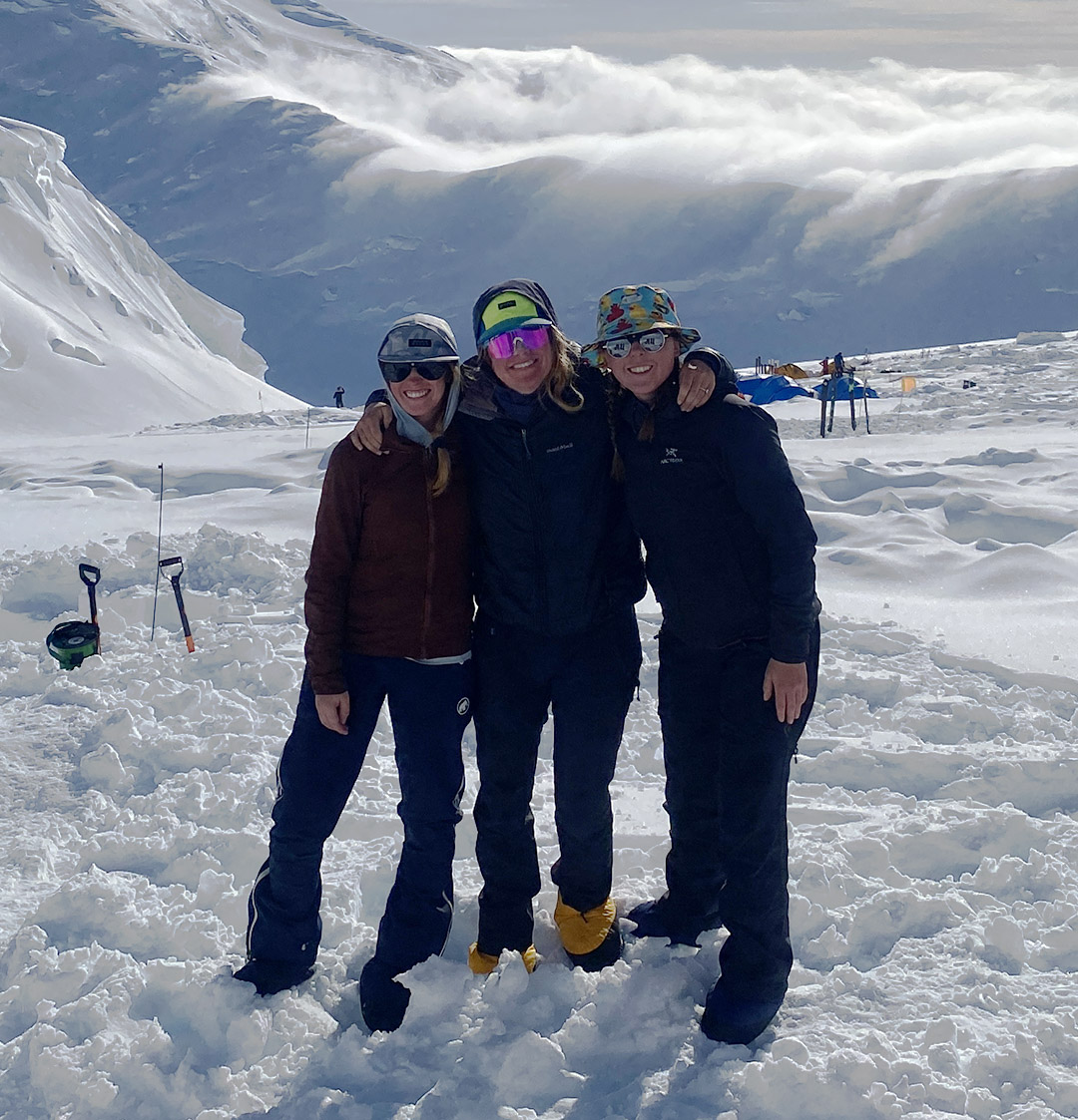
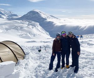
Field Team Members: Keegan Bellamy (MS Student, UMaine), Emma Erwin (PhD student, UMaine), Claire Bicknell (BS Student, Alaska Pacific University)
Funding Support: The Robert and Judith Sturgis Family Foundation
Research Background:
This project expands previous geophysical studies conducted in Denali National Park (DNP), on the Kahiltna Glacier and Begguya (Mt. Hunter) summit plateau to improve mass balance estimates and provide a unique high-altitude dataset for comparison to other snowpacks across Alaska and Canada. Globally, glaciers are exhibiting significant decreases in mass balance, losing more mass than they are gaining through accumulation (Arendt et al., 2002). This is especially true in Alaska and western Canada, where glaciers are more sensitive to shifts in annual mean air temperature and precipitation regimes in response to climate forcing and are contributing more to sea level rise than all other mountain glacier systems globally (Arendt et al., 2022; Zemp et al., 2019; Larsen et al., 2007). The Kahiltna Glacier provides one of the greatest elevation ranges of any mountain glacier on Earth (300 to 4,300 meters above sea level (m a.s.l.)), offering a phenomenal opportunity to observe spatial variations in snowpack properties from high in the dry snow zone down to the lower wet snow zone. Previous baseline mid- to high-frequency (40-900 MHz) common-offset ground-penetrating radar (CO GPR) surveys conducted on the Kahiltna Glacier and Begguya Plateau from 2008-2014 and 2022 provide the foundation for this research (Campbell et al., 2012a, 2012b; Winski et al., 2012). Field teams were able to characterize discrete layering through the dry (>3,900 m a.s.l.), and percolation zones (~2,800-3,900 m a.s.l.) but not the wet snow zones (<2,800 m a.s.l.) within DNP (Campbell et al., 2012a, 2012b). These wet zones contain significant liquid water content compared to dry snow zones and thus alter the GPR signal returns. The goal of this project is to further constrain the spatiotemporal variability and distribution of snowpack properties (e.g. density, water content, and snow water equivalent) of the Kahiltna Glacier and Begguya Plateau.
Expedition Report:
Fieldwork was conducted on the Kahiltna Glacier and Begguya (Mt. Hunter) summit plateau located within Denali National Park, Alaska. The study locations require access via Talkeetna Air Taxi’s ski planes and the National Park Service (NPS) helicopter, specifically equipped for high altitude flying, from the nearby town of Talkeetna. Our team traveled to Denali Base Camp (2,194 m a.s.l.) on June 14th via ski plane. The Kahiltna Glacier hosts the West Buttress Route, which sees over 1,000 climbers attempting to summit Denali each year (National Parks Service, 2021). We met many of these climbers as we traversed the lower half of the West Buttress to Denali Camp II (3,352 m a.s.l.) to acclimatize for our time on the Begguya plateau. After waiting out numerous storms for over a week at Camp II, we received word from NPS to traverse back to Base Camp for our flight to Begguya. Our traverse back to Base Camp was met with even more storms, resulting in our team remaining tent-bound at Kahiltna Pass for two days. We waited at Base Camp for a few days before flying to Begguya (3,962 m a.s.l.) with the NPS helicopter on July 1st. On the plateau, we faced a series of consistent and powerful storms that required significant time to maintain camp, rather than conducting research. We were on the plateau for eight days before a short weather window allowed NPS and Talkeetna Air Taxi to extract us from the plateau and fly back to Talkeetna on July 9th. The remainder of our time in Talkeetna and Anchorage was spent recovering, preparing, cleaning, and conducting repairs on gear damaged during the storms prior to shipment.
In total, our team was in the field for 27 days and were only able to safely conduct science for five of those days (including the two days traversing to Kahiltna Pass). We endured several large storms with high winds, heavy snowfall, and freezing rain and spent most days maintaining camp, shoveling snow, and recovering from camp maintenance due to the altitude.
Methods:
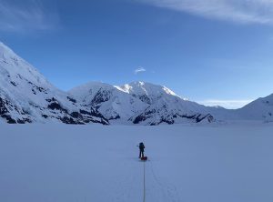
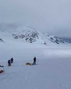
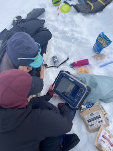
Due to unfortunate circumstances regarding equipment procurement, we were unable to perform geophysics surveys as originally proposed using a 500 MHz multi-offset GPR system on the Kahiltna Glacier. Alternatively, we deployed a shallow (900 MHz) GPR system to complete a geophysics survey from Base Camp (2,194 m a.s.l.) to Kahiltna Pass (2,895 m a.s.l.). The system was hosted on a plastic sled provided by Talkeetna Air Taxi and was towed behind me as we skied along the centerline of the Kahiltna, adding an additional ~40 lbs to an already loaded sled. Despite many challenges along the way, we were successful in collecting sufficient radar data from the Kahiltna traverse that may be used to better characterize the wet snow zone (<2800 m a.s.l.). In addition, once arriving at Camp I on our descent to Base Camp, we realized our cache was nowhere to be found. Using GPS coordinates of the cache location, we deployed the GPR system, which allows us to visualize the upper ~20m of the glacier surface, probes, and dug several pits over a few hours in an attempt to locate the cache. Although the search yielded no results and we were unable to locate the cache (likely extracted by a different climbing team), our team remained positive and saw this as a fun, interactive, and interesting way of using our scientific tools for non-science related activities.
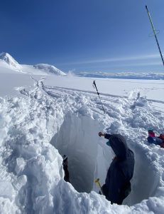
Upon arrival to Begguya, we excavated a 4.15 m deep snow pit at the location of the 2013 Denali ice core site to conduct snow density measurements. However, high winds and heavy snowfall from a storm filled the snow pit overnight and we were unable to collect density measurements. In addition, unfortunately, the sheer number and magnitude of storms severely limited our ability to safely conduct science and we were unable to collect any of the proposed GPR data on the plateau.
Acknowledgements:
This expedition would not have been possible without the support, assistance, and care of Emma Erwin (PhD student, UMaine) and Claire Bicknell (BS Student, Alaska Pacific University). Their positive attitudes and endurance made a huge difference during the many storm days in the tent. Talkeetna Air Taxi staff and Denali National Park rangers and pilots were critical in making this project happen. Funding for this project was generously provided by the Robert and Judith Sturgis Family Foundation, the Cold Regions Research and Engineering Laboratory, American Alpine Club and the University of Maine Graduate Student Government.
References:
Arendt, A. A., Echelmeyer, K. A., Harrison, W. D., Lingle, C. S. and Valentine, V. B.. (2002). Rapid Wastage of Alaska Glaciers and Their Contribution to Rising Sea Level. Science, 297(5580), 382-286. doi:10.1126/science.1072497
Campbell, S., Kreutz, K., Wake, C., Osterberg, E., Arcone, S., Introne, D., Winski, D. and Volkening, K. (2012a). Flow dynamics of an accumulation basin: A case study of the upper Kahiltna Glacier on Mount McKinley, Alaska. J. Glaciol., 58(207), 185-195. doi:10.3189/2012JoG10J233
Campbell, S., Kreutz, K., Wake, C., Osterberg, E., Arcone, S., Winski, D. and Volkening, K. (2012b). Melt regimes, internal stratigraphy, flow dynamics, and glaciochemistry of three glaciers in the Alaska Range. J. Glaciol., 58(207), 99-109. doi:10.3189/2012JoG10J238
Larsen, C. F., Motyka, R. J., Arendt, A. A., Echelmeyer, K. A. and Geissler, P. E. (2007). Glacier changes in southeast Alaska and northwest British Columbia and contribution to sea level rise. J. Geophysical Research, 112(F01007), 1-11. doi:10.1029/2006JF000586
National Park Service. (2021, December 31). Annual mountaineering summaries: 2020-Current. Retrieved from Annual Mountaineering Summaries 2020s – Denali National Park & Preserve (U.S. National Park Service) (nps.gov)
Winski, D., Kreutz, K., Osterberg, E., Campbell, S. and Wake, C. (2012). High-frequency observations of melt effects on snowpack stratigraphy, Kahiltna Glacier, Central Alaska Range. Hydrol. Process., 26, 2573-2583. doi: 10.1002/hyp.9348
Zemp, M., Huss, M., Thibert, E., Eckert, N., McNabb, R., Huber, J., Barandun, M., Machguth, H., Nussbaumer, S. U., Gartner-Rover, I., Thomson, L., Paul, F., Maussion, F., Kutuzov, S. and Cogley, J. G. (2019). Global glacier mass changes and their contributions to sea-level rise from 1961 to 2016. Nature, 568, 382-386. doi: 10.1038/s41586-019-1071-0