
Sunshine (finally) in the Arctic: Exploring Greenland’s Crevasses at Raven Camp
Sunshine (finally) in the Arctic: Exploring Greenland’s Crevasses at Raven Camp
Field Team Members: Jessica Scheick and Stephanie Mills
Location: Greenland
Dates: 2-5 August 2014
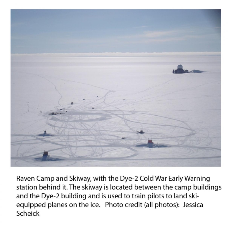
This trip marks the continuation of an investigation by graduate student Jessica Scheick and advisor Gordon Hamilton of the cause of several cracks that appeared across the Raven Skiway (a landing strip on the Greenland Ice Sheet for ski-equipped planes) in July 2012. These cracks appeared during a summer of unprecedented melt and pose potential hazards to safe field logistics and may provide a mechanism for water to reach the bed and cause additional dynamic changes to ice flow, increasing the contribution of the Greenland Ice Sheet to sea level rise. This project aims to help us better understand the reasons for the formation of these cracks and whether or not we might expect to see cracks forming farther inland than has previously been observed. Additional information on earlier fieldwork efforts that are part of this project can be found on the Polar Field Services “Field Notes” blog pages, linked within the text below.
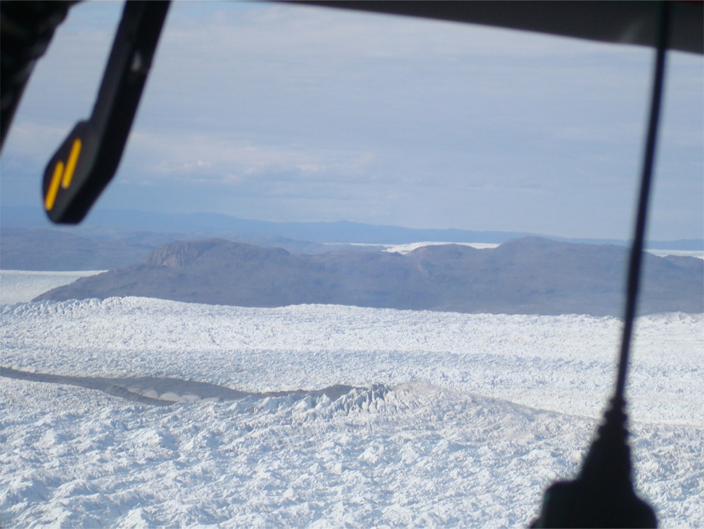
Last July, we returned to Kangerlussuaq, Greenland to continue collecting the data needed to investigate the cause of a series of cracks that appeared across the Raven Camp Skiway in July of 2012.
Fieldwork for the project began in August 2012 (http://polarfield.com/blog/investigating-greenland-crevasses-raven-camp/), when we set up a strain grid, composed of a series of markers that were installed and surveyed, in the area around the Raven Skiway. Throughout the summer of 2013, we made several more trips to install and survey (using global position system (GPS) receivers) additional markers between Raven Camp and the margin of the ice sheet (http://polarfield.com/blog/life-margin-exploring-greenland-crevasses-raven-camp/). These additional points expanded the Raven Camp strain grid installed in 2012 to provide broader scale information on the ice flow patterns in the region. Unfortunately, bad weather during the final leg of the 2013 fieldwork meant we couldn’t get to Raven Camp to resurvey the markers there, so a return trip had to be planned for the following summer. Without resurveying the markers, we would be unable to complete our analysis: in order to investigate whether the ice is flowing downstream fast enough to pull away from the ice upstream and form cracks (think about pulling pizza dough apart quickly, rather than slowly stretching it), we need to know how quickly it is moving in at least two locations. This requires knowing the location of our markers on the ice at multiple times (if you know what time you left your house and what time you got to your friend’s house, and how far apart they are, you can estimate your average travel speed between the two houses).
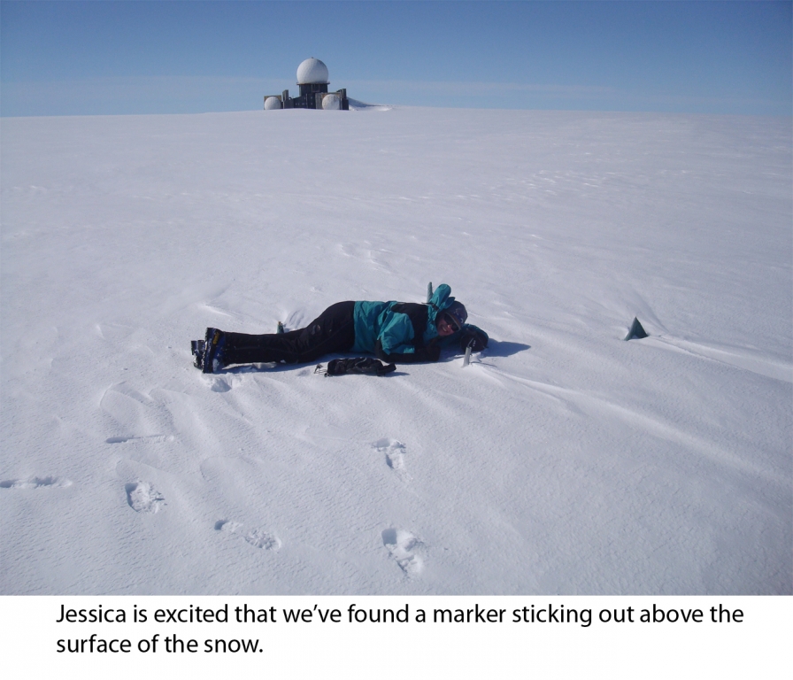
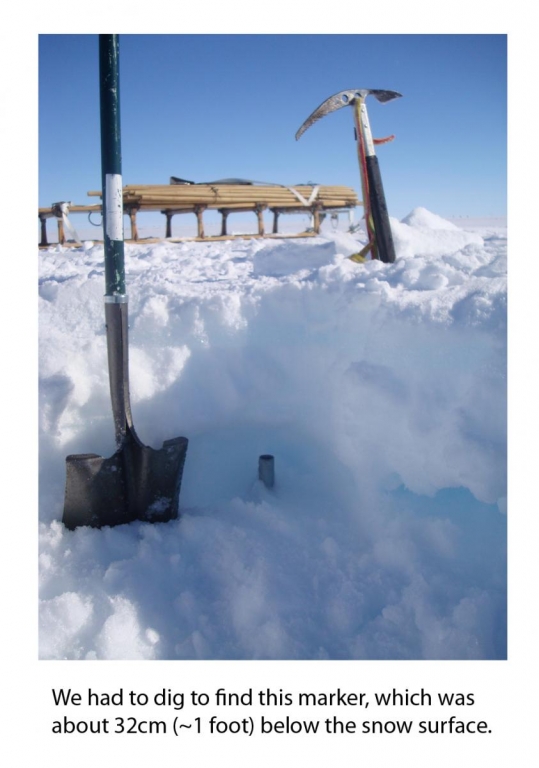
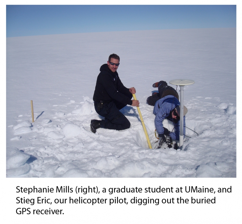
In July 2014, we returned once again to Kangerlussuaq and Raven Camp. Because almost two years had elapsed since we originally installed the markers at Raven Camp, we were not sure if we would be able to find the markers at all due to the accumulated snowfall. Luckily, we found most of them, though a few required some digging to expose.
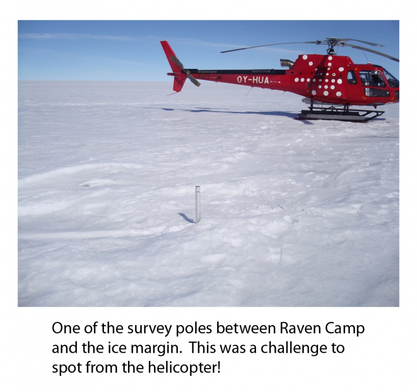
We took advantage of the clear skies during this trip to resurvey some of the points located between Raven Camp and the margin of the ice sheet, as well as locate and dig up a GPS receiver that had spent the winter in Greenland because we’d been unable to recover it the previous summer.
Now, back at UMaine, we are hard at work processing the data we’ve collected and using it to better understand why the cracks formed across the Raven Skiway and whether or not it will be safe to continue landing planes on the ice at Raven Camp.
This research is funded by a National Science Foundation Grant ARC-1339465.