
Archaeological and Glacial Geologic Investigations of the Nevado Coropuna, Peru
Archaeological and Glacial Geologic Investigations of the Nevado Coropuna, Peru
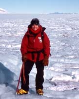
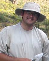
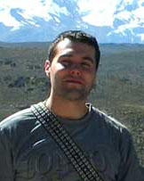
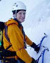
Kurt Rademaker, Gordon Bromley, Claire Todd and Louis Fortin
May 16, 2006 to July 15, 2006
| This project seeks to better understand links between climate change, the glacial history of the tropical Andes, and the initial human settlement of South America. At the end of the last ice age some 13,000 years ago, early foragers called Paleoindians were first entering South America, one of the last continents on earth to be permanently inhabited by people. This was an exceptionally dynamic time characterized by major environmental transformations: climate patterns were shifting, glaciers were in retreat, and the distribution of plant and animal communities was changing rapidly. How did these early settlers successfully adapt to such changes and rapidly colonize a continent of productive coasts, the rugged Andes Mountains, and the vast Amazon? |
| Our 2005 Churchill-funded expedition to the Nevado Firura, a 5,499 m high, glaciated volcano, discovered numerous archaeological sites on and among glacial landforms. These sites are possibly the world’s highest elevation Paleoindian settlements. We mapped and sampled glacial deposits of the Nevado Firura in order to reconstruct glacier extent at the time of this early occupation. Our findings validated the Paleoindian coast-highland link and demonstrated that glacier margins can be highly productive environments with abundant water, flora, and fauna – and that periglacial environments may have been vital for the success of Paleoindian populations, just as they are important to Andean peasant communities today. It therefore follows that late-Quaternary ice-marginal zones form a logical starting point for our investigation into early human land-use behavior in the central Andes. |
Understanding the relationship between the contemporary early highland and coastal sites, as well as addressing the question of initial migration, will require additional archaeological work between the highland and coastal locales to “connect the dots.”
Glaciers are sensitive climate indicators, waxing and waning in response to temperature and precipitation fluxes. A record of glacier fluctuation can therefore be used to determine both the timing and magnitude of climate-change events. To reconstruct former glacier extent on Nevado Coropuna we will map the distribution, elevation, and morphology of moraines, drift sheets, erratics and erosional features onto 1:20,000 scale aerial photos. Hand-dug pits will allow sedimentologic and stratigraphic characterization of each unit. We will correlate moraines by position, soil development and physical weathering characteristics of internal and surficial clasts. In addition, we will use a Dutch corer to extract sediment cores from local bogs in order to obtain minimum ages for glaciation. The glacial geologic mapping will be used in close conjunction with the surface-exposure program to ensure careful sampling of moraines and erratics.
Our 2006 research offers an exciting opportunity to explore the relationships between climate and environmental change and the initial Paleoindian settlement of South America at the end of the last ice age. Moreover, our interdisciplinary approach will enable us to pool logistical resources and labor to continue cooperative fieldwork in this remote area of the central Andes.
Archaeological and Glacial Geologic Investigations of Nevado Coropuna, Peru Project Page
Dan and Betty Churchill Exploration Fund
Archaeological and Glacial Geologic Investigations of Nevado Coropuna, Peru
Gordon Bromley, Kurt Rademaker, Sean Birkel and Louis Fortin
The proposed interdisciplinary project “Archaeological and Glacial Geologic Investigations of Nevado Coropuna, Peru” seeks to better understand links between climate change, the glacial history of the tropical Andes, and the initial human settlement of South America. At the end of the last ice age some 13,000 years ago, early foragers called Paleoindians were first entering South America, one of the last continents on earth to be permanently inhabited by people. This was an exceptionally dynamic time characterized by major environmental transformations: climate patterns were shifting, glaciers were in retreat, and the distribution of plant and animal communities was changing rapidly. How did these early settlers successfully adapt to such changes and rapidly colonize a continent of productive coasts, the rugged Andes Mountains, and the vast Amazon?
Sites such as Quebrada Jaguay, Peru, excavated in the 1990s by a UMaine team suggest that Paleoindians were settling the coast very early, taking advantage of rich Pacific fisheries. Obsidian (volcanic glass) artifacts found at Quebrada Jaguay were geochemically sourced to the Alca obsidian source, located some 100 miles to the north in the Peruvian highlands. This finding indicates contact between the coast and highlands during the period of earliest human settlement. As the only substantiated link of its kind in South America, the Alca connection offers the chance to evaluate competing models of initial migration. It is likely that the inhabitants of Quebrada Jaguay were highly mobile, moving seasonally between the coast and the highlands, and therefore additional Paleoindian sites should be located adjacent to the Alca obsidian source.
Our 2005 Churchill-funded expedition to the Alca source and Nevado Firura, a 5,499 m high, glaciated volcano, discovered numerous archaeological sites on and among glacial landforms. These sites are possibly the world’s highest elevation Paleoindian settlements. We mapped and sampled glacial deposits of the Nevado Firura in order to reconstruct glacier extent at the time of this early occupation. Our findings validated the Paleoindian coast-highland link and demonstrated that glacier margins can be highly productive environments with abundant water, flora, and fauna – and that periglacial environments may have been vital for the success of Paleoindian populations, just as they are important to Andean peasant communities today. It therefore follows that late-Quaternary ice-marginal zones form a logical starting point for our investigation into early human land-use behavior in the central Andes.
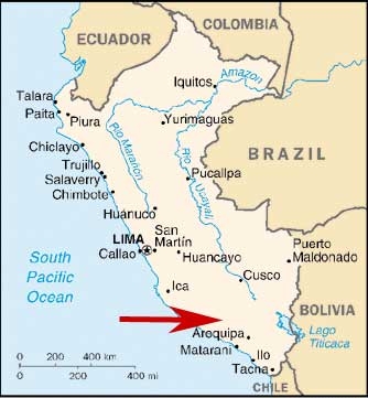
Understanding the relationship between the contemporary early highland and coastal sites, as well as addressing the question of initial migration, will require additional archaeological work between the highland and coastal locales to “connect the dots.” Kurt’s Ph.D. work over the next few years will target the entire corridor between Quebrada Jaguay and the early highland sites to examine patterns of Paleoindian mobility and subsistence at the end of the last ice age. The first step will be to conduct an archaeological survey of the extensive periglacial zone surrounding Nevado Coropuna, a 6,431 m high, glaciated stratovolcano located directly between the Alca source and Quebrada Jaguay. This research would be impractical without a more thorough understanding of late-glacial climatic shifts, fluctuating glacial margins on Nevado Coropuna, and rapid transformations of ecological communities in the surrounding environment. We propose to utilize glacial geology to reconstruct changes in glacier extent on Nevado Coropuna since the last glacial maximum (LGM) and to date these changes accurately using surface-exposure and radiocarbon methods.
Glaciers are sensitive climate indicators, waxing and waning in response to temperature and precipitation fluxes. A record of glacier fluctuation can therefore be used to determine both the timing and magnitude of climate-change events. This geologic-dating program, which will form an integral part of Gordon’s Ph.D. work, also has the potential to answer key questions in tropical climatology: when did the LGM occur in the tropical Andes? What was the magnitude of atmospheric cooling at the LGM? Was deglaciation in the tropics punctuated by a climatic reversal contemporaneous with the Younger Dryas of the North Atlantic?
Nevado Coropuna is an ideal candidate to address these questions, as well. First, during the 2005 field season we observed an abundance of striking, well-preserved glacial deposits on the volcano. Second, because paleoclimate data from the arid tropics are extremely scarce, this record from the western Andes will form a valuable contribution to the tropical dataset. Third, in anticipation of forthcoming ice-core data from Nevado Coropuna, our study will enable direct comparison of ice-core and glacial geologic data from a single site.
To reconstruct former glacier extent on Nevado Coropuna we will map the distribution, elevation, and morphology of moraines, drift sheets, erratics and erosional features onto 1:20,000 scale aerial photos. Hand-dug pits will allow sedimentologic and stratigraphic characterization of each unit. We will correlate moraines by position, soil development and physical weathering characteristics of internal and surficial clasts. In addition, we will use a Dutch corer to extract sediment cores from local bogs in order to obtain minimum ages (14C) for glaciation. The glacial geologic mapping will be used in close conjunction with the surface-exposure program to ensure careful sampling of moraines and erratics.
We will obtain rock samples from glacial landforms for Neon cosmogenic exposure age dating, the appropriate dating method for the local lithology. Forty rock samples should reveal trends in moraine ages and identify erroneous results. Radiocarbon samples collected from excavations and sediment cores will be used to cross-check Neon dates and provide minimum and maximum ages for glacial episodes. Cosmogenic and radiocarbon samples will be prepared at the University of Maine and analysed at Purdue University’s PRIME Lab and the University of Arizona NSF Lab, respectively.
To continue our search for early archaeological sites in the central Andes we will conduct a survey of caves, rock shelters, and other likely habitation areas in the periglacial zone. This work will identify likely locations for more extensive sub-surface excavations in succeeding field seasons, which will ultimately enable us to examine patterns of prehistoric settlement, subsistence, and mobility through the late glacial interval. The distribution of archaeological sites will also provide an additional line of evidence to help us reconstruct post-LGM environmental changes around Nevado Coropuna.
Our proposed 2006 research offers an exciting opportunity to explore the relationships between climate and environmental change and the initial Paleoindian settlement of South America at the end of the last ice age. Moreover, our interdisciplinary approach will enable us t o pool logistical resources and labor to continue cooperative fieldwork in this remote area of the central Andes. Thank you very much for considering our research proposal.
This itemized budget includes all field work costs for Gordon Bromley, Kurt Rademaker, Sean Birkel, and Louis Fortin from May 15 to June 29. Roundtrip airfare for Kurt Rademaker is provided by a National Science Foundation grant (Dr. Dan Sandweiss, Principal Investigator). Roundtrip airfares for Gordon Bromley and Sean Birkel are provided by grants from the Geological Society of America and the UMaine Association of Graduate Students, respectively. We have applied for additional funding to cover laboratory sample preparation and analyses from the Geological Society of America, Sigma Xi, and the UMaine Association of Graduate Students.
Journal Entries
22nd May 2006
| 22nd May 2006 | Our outfitter, Saul Ceron, woke us early this morning with news of an impending strike by Arequipa?s taxi drivers and certain gridlock in the city today. So we left for Coropuna somewhat in a hurry and were crossing the desert outside Arequipa by breakfast time. The drive to Coropuna is long ? eight hours or so ? and in places very rough. The road descends into the second-deepest canyon in the world, the Majes, and then rises up in a long series of unpaved switchbacks to the plateau edge at 4300 m above sea level. En route is a park dedicated to the local discovery of fossilised dinosaur bones and footprints and so, braving swarms of biting flies, we stopped to tour this attraction which features life-sized models of a Diplodocus and a Megalosaurus. Once on the plateau, the glaciated mass of Coropuna, turning pink in the sunset, dominates the horizon to the northeast. Another three hours of extremely bumpy driving brought us to the small herding station of Mauca Llacta, our home for the night and starting point for the walk in to Coropuna.After three days of soft beds, fine cuisine, and leisurely living in Arequipa, Mauca Llacta is a wake-up call to what life in Peru is really like. The houses are single storey, constructed from adobe or concrete, with no electricity or water (water is collected from a small stream). The diet of the station?s inhabitants is meagre – alpaca meat, potatoes, and occasional fruit brought up from the canyons below ? and, consequently, the people of Mauca Llacta are relatively small and thin, yet they are still some of the most industrious and helpful people I?ve met anywhere. Señor Ermitanio HH, our mule driver from last year, lives here and we hope to find him tomorrow to arrange some mules (called ?burros?) for our work this year. Tonight, however, we are staying in a small concrete barn behind the town?s medical centre. It is dusty and really cold in here but serves to keep the wind and prowling dogs at bay. |
|---|---|
| 25th May 2006 | Today, we established our camp at 4800 m in a beautiful glacial valley on the north side of Coropuna. With the bulk of our gear carried by four ill-tempered burros and being successfully acclimatised to the altitude, the walk took only about three hours. We?re camped in an old corral on the edge of the valley bottom and, though the sun leaves it early in the day, it is sheltered from the wind and enjoys a lovely view of Coropuna. For dinner tonight we made a wonderful curry (it?s best to use vegetables quickly as the constant freezing and thawing turns them to mush within a few days) which is keeping us quite warm even though the temperature is dropping quickly. During the daytime, when the sun is strong, our camp is warm and life is good, but once the sun sets it?s a very different story: the bog freezes, frost forms on the inside of the tents, and even a hot fire is barely sufficient to keep us up much after 8pm. Fortunately, Claire has down boots which she slips on in the evening and I?ve got a huge down jacket that should keep me toasty for the next four weeks. |
| 30th May 2006 | Success and failure frequently come together. Today, we found a treasure trove of well-situated organic material to collect for radiocarbon dating (success) but rendered our coring equipment quite useless (failure). We now have to figure out a way of mending this broken, heavy rig and getting it safely back to Maine. However, the organic material is positioned so that it should provide really good data for the timing of glacial advances on the north side of Coropuna and for that we celebrate with another curry! |
| 1st June 2006 | A large cold front passed over today, bringing snow squalls and storm clouds to Coropuna. This is unusual weather for a region which, during the austral winter, typically is very dry and stable and makes fieldwork a little more difficult! Nonetheless, Claire and I spent the day in a valley east of camp collecting rock samples for geochronology and mapping glacial deposits as best we could. When the sun is obscured by cloud the temperatures here stay below freezing all day, and so we tried to move as quickly as possible to stay warm. However, our particular sampling technique requires that someone (fortunately for me this usually is Claire) lie on the ground to get exact measurements of the horizon, a process that can take up to five cold minutes!
A herd of deer reside in this valley, you can see their footprints in the gravel and occasionally catch a glimpse of them running up the scree. They look very tasty and, I?m sure, would make a fine alternative to rice, biscuits, and boring Peruvian cereal! Talking of food, as Claire and I were having lunch (generally regarded as the day?s highpoint) a heavy squall came into the valley and we ran off to find a cave in which we could shelter. And we found a good one, though to our surprise it also served as an Incan tomb. On top of a carefully constructed adobe wall, next to two beautifully crafted water pitchers, was a human skull and various assorted bones. What fine company in which to finish ones lunch. |
| 9th June 2006 | Our work on the north side of Coropuna is complete and we have moved our camp to the mountain?s west side, to a lake called Lago Pallar Cocha. This camp-move took two days to complete: on the 8th we walked back to Mauca Llacta and today we walked the twenty five kilometres south to the new site. Today?s walk took us past ancient Andesite flows, across a large sandy basin called Coropuna Plaza, and up past the glaciers spilling down from between the volcano?s two highest summits. To finally see the lake after such a long, hot slog was like winning the lottery! The irresponsible bathroom habits of western tourists to the area (human waste and toilet paper wedged under stones ? it isn?t difficult to clean up after yourself!) forced us to find a better camp site than the obvious corral. So we have found a lovely site amongst giant boulders, next to a stream, and well hidden from any curious passers-by. It?s extremely comfortable! We?re taken to cooking all our meals in big pots on the fire as the low-quality Peruvian petrol has clogged our stoves with soot. As it turns out, however, we?ve found the fire to be very easy to prepare and efficient to use, if a little smoky at times. All it needs is a constant supply of dried cow pooh, our fuel of choice!Work on this side of the mountain should take about a week and a half and might be a little less straightforward than on the north side. Glacial deposits are less distinct and there has been extensive reworking of the landscape by meltwater rivers. It?s time to utilise a little more detective geology. |
| 10th June 2006 | We stumbled across a hitherto unknown section of the Inca road network today, winding its way upwards at 5100 m towards the snowline on Coropuna! It is beautifully paved in places, a little eroded by slope processes in others, and a complete mystery. Why is it there? Where did it go? Coropuna was (and still is) the dominant mountain deity, or apu, in these regions, so much so that an Inca temple is reputed to be located somewhere on the mountain. Perhaps, therefore, this road had some religious purpose, maybe transporting offerings and sacrifices to the apu. Whatever its purpose, it is strange to find something so obviously human in this glacial desert environment. Beyond the road, Claire, Kurt, and I found large fields of penitentés. These are snow spikes ? or blades ? that form at high altitudes where temperatures are low but the solar radiation intense. They are inclined towards the midday sun and, being very hard and about shin height, make for exceedingly slow and painful travel! The beautiful phenomena are typical of tropical mountains. |
| 13th June 2006 | Claire and I collected eleven rock samples today, which made for very heavy bags and a tiring walk back to camp in the dark. But that?s our hardest day over and done with, it?s all easy from here on. Kurt went back to Mauca Llacta, on foot (it?s about thirty five kilometres!), to get us more supplies. We realised last night that we didn?t have quite enough food to get us comfortably through to the end of the project on the 19th and so he kindly volunteered to purchase more rice, lunch things, and other assorted goodies from the town. We use so much rice up here, especially as we turned to making it with milk and sugar for breakfast once the useless Peruvian ?cereal? was gone. We call it breakfast rice and it?s absolutely stunning with jam and evaporated milk, plus it keeps you full until the afternoon. There are mice in camp, but they seem more interested in an old salami sausage we thought we?d disposed of weeks ago than in our rice. Louis has tried fishing for trout in the lake, using the same salami, but to no avail. Sensible fish. |
| 19th June 2006 | This entry is being written in Arequipa, after a successful departure from Lago Pallar Cocha this morning. After making sure all our rubbish and waste was burned or bagged, we transported all our gear and two sacks of rock samples to the road where, as agreed a month earlier, our 4×4 was waiting. But before we could make the bumpy trip back to the bright lights and luxuries of Arequipa we had to turn north back to Mauca Llacta to retrieve the odds and ends of gear we?d stashed there as well as all the rock samples from the north side of the mountain. That also gave us a chance to say goodbye to Ermitanio and play a little football with the local schoolchildren. Whilst fieldwork is a fun and exciting adventure, it is always a relief to head for home when all is done and have that first shower after four and a half weeks of sweat and filth! Yesterday, Kurt and I celebrated the successful completion of our work with a trip to the summit of Coropuna, marked by the remains of a European meteorological station. It?s like climbing into another world. We saw the sun come up over neighbouring Nevado Solimana and turn the glaciated peak a vibrant gold; a condor drifting up the glaciated valley below us; and the distant fog of the Peruvian coast fifty miles to the west. Now back in Arequipa, we have dined well and have had to accept the tenfold increase in the tourist population since we left in May. The only physical signs of our season on Coropuna are sunburned lips and long hair! |