Field Team Members: Karina M. Cortijo-Robles (Researcher), Elizabeth Leclerc (Research Assistant), and Mariana Z. Aguirre Rodriguez (Volunteer)
Funding Support: The Robert and Judith Sturgis Family Foundation
Background & Significance:
Tibes, on the south side of Puerto Rico, is one of the best-preserved Antillean indigenous ceremonial centers, and ongoing studies have shown its undeniable role as a site of past human societies and human-environment dynamics. Hurricanes are not unknown to Antilles populations, being now more present due to climate change. New emerging disciplines, such as paleotempestology, have tried to understand how hurricanes have affected the landscape and human communities in the past. The proposed study will address the paleotempestological record of the indigenous ceremonial center Tibes in Ponce, Puerto Rico, using the analog model approach through sediment cores. The objectives of the research are to understand the impact of major hurricanes on cultural development by (1) identifying the significant features of the two most recent catastrophic hurricanes (Hurricane Maria in 2017 and Not Named in 1929) and (2) reconstruct a paleotempestological record for Tibes and interpret how the population could have adapted to the hurricanes or how they led to the abandonment of the site.
Fieldwork:
In June 2023, the field team worked on the beach coast in Ponce and at the site of Tibes to collect the sediment cores or soil samples. Two shovel pit tests were conducted near the Portugues River (Photos 1 and 4), followed by collecting the sediment cores (Photos 2). The same two-step procedure was replicated in two sites parts of Tibes, except that a screen was used to identify archaeological material during the shovel pit test (Photo 5). The work at Tibes was done with permission of the site director, Irma L. Zayas. During the beach coast expedition, La Guancha was selected due to the notable profile of the berm and the back dunes (Photo 3). Two shovel pit tests were done, and a sea wall was studied. In every shovel pit test and on the sea wall, a soil profile was drawn, followed by collection of environmental and geographical data.
Next Steps:
I brought the soil samples and sediment cores back to the University of Maine for analysis, where I will undertake several tests on the samples, such as grain-size analysis and a loss on ignition (LOI), test to identify hurricane signatures. A piece of charcoal was found in the sea wall profile that will be sent to CAIS at the University of Georgia for radiocarbon dating.
Acknowledgments: I am very grateful to The Robert and Judith Sturgis Family Foundation for their support of my research.
Field Photos:
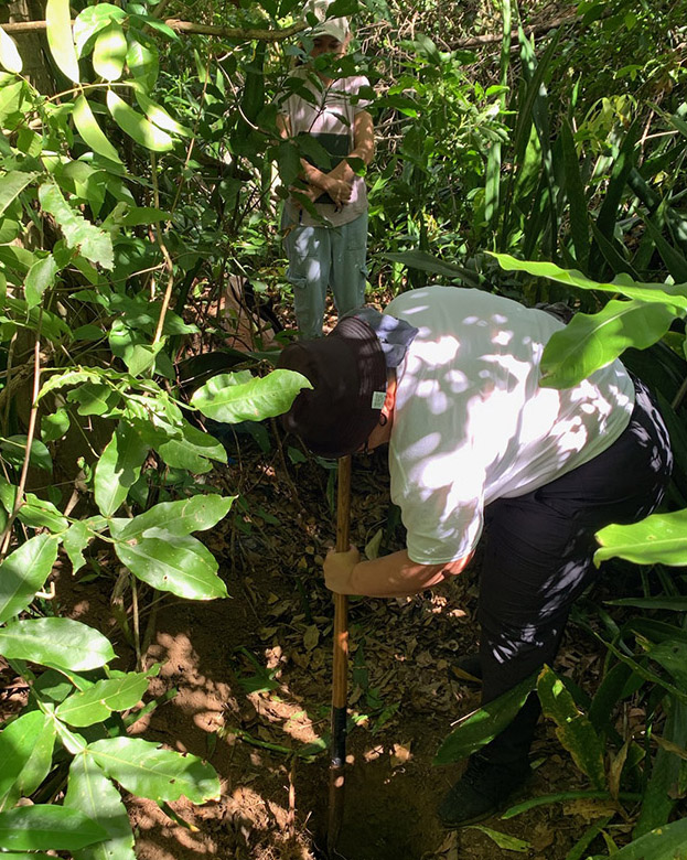
Photo 1. Shovel pit test near the Portugues River at the Tibes Indigenous Ceremonial Center.
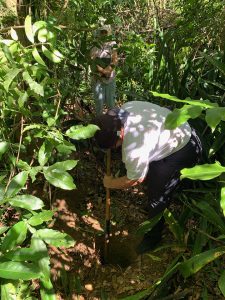
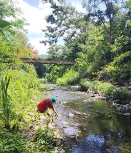
Photo 2: Collection of sediment core near the Portugues River at the Tibes Indigenous Ceremonial Center.
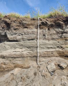
Photo 3. Exposed sea wall at La Guancha Beach in Ponce, Puerto Rico.
Photo 4: Field team at Portugues River.
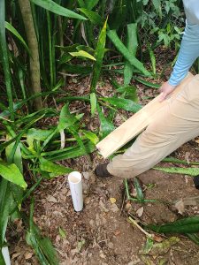
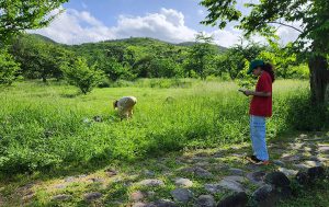
Photo 5: Field team at the Tibes Indigenous Ceremonial Center.