Constraining Snow and Firn Properties in Western Canada
Expedition Location: Kluane National Park and Reserve, Yukon, Canada
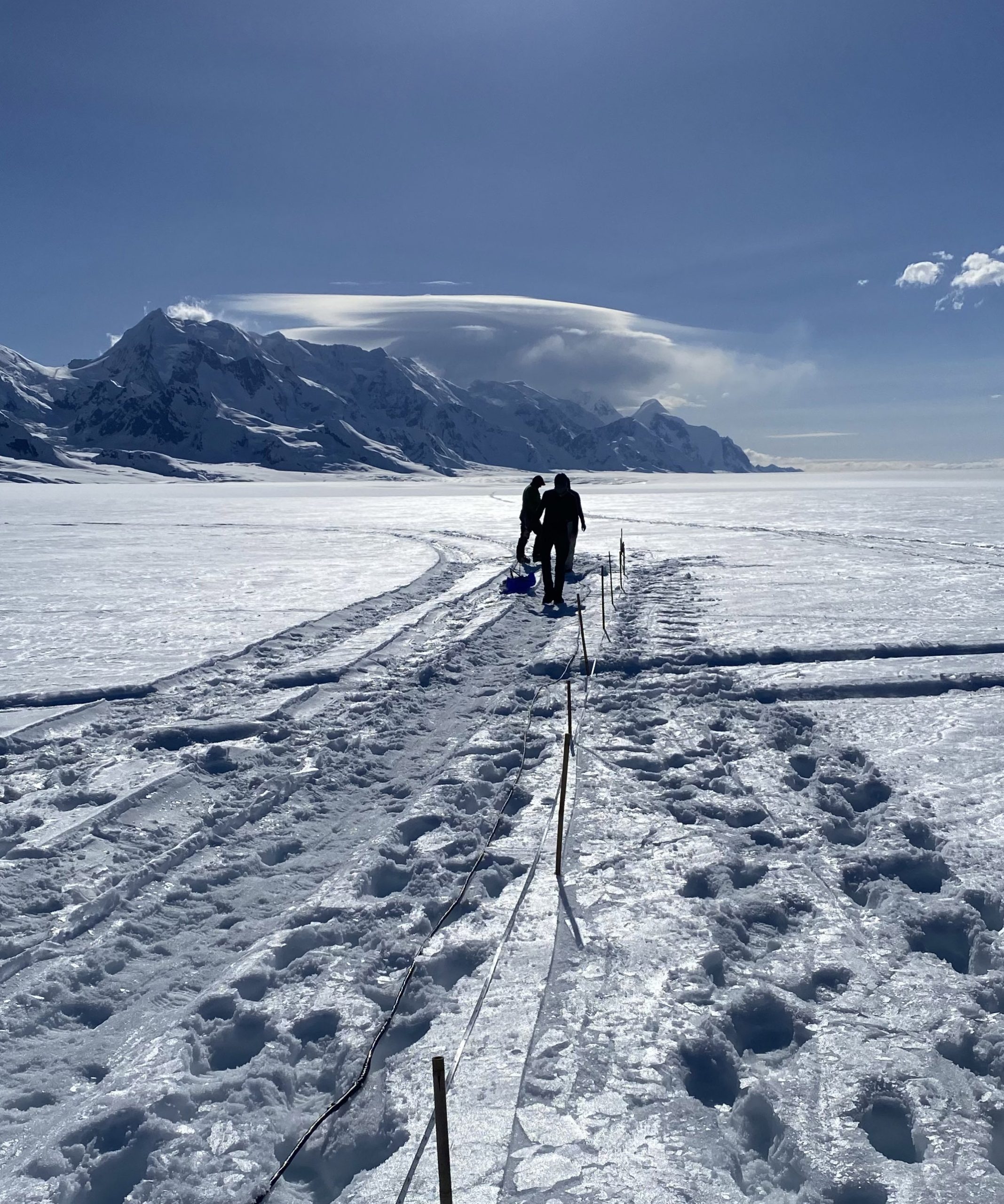
Upper Seward Glacier
Expedition Dates: May 12-23, 2023
Field Team Members: Mikaila Mannello (MS student, UMaine), Martin Truffer (University of Alaska Fairbanks), Doug Brinkerhoff (University of Montana), Victor Deveaux-Chupin (PhD Candidate, University of Alaska Fairbanks), Michael Daniel (PhD Student, University of Arizona), Annegret Pohle (PhD Student, University of Alaska Fairbanks)
Eclipse Icefield
Expedition Dates: June 1-5, 2023
Field Team Members: Ingalise Kindstedt (PhD Candidate, UMaine), Emma Erwin (PhD Student, UMaine), Renée Clavette (PhD Student, UMaine), Mikaila Mannello (MS student, UMaine)
Funding Support: The Robert and Judith Sturgis Family Foundation, UMaine Graduate Student Government, and The Golden Sea to Sky Foundation
Background & Study Sites
The purpose of this study is to provide better constraints on the spatial variability of snow and firn extent, volume, and meltwater storage capacity across Alaska and Canada. The focus of this research is on the Upper Seward Glacier and Eclipse Icefield, both located in Kluane National Park and Reserve, Yukon Territory, Canada. Assessing the health of these glacier systems is of crucial importance in whichever climate warming scenario comes to fruition in the coming decades.
Two ways to assess the health of a glacier are 1) to determine the net mass gained and mass lost (mass balance) of the system and 2) to determine the thickness of firn which is transforming into glacier ice. Efforts to determine mass balance require calculating the remaining amount of water added to the system from the annual accumulation of snow. This is accomplished by using the snow’s density and amount of accumulation to calculate snow water equivalent (SWE), or the depth of a column of snow if it were melted into liquid water. One way we determine both the depths of the accumulation and of the firn is through the use of ground-penetrating radar (GPR). GPR is a technique where we send out an electromagnetic wave into the ground (or ice) and listen for it to return. The timing of the returns, or reflections, caused by changes in density and water content of the snow and ice, provides valuable information about subsurface properties including snow depth.
The Seward and Eclipse Icefields were ideal case study locations for this research because they 1) are largely accessible during the summer season due to existing field research teams conducting research at these locations (University of Alaska – Fairbanks is conducting research at Seward Glacier and colleagues from UMaine with research on Eclipse Icefield), 2) the two study sites cover a range of elevations from the dry to wet snow zones thereby covering the bounds of low to higher potential water content, and 3) field research during the early summer which will allow us to determine if water is retained in the snowpack and firn of these glacier systems during the winter months, which has been observed in other glacier locations (e.g, Greenland; Forster et al., 2014) and currently interpreted from recent remote sensing analyses of Alaska and Canadian glaciers (Johnson and Meyer, 2022) but not yet confirmed by ground-based observations of these glaciers. Additionally, these study sites provide an opportunity to observe phenomena between coastal and inland environments covering the range of glaciers we intend to upscale to.
While the Juneau Icefield is the main focus of my PhD research, participating in these two additional field seasons this year, including radar surveys on the Seward Glacier with Dr. Martin Truffer (UAlaska) to ground-truth airborne radar surveys of accumulation and also conducting radar and snow-firn coring on Eclipse Icefield with Ingalise Kindstedt, Emma Erwin, and Renée Clavette (UMaine) for their doctoral research, was important to help me upscale my observations from the JIF more broadly across Alaska and Canada.
Methods
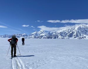
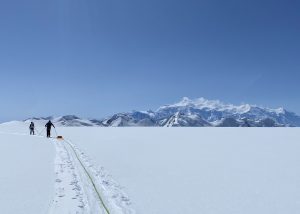
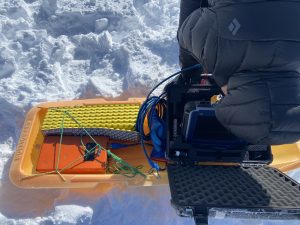
For shallow snow and firn studies on the Upper Seward Glacier, we used 400 MHz common-offset ground-penetrating radar and snow density sampling. We ski towed this system over 60 km across the study site, targeting areas we suspected would capture the best spatial variability in snow and firn thickness. We also conducted a wide-angle reflection and refraction survey using 2-400 MHz antennas to better constrain radio wave velocity and estimates of density and liquid water content. Additionally, we collected 5 km of repeated transects using a 200 MHz hyper-stacking ground-penetrating radar to analyze with respect to 400 MHz surveys. Combined, these data will enable us to calculate snow water equivalent across this study site, better determine the radio wave velocity within the snow and firn, and additionally allow for a comparative analysis of different shallow radar instruments.
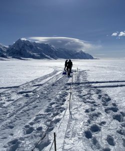
The proposed surveys on Eclipse Icefield with the 1 GHz multi-offset ground-penetrating radar system were unable to be completed as originally proposed due to unforeseen delays in equipment procurement. Instead, we focused on using 900 MHz common-offset ground-penetrating radar to examine continuity of melt layers between two firn core locations across the ice divide which we ski-towed between sites. Combined with the depth density profiles of each core, these data will be used to determine the snow water equivalent between core sites and better constrain radio wave velocity estimations.
Acknowledgements
This research would not have been possible without the generous support from several sources, including critical funding from Robert and Judith Sturgis Family Foundation, The Golden Family Foundation and UMaine Sea to Sky, UMaine Graduate Student Government, and the University of Alaska-Fairbanks. We appreciate the tactful logistical support of pilots at Icefield Discovery, helicopter pilots at Horizon Helicopters, and staff at Kluane Lake Research Station. We acknowledge that this research was conducted on the lands of the Kluane, Champagne and Aishihik, and White Rivers First Nations peoples, past and present.
References
Forster, R., Box, J., van den Broeke, M. et al. (2014) Extensive liquid meltwater storage in firn
within the Greenland ice sheet. Nature Geoscience, 7, 95–98.
Johnson, A.C. and Meyer, F.J. (2022) Detection of glacier firn aquifers across Alaska using time
series of Sentinel-1 SAR. In Fall Meeting, AGU.
Field Photos