Andrea Tirrell¹², Michael Cianchette², Mackenzie Connor²
¹Climate Change Institute, University of Maine, USA
²School of Biology and Ecology, University of Maine, USA
Expedition Funding: Churchill Exploration Fund
Field Expedition Location: New England alpine sites (New Hampshire, Maine, and Vermont)
Project Overview:
New England alpine plant populations exist as scattered mountaintop “sky islands”, separated by a “sea” of northern hardwood forest. After deglaciation ~13,000 years ago, New England was initially dominated by tundra plant species found largely in the Arctic today. As climate changed, these species were limited to high elevation sites, where high winds and freezing temperatures limit tree growth. These sites, which exist across mountainous regions of Maine, New Hampshire, and Vermont are thought to be cool-climate refuges for these tundra relic species when the regional climate warms. Understanding their history and present-day distributions could then provide insight into their future vulnerability to climate change. Because these rare mountaintop communities are often managed by separate agencies, plant distribution surveys have taken place sporadically over the last century, with each study using differing field methods. Therefore, it is not entirely clear how interconnected these alpine plant communities are, or how they may have changed through time. New England’s high peaks are also often heavily trafficked, either because of their popularity with hikers or the presence of ski resorts and auto roads. Along with changes in climate, human activity may also be impacting the presence of rare alpine species across the region.
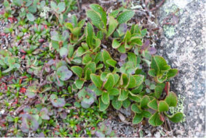
Figure 1: Arctous alpina, also known as alpine bearberry, occurs in small, disjunct populations in New Hampshire and Maine and is listed as rare in both states.
Data Collection:
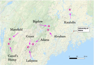
During the summer of 2021, our expedition team traveled across New England to eight alpine sites in New Hampshire, Maine, and Vermont: Mt. Abraham, Mt. Bigelow, and Katahdin in Maine, Mt. Adams, Mt. Guyot, and Mt. Lafayette in New Hampshire, and Mt. Mansfield and Camel’s Hump in Vermont (Figure 2).
At each site, we followed 10-50 m transects, identifying species and estimating cover in 1m2 quadrats. This approach will allow us to reliably quantify how many species are present across each mountaintop, which we can then compare to present-day diversity. The ultimate goal of this research is to identify whether any community changes have occurred as a result of climate change, hiker visitation, or topographic differences across sites.
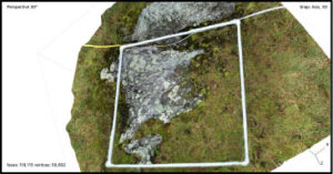
With the help of Aaron Putnam of the Climate Change Institute, we used photogrammetry, or the creation of 3D image models, to create virtual permanent plots at each site. These images can then be replicated during future surveys without the disturbance associated with permanent structures (Figure 3).
We were also able to make collections of the pincushion plant (Diapensia lapponica), a rare Arctic species that also occurs in New England’s alpine zones. We also deployed temperature data loggers at six summits to track summer temperatures. These climate data will be compared with the characteristics of pincushion leaves, to see if this species is showing evidence of local adaptation on isolated mountaintop “islands.”
Figure 2: Map of field site locations across New England.
Figure 3: An example of a 3D image model, or virtual permanent plot.
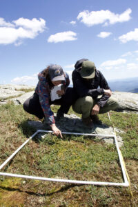
Figure 4: 1m X 1m quadrats were laid along 50 m transects to estimate percent cover for each plant species present in eight alpine areas across New England. Andrea Tirrell (left) and Michael Cianchette (right) estimate plant coverage on Mt. Mansfield summit, Vermont, USA.
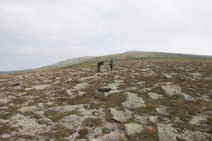
While we selected new transect locations for most of our field sites because of a lack of historic surveys, we were able to find and repeat five historic transects taken in 1989 on Katahdin in Baxter State Park, Maine, USA. With the help of original surveyors Charlie Cogbill and Baxter Research Committee member Don Hudson, we relocated their original sampling sites from 32 years prior. Our new data can then be directly compared to their historic data to identify any changes in the vegetation on Katahdin.
Overall, this research will allow us to better understand how rare alpine plant communities in isolated “sky islands” may be changing through time. Our hope is that this work will also provide a present-day baseline for agencies to continue monitoring these plants in the future as the world warms.
Expedition Funding:
This research expedition was generously funded by the Churchill Exploration Fund. Without this fund, travel between New England field sites for our 2021 season would not have been possible.
Figure 5: Five historic transects, originally sampled 1989, were relocated on Katahdin, in Baxter State Park, Maine, USA. Michael Cianchette (left) and Andrea Tirrell (right) record species percent covers on the Northwest Plateau of Katahdin.
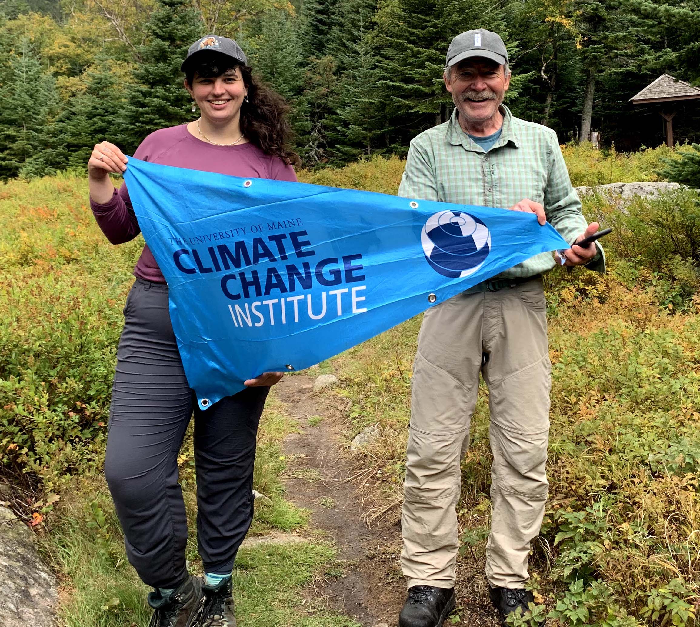
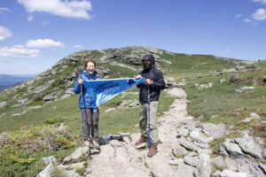
Figure 6: Mackenzie Connor (left) and Michael Cianchette (right) hold the CCI flag on Mt. Mansfield summit, Vermont, USA.
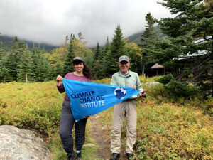
Figure 7: Andrea Tirrell (left) and Don Hudson (right) hold the CCI flag at Chimney Pond after a long day of sampling on Katahdin. Don Hudson was the original surveyor who, along with Charlie Cogbill, first identified alpine plant community types on Katahdin for Baxter State Park in 1989. The data collected 32 years prior to our surveys in 2021 will be used to identify shifts in species distributions that may have occurred.