
Abrupt Climate Change during the Last Glacial Termination in Maine
Expedition Dates: May-October 2021
Expedition Field Team Members:
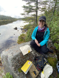
Maraina Miles1,2, Meghan Spoth1,2
- Climate Change Institute, University of Maine
- School of Earth and Climate Science, University of Maine
Expedition Funding: Dan & Betty Churchill Exploration Fund
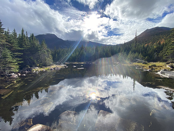
Field Expedition Location: Baxter State Park, Maine
Summary:
Katahdin, the largest mountain in Maine, offers a unique view into the climate of the past. Draped along the flanks of the mountain are glacial deposits that can reveal how the climate of the North Atlantic region responded to the abrupt warming of the end of the last ice age. In the face of climate change, there is an urgent need to understand how each part of Earth’s climate system reacts to abrupt change. We are currently entering uncharted territory; however, the fast-changing climate of the last glacial termination (11,700-18,000 years ago) can provide an analogue to guide the development of future climate models – the first step in helping society prepare for an uncertain future. Our goal for the 2021 field season was to collect samples from glacially transported boulders for beryllium-10 surface exposure age dating to reveal the thinning history of the Maine Ice Cap, which we plan to use to reconstruct the pattern of climate change during the termination.

Methods:
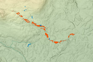
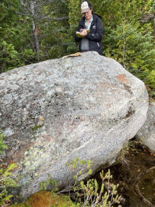
To find out when the ice retreated or readvanced, we began by mapping glacial landforms in QGIS using newly released LiDAR imagery of the area. Next, we collected rock samples from boulders on these landforms. The samples were brought back to the UMaine Cosmogenic Isotope Laboratory and are currently being processed for beryllium-10 (10Be) surface exposure dating. This method works like an isotopic ‘clock’ and reveals when the boulders were deposited by a glacier. The boulders were plucked from the underlying bedrock by a flowing glacier and then deposited on a moraine. Once a boulder is released from the glacier and exposed to the atmosphere, it begins accumulating 10Be, a cosmogenic isotope that forms within a rock as is it bombarded with cosmic rays, which are constantly raining down on Earth. Therefore, the amount of 10Be in a boulder can tell us when that boulder was deposited by a glacier, and thus when the glacier was last at that location. To isolate the 10Be, the samples are crushed into a fine sand and etched in acid until only pure quartz remains. The quartz is then dissolved, and the 10Be is extracted in a series of chemical steps.
Project Goals & Initial Results:
One of our goals during the summer of 2021 was to collect samples along a newly discovered lower-elevation moraine in the southern section of Baxter State Park. This moraine may have been deposited in the Bølling–Allerød (14.7-13.0 ka), a period when the climate changed rapidly but displayed many complexities that we don’t yet understand. Because of the steep slope of the moraine, this may be evidence of a glacial readvance during the Bølling–Allerød. Overall, 10 samples were collected on the moraine. We also collected six samples above the moraine, on smaller recessional ridges, and eight below it to fully constrain the timing of moraine deposition. These samples currently are awaiting analysis at Lawrence Livermore National Laboratory.