
Rediscovering the Ancient Maya City of Tikin Ha, Belize
Expedition Dates: February – March, 2019
Expedition Field Team Members:
Field Team: Brett A. Houk1, Gregory Zaro2,3, Mark D. Willis4
1 – Texas Tech University – Department of Sociology, Anthropology, and Social Work
2 – University of Maine – Department of Anthropology
3 – University of Maine – Climate Change Institute
4 – Flinders University – College of Humanities, Arts, and Social Sciences
Expedition Funding: National Geographic Society (NGS-51012R-18)
Site Rediscovery and Initial Investigations
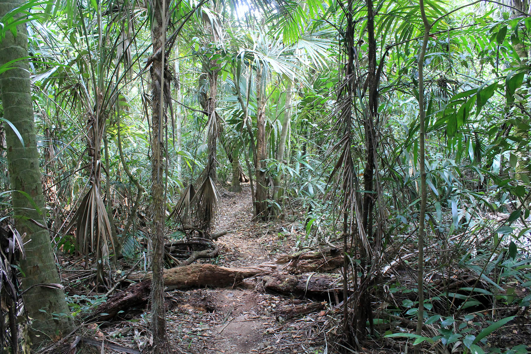
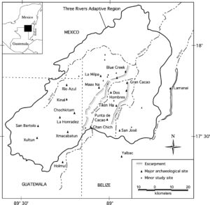
In 2016, while inventorying trees, a logging crew working on Laguna Seca Ranch reported seeing several large mounds atop the Booth’s River Escarpment in the remote densely-forested northeastern corner of the property. The rugged and hilly terrain constitutes the eastern limit of the Petén Karst Plateau and the eastern edge of the Three Rivers adaptive region. In February of 2017, and with permission from the Institute of Archaeology in Belize, our crew headed to the location described by the logging crew and encountered a large previously unrecorded Maya site, now named Tikin Ha—Mopan Mayan for “dry water.” During this inaugural 2017 effort, our small team had only three hours to explore the overgrown ruins—just enough time to produce a sketch map of a large plaza and associated structures and to conduct one drone mission above the forest canopy.
Our initial assessment indicated that the plaza was the sixth largest known in the Three Rivers adaptive region, and the crew mapped an alignment of massive structures along the eastern edge of the plaza. We estimated the tallest building, a temple-pyramid, to measure approximately 20 m in height above the plaza surface. Based on the size of the plaza, we also believed that additional monumental structures were also very likely, including the possibility of a large acropolis or several elite palace structures. A Digital Elevation Model (DEM) of the forest canopy, produced from the drone imagery, hinted at additional high ground toward the east of the known plaza and a likely candidate for additional monumental architecture. With generous support from the National Geographic Society (NGS), we returned to Tikin Ha in February and March of 2019 to identify the extent of the monumental core of the site, systematically map its ruins, and archaeologically test plaza and courtyard spaces.
2019 Field and Lab Methods
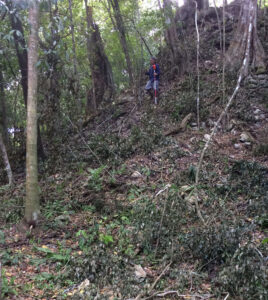
Our documentation of Tikin Ha in 2019 involved cutting transect trails through the dense jungle in the cardinal directions from the known plaza, as well as to the northwest, southwest, and southeast. One transect extended from the site core 1.1 km southeast to the base of the Booth’s River Escarpment, terminating at the Booth’s River Marsh. In addition to these formally cut transects, we also utilized more informally cleared walking trails between discovered groups of architecture as a way to explore the terrain around the monumental core (Figure 2). To facilitate mapping, project workers cleared the undergrowth that shrouded major architectural groups.

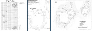
Mapping proceeded in two phases. Initially, project members used a reflectorless Leica TS15 Total Data Station (TDS) to establish control points and map the large plaza at the site. We then used an iGage iG3S GNSS unit to determine the UTM coordinates for each control point. In the second phase, project members used a Nikon DTM 322+ TDS and Spectra Precision Nomad data collector to map additional groups of architecture and refine areas of the large plaza’s map (Figure 3). In addition, we used the tape-and-compass technique to document small settlement mounds and patio groups visible along transect lines and informal trails.
To establish the chronology and age of Tikin Ha, crews excavated eight test pits within plaza and courtyard spaces. In all cases, units were excavated in cultural/natural levels to bedrock or otherwise sterile sediments to document the number of construction episodes. To assess chronology, we relied primarily on formal and stylistic traits of ceramic artifacts and a single AMS-radiocarbon date from a faunal bone found exposed in a looter’s trench but in primary context.
Results
Exploration at Tikin Ha resulted in the documentation of the large plaza (Group A) originally visited by BEAST in 2017, and the discovery of another large monumental group of architecture to the east of the plaza (Group B). Combined, Groups A and B constitute the monumental focus of Tikin Ha. The final topographic map of the two groups is based on over 12,500 individual TDS points (Figure 4). Exploration and mapping also recorded a large courtyard group west of the Main Plaza (Group C), three moderate-to-large courtyards southeast of the Main Plaza (Group D), and smaller mounds and courtyards along various survey transects and trails.
Pottery fragments recovered from eight test excavations within plaza and courtyard spaces in the epicenter of Tikin Ha suggest the site core was built near the end of the Late Classic period. Interestingly, each excavation encountered only one construction episode. Although the ceramics do not provide enough chronological resolution to determine if all areas of the site were constructed in one large event, they were certainly constructed around the same time. Our single absolute date from the bone cord holder pin in Structure B-11 in the acropolis returned a 2σ calibrated date range of AD 669–769. Because we did not conduct excavations on structures or clean looters’ trenches to draw detailed profiles, we cannot say at this time if the monumental buildings in Groups A and B are also single-phase constructions.
Our preliminary data suggest Tikin Ha was built quickly and occupied for a comparatively short period of time. Tikin Ha’s brief occupation period may explain why the Main Plaza accounts for such a high percentage of the monumental area at the site. Unlike mature cities, which have generations of growth and expansion, it is possible that Tikin Ha’s builders never had time or motivation to construct additional monumental groups prior to its abandonment. Coupled with the apparent short-lived growth trajectory, the proportionally large plaza of Tikin Ha against its limited extent of monumental construction may suggest that it had only recently acquired broader territorial control prior to its abandonment near the end of the Classic Period.
Please contact Gregory Zaro (gregory.zaro@maine.edu) with any questions.