High-Elevation Ice Core Reconnaissance on Tupungatito Caldera Glacier
Tupungatito Caldera Glacier, Central Andes
High-Elevation Ice Core Reconnaissance on Tupungatito Caldera Glacier, Central Andes, Chile
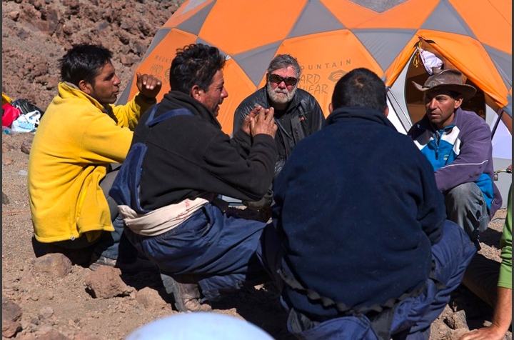
Paul A. Mayewski, Gino Casassa, Gonzalo and Sebastian Camps, Daniel Dixon, Daniel Frye, Bjorn Grigholm, Andrei V. Kurbatov, Michael Morrison, Mario Potocki.
(With indispensable assistance of local Arrieros: Fernando, Ismael, Marcelino and Antonio)
The high elevation glaciers of the central Andes hold the potential of yielding robust climate and environmental records to elucidate regional natural and anthropogenic climate variability. The current spatial coverage of ice core records in the Andes is quite limited and more sites are required to access past, present and future regional and global climate changes.
In February 2010 the Climate Change Institute conducted an expedition, led by Paul A. Mayewski, to Tupungatito Caldera Glacier (TCG), Chile. The goal of the field season was to retrieve a shallow ice core, conduct GPR/GPS surveys, and initiate a mass balance study with ultimately purpose to determine if TCG is a suitable location for a deep ice core. The shallow ice core will be analyzed for water isotopes and trace elements to reveal if TCG has preserved annual chemical signals. The presence of clear annual signals will suggest that TCG is excellent site for a deep ice core.
- Feb. 8th Leave USA
- Feb. 9th Arrive Santiago and meet local guide Gonzalo
- Feb 10th Meet Gonzalo and discuss plan
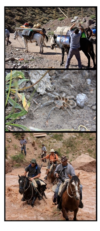
- Feb. 11th Drove for 4 hrs to trail head. Packed mules with camping gear and field equipment. Hiked for 2-hours (4 km) to first camp site at 2300 m. Slept in bivvy bags under stars (6-inch hairy spider next to Mario’s bag!).
- Feb. 12th Hiked for ~4 hrs (9 km), forded river on horseback, and made second camp at 2650 m. Weather was hot and sunny.
- Feb. 13th Hiked for ~4 hrs (8km) to third camp at 3150 m. Felt temperature drop as we ascended the mountain valley. Paul and Gino continue scouting trail up to 4200 m on horseback.
- Feb. 14th Rest and relaxation day. Acclimatization hike up to 3450 m (~4.5 km) and sleep back down at 3150 m.
- Feb. 15th Rest day. More acclimatization hikes. Paul and Gino scout trail up to 5000 m on horseback. Arrieros move science gear up to 4200 m.
- Feb. 16th Packed mules ready for move up to 4200 m. Hiked for ~4 hrs (7 km) up to 4200 m camp.
- Feb. 17th Rest day. Acclimatization hikes.
- Feb. 18th Rest day. Acclimatization hikes. Paul, Gino, and Arrieros ride up to 5400 m with ice core drill and scientific equipment and scout a campsite near ice edge.
- Feb. 19th All hike for ~ 3 hrs to 4900 m campsite (except for Gonzalo and Sebastian, who remain at 4200 m). Patch of Neve Penitente next to campsite provides fresh water!
- Feb. 20th Rest day. Volcanic gases drifting down the mountain side fill the camp site with the smell of rotten eggs (H2S). Acclimatization hikes up to the Tupungatito sulfur lake.
- Feb. 21st Radar survey conducted on glacier to determine ice thickness and locate suitable drillsite.
- Feb. 22nd Rest day.
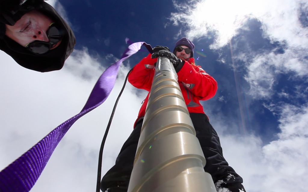
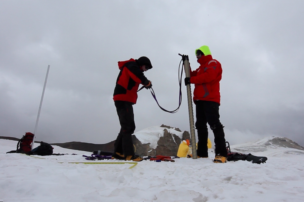
- Feb. 23rd Hiked up to 5600 m. Set up tent at glacier camp. Used ice core drill to install accumulation poles for mass balance study. Returned to 4900 m in evening.
- Feb. 24th Hiked back up to glacier camp and put up second tent. Spent rest of day relaxing and acclimatizing.
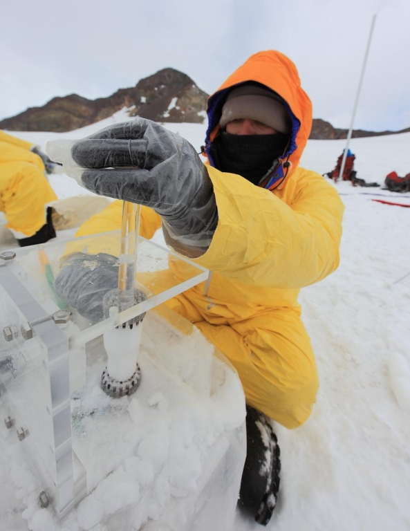
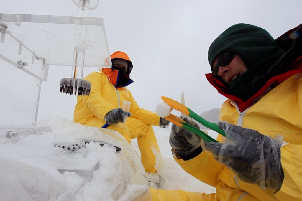
- Feb. 25th Hiked ~2 km across glacier to drill site. Drilled ~16m and processed core at 10 cm resolution. Temperature loggers were place in borehole to estimate mean annual temperature of the glacier. Returned to glacier camp for night.
- Feb. 26th Hiked to drill site and retrieved remaining equipment. Dismantled glacier campsite and returned to 3150 m camp on horseback.
- Feb. 27th Earthquake strikes at ~3:35 am! Everyone is safe. Aftershocks continue all day.
- Feb. 28th Hiked back down to trail head. Van ride back to Santiago.