Atacama Desert of South America
Atacama Desert of South America
Desert Resource Management and Punctuated Environmental Change
Greg Zaro & Alissa Dubois (text written by Alissa Dubois)
The Cola de Zorro archaeological site between the Ilo and Tambo River valleys on the Southern Peruvian coast is situated in what is now one of the driest landscapes on Earth (Figure 1). In addition to its location in the northern extent of the Atacama Desert, the region surrounding Cola de Zorro has been exposed to regular flooding, earthquakes, volcanic activity, and prolonged droughts, as evidenced by the archaeological and historical records (Keefer et al. 2003; Magilligan et al. 2008; Reycraft 2000; Thouret et al. 1999; Zaro 2007; Zaro et al. 2008; Zaro et al. 2010; Zaro and Umire-Alvarez 2005). Yet, despite the site’s seemingly non-conducive environment for human habitation, small populations found ways to survive at Cola de Zorro for centuries, from at least the late prehispanic era (ca. A.D. 900-1400) through the Spanish colonial period (ca. A.D. 1532-1821), and possibly longer (Zaro 2009). As such, the site represents an important example of human ingenuity in the face of environmental hardship and change over time.
In the context of contemporary global change and desertification of many parts of the world, it is important to know how past societies dealt with such challenges. Groups of people situated at Cola de Zorro and neighboring villages may have utilized strategies varying from resource switching to diversification to abandonment, though specific responses to perturbations remain unclear (Zaro 2009). The goal of the proposed project was to better understand the socioeconomic responses to these environmental challenges, and particularly to massive flood events of the fourteenth and seventeenth centuries (Keefer et al. 2003; Reycraft 2000; Satterlee et al. 2000) and the A.D. 1600 eruption of the Huaynaputina volcano (Thouret et al. 1999). Each of these events is evident in the material record at Cola de Zorro.
The set objectives for the project were to gain knowledge of (1) the impact of environmental perturbations on local population numbers from the late prehispanic to the Spanish colonial period, (2) the degree to which non-local resources played a role in the post-disaster subsistence economy, and (3) the incorporation of diversification strategies into the subsistence economy, perhaps including greater proportions of marine and lomas(inland fog-fed forest) resources (Zaro 2007). To measure subsistence change at Cola de Zorro, excavation and analysis targeted material assemblages from domestic, midden, agricultural, and mortuary contexts, including food remains.
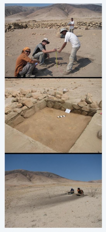
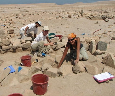
Expedition Field Notes:
Feb. 17-21, 2010. We left the apartment at 6:00am each morning. The drive to Cola de Zorro took 1.5 hours over bumpy roads. This week we used a total station to map the site. We focused on general topography and on the agricultural terraces of sectors 1 and 2. We also set up the excavation units. We placed 8 units among corrals, domestic compounds, a cemetery, and a shell midden deposit. In addition, we organized our documentation forms and equipment.
Feb. 22-28, 2010. We started excavating this week. The first unit was located within a looted cemetery. We hoped to find intact tomb architecture despite the damage done by the looters, but it was too disturbed to identify structures. We found ceramics shards, marine shell, macrobotanicals, bone, and human teeth. We completed two units in a domestic compound. In these units, we carefully removed the stones that collapsed from the wall. We were looking to see if the volcanic ash was below or on top of these stones to determine when the domestic wall was abandoned (before or after 1600 Huaynaputina ash).
March 1-7, 2010. This week we excavated units in domestic and corral contexts. Within the domestic compound unit, we found burned ceramics, bone, and marine shell. The bones are of fish, rodents, and larger terrestrial animals. There are also hearth areas of denser burned materials. We found what we think is an unfinished grind stone. We started a Spanish-colonial corral unit in sector 2. The corral unit came down on a deconstructed terrace wall and it didn’t contain anything more than excrement. We did a surface survey of the corral and found camelid/goat, donkey, and horse excrement. We also mapped all the units.
March 15-21, 2010. This week we worked on 5 units within the same 3-room domestic compound. The first unit was in a corner of the middle room. We found the usual marine shell, bone, ceramics, etc., but we also found a dog paw with all the bones intact. In another unit we found a neon yellow mineral (similar in color to Inca Kola). In addition, one of the units contained a relatively recent wind shelter. At the end of the week, we counted and re-bagged all the materials and artifacts that we found. Additionally, we labeled and numbered ceramic shards.
March 22-28, 2010. It took us 30 minutes to walk to the farthest unit with all of our equipment. It was at the base of the mountain and uphill the whole way. All four of us went to work on this unit and luckily we were able to finish in one day. We found Spanish-colonial and Chiribaya ceramics. There was also a lot of glass. After that, we went to sector 3 to start the final few units. We placed the units in a 2-room domestic compound. When we went to map in the units, we realized that we didn’t have the walkie-talkies, so we created a human chain in order to map the farthest unit. At the end of the week we did lab work, including counting, weighing, and re-bagging materials, and washing and numbering ceramics. In addition, we began drawing diagnostic ceramic shards.
March 29-April 2, 2010. We finished excavating this week. Anna, our Instituto Nacional de Cultura (INC) supervisor came for a day. We showed her our paperwork, materials, and excavation progress at the site. After the units were completed, we started back-filling all the units.
April 3-30, 2010. The last month was spent doing lab work and documentation. We washed the last of the ceramics; counted, weighed, and re-bagged the remaining materials and artifacts; and numbered ceramic shards. We drew ceramic shards and photographed all decorated and rim ceramic pieces, as well as select macrcobotanicals, diagnostic marine shells, and other artifacts.