
The Cause of Ice-Age Terminations, Falkland Islands
The Cause of Ice-Age Terminations, Falkland Islands
Jillian Pelto, Dr. Brenda Hall, & Dr. Thomas Lowell
February — March 2015
Funding Support: Dan & Betty Churchill Exploration Fund
I accompanied Dr. Brenda Hall of the University of Maine and Dr. Thomas Lowell of the University of Cincinnati to the Falkland Islands for three weeks from February to March 2015. The overarching goal of this project, the larger part of which was sponsored by the National Geographic Society, is to determine the cause of the termination of the last ice age. A leading hypothesis is that shifts of Southern Hemisphere oceanic fronts driven by Northern Hemisphere cold periods may have played a key role in ending the last ice age (Denton et al., 2010). An important step towards assessing this hypothesis is to gather paleoclimate records from mountain ice fields along a north-south gradient to determine if rapid warming was a fundamental characteristic of the termination in the southern mid-latitudes. The Falkland Islands are one location where these large goals can be addressed. Our work consisted of coring lakes, mapping glacial landforms and sediments, and collecting samples for surface-exposure age dating, all to begin to determine the timing and magnitude of the last deglaciation in the Falkland Islands.
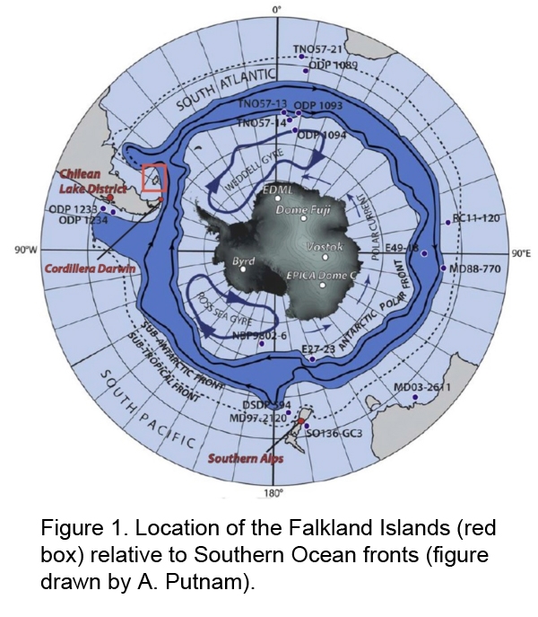
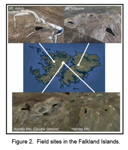
The Falkland Islands are 650 km off the eastern tip of South America; the two main islands are East Falkland and West Falkland (Fig. 1). The landscape is a combination of small mountain ranges and plains. We explored cirques and tarns at three field sites on East and West Falkland (Fig. 2). The Falkland Islands are very windy, and the direction of the wind is often very inconsistent. This made camping and coring difficult at times. We utilized windy days by collecting rock samples for dating, exploring, and sketching maps of the terrain in order to get a better picture of the overall landforms. The moraines all tend to be very large and steep in relation to the size of the cirques. Frequently there are several moraines in front of each tarn.
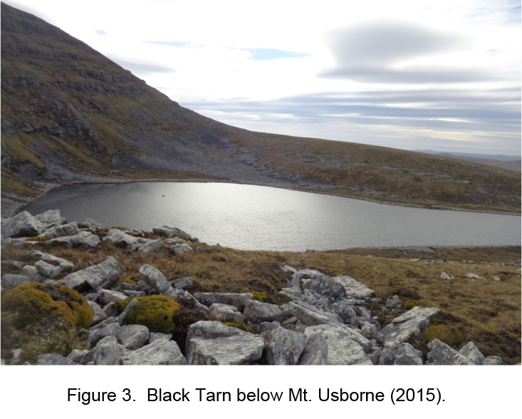
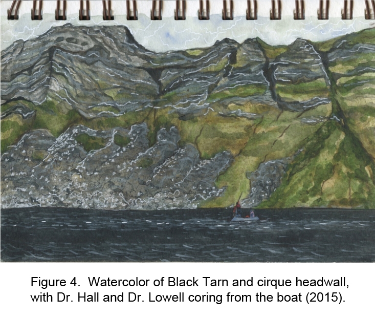
We began our research on East Falkland in the cirques below the headwall of Mt. Usborne (Fig. 3). We successfully cored the upper six meters of sediment in the Black Tarn (Fig. 4). The top meter is composed of organic material interbedded with what appears to be wind-blown silt deposited post-glaciation. The lower meters consist of grey-blue silty clay with fine laminations. These layers are inorganic and are potentially varves, or annual deposits laid down by seasonal input of glacial rock flour into the lake. The cores should be very useful to determine the fluctuations in glacial extent on Mt. Usborne since the last glacial maximum. Limitations with the coring equipment and weather prevented us from coring further; it is quite possible that there are several more meters of sediment. Dating of the lowest retrieved organic sediments is now underway. To determine when the glacier last occupied the Black Tarn, we collected eighteen rock samples for surface exposure-age dating. These analyses also are in progress.
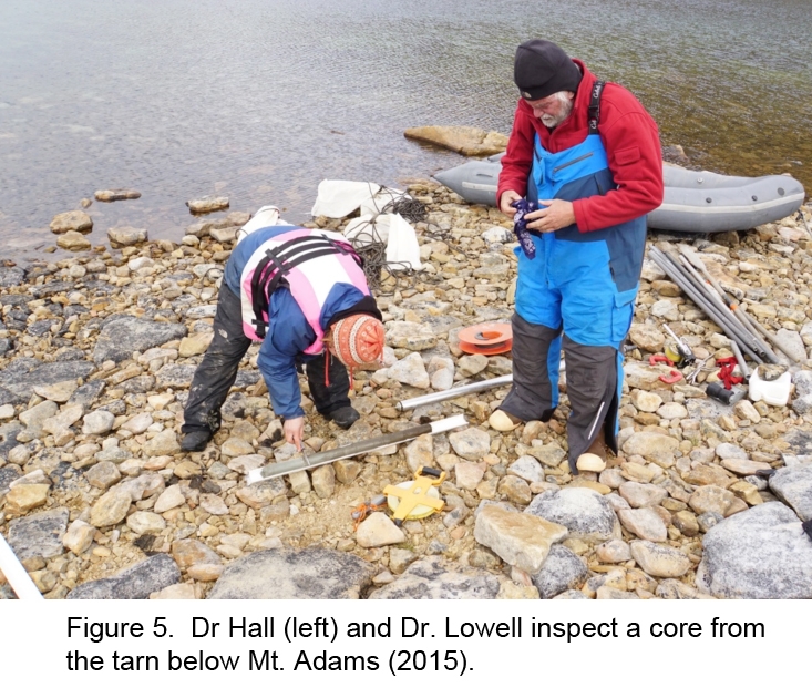
We traveled by ferry to West Falkland and after some difficult travel we made it to Mt. Adam, where we camped below the headwall. The following day Dr. Lowell and I recorded the bathymetry of the adjacent tarn, and we determined the best coring location based on the bottom profile. He and Dr. Hall were able to core the tarn to a depth of three meters. The top two meters are composed of organic material. The bottom meter has alternating sections of organic material and less organic silt and is underlain by blue clay of presumed glacial origin (Fig. 5). Coring halted on hitting rock. Dates of the lowest organic materials will yield minimum ages for deglaciation. In addition to the coring, we were able to collect a number of peat samples from sections, which provide information on the evolution of the moraine landscape.
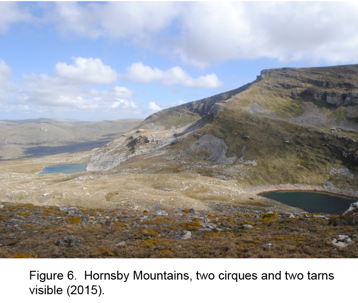
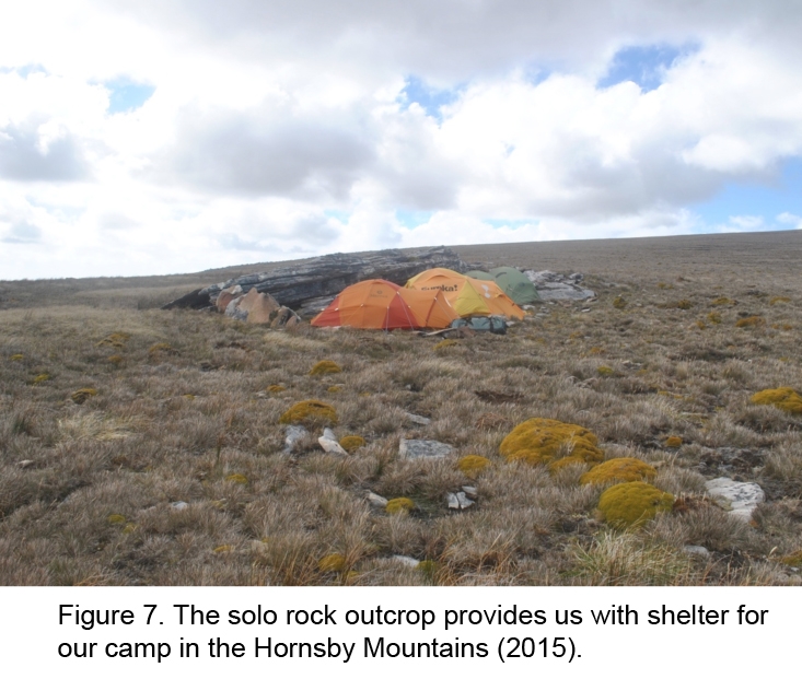
Our final destination was the Hornsby Mountains near the east coast of West Falkland (Fig 6, 7). We were unable to core at this location, because the great distance between where we could drive and the tarns made it impractical in the time available. However, we mapped the extensive system of moraines associated with three different cirques, and were able to take samples from more than 30 rocks for surface exposure-age dating.
Because of shipping issues, we did not receive our samples until the middle of the summer, and some analyses may not be possible because of the long transit time. So far, the stratigraphy of the cores has been analyzed. I have measured the magnetic susceptibility of each core, which provides a record of magnetic minerals, and generally of inorganic content. This allows a first-order separation between cold and/or dry periods with mineral sedimentation vs. warmer and/or wetter times with more organic growth. The next steps are to examine the organic content, to assess the chronology, and to identify the tephra found in one of the tarns. It is anticipated that the cores will afford a record of the structure of the last deglaciation in the Falkland Islands, including periodic shifts in climate that may relate to changes in the position of the westerly winds.
I truly appreciate being able to travel and participate in fieldwork. It taught me how to conduct a research project: planning, logistics, sampling, and subsequent lab work. I was able to experience first hand the amount of work it takes to collect sediment cores and rock samples. Seeing the equipment used and being able to participate in the process taught me about the investigative process of a field scientist. I learned how to record the bathymetry of glacial tarns and how to take rock samples for 10Be dating. This involved understanding the theory behind what makes a good exposure-age sample, as well as how and what to record as field data for these samples.
I also learned a lot by listening to Dr. Brenda Hall and Dr. Thomas Lowell discuss the landscape and their hypotheses for how and when features were formed. It is a complex process to figure this out, and the Falklands landscape has many unsolved oddities. I really enjoyed learning how scientists can map landforms to determine the natural history of a location. It was exciting to work in the Falklands because so little research has been done there.
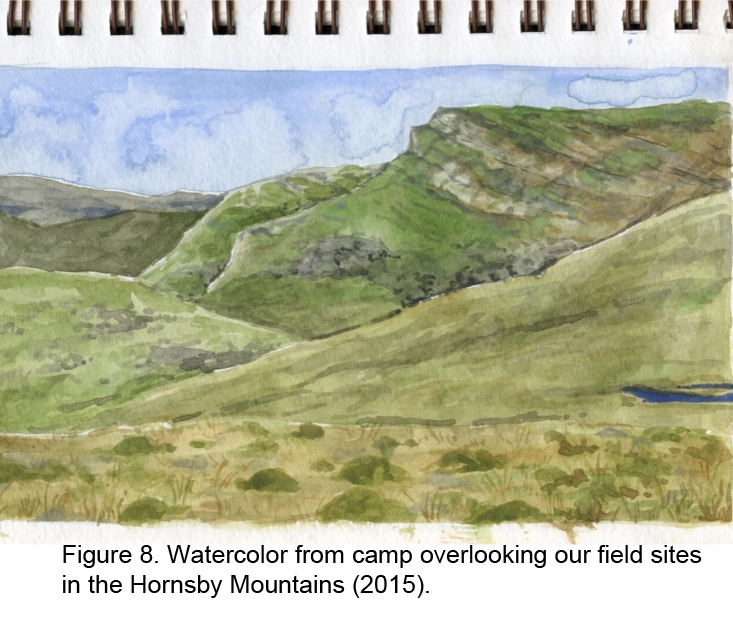
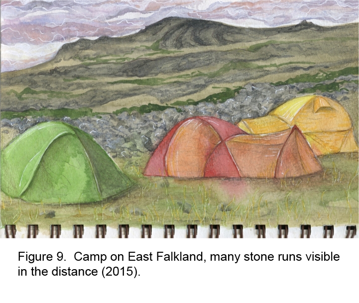
In addition to the scientific learning opportunity, I was also able to use this experience to further my goal of using art to communicate science. I created nine field sketches in the Falklands, in spite of many windy and rainy days (Fig. 8). These sketches, which contributed to my Honor’s Thesis, Art as a Tool to Communicate Science, offer another view of the science and natural landscape in the Falkland Islands.
References:
Denton, G., Anderson, R., Toggweiler, J.R., Edwards, R.L., Schaefer, J., & Putnam, A., 2010, The last glacial termination: Science, v. 328, p. 1652-1656.