

SIERRA Workshop:
Aerial Monitoring of the Cryosphere using Mars Helicopter-class Autonomy
When and where will the workshop be held?
Dates: Thu-Fri Nov 12-13, 2026
Location: BGSC Room 300, University of Maine, Orono, Maine, USA
Format: hybrid in-person / online
Organizers
Co-organized by:
Dr. Seth Campbell (UMaine)
Dr. Jeff Delaune (Caltech/JPL)
Dr. Brent Minchew (Caltech)
Dr. HP Marshall (Boise State University)
Dr. Scott Braddock (UMaine)
What topics are covered by the workshop?
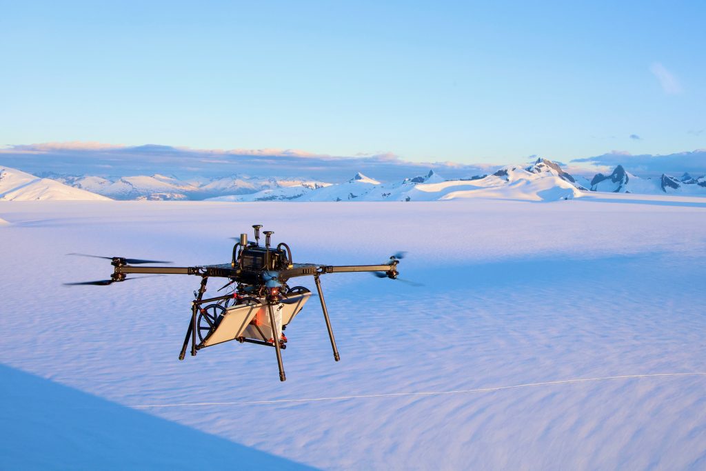
This workshop will investigate the potential of “Mars helicopter-class” autonomous aerial systems for traversing entire ice sheets and mountain ranges on months-long missions to fill the spatial and temporal resolution gap in our observations of the cryosphere.
The evolution of the cryosphere in the next century will have major impacts on society. The melting of the ice sheets, especially in Antarctica, is driving sea level rise predictions. Under median projections (~1 meter in the next 75 years), approximately 230 million people are likely to lose their homes. Half of them live on less than $5/day. Snow and ice stored in the mountains supplies 60% of the fresh water flows worldwide. Two billion people depend on this water tank that is depleting at an accelerating rate.
This workshop is motivated by two observations:
– Cryosphere scientists have recently started to deploy miniaturized sensors on low-altitude drones to improve on satellite/aircraft limitations but are limited by the lack of autonomy.
– The Ingenuity Mars helicopter readily demonstrated autonomous flights in a more remote, cold and low-density altitude settings than the Earth’s cryosphere. The new Skyfall NASA mission launching in 2028 will include 3 new autonomous helicopters equipped with GPR’s to survey subsurface ice on the red planet.
The SIERRA concept (Snow & Ice Exploration using Rotorcraft, Remote-Sensing & Autonomy) is based on autonomous, solar-powered polar-hardened rotorcraft to collect high spatio-temporal resolution observations. By replacing runway-dependent aircraft with rotorcraft, SIERRA enables safe take off and land amongst crevasse hazards using terrain perception. Solar charging enables season-long operations during the Antarctic summer, with no human battery swap needed. Active thermal management prevents ice build-up on critical surfaces (airfoils, solar array, landing legs).
Workshop goals
The goal of this workshop is to bring together world-class cryosphere scientists, instrument designers, robotics engineers and program managers from academia, industry and funding agencies to:
1) Identify the critical new aerial observations SIERRA could help collect to improve our understanding of the cryosphere
2) Design the concept of operations for SIERRA across various applications
3) Identify the new technology gaps required to enable the various SIERRA missions
4) Propose a strategic roadmap for funding and implementation
5) Write a white paper summarizing the conclusions of this workshop and to be used for the proposal effort
To anchor the discussions, we will focus on two reference scenarios:
- Ice sheet dynamics near the grounding zone in Antarctica
- Snowpack evolution in continental US
Schedule of speakers
Schedule of speakers TBA
Thursday November 12
Google Drive (slides & materials):
Zoom (remote participation):
Friday November 13
Google Drive (slides & materials):
Zoom (remote participation):
Virtual attendance
Click this Zoom link to attend virtually.
Additional information form
If you’re planning to attend, please fill out this form to give us a better sense of scheduling. Please share this form with others in the community who are interested in attending the workshop. We look forward to seeing you all soon!
Link to additional information form
Where to stay
Hotel Ursa on the University campus may have availability. You can contact them via the link below.
Parking
Workshop attendees can check into the Buchanan Alumni House each morning and get a parking pass for free. That allows you to park in Black labeled lots. There is one right outside Bryand Global Sciences Building.
Here is a link to a campus map with all the parking lot details that are color coded:
Link to University of Maine campus map.
Link to University of Maine visitor parking information site.
Funding source
Source of funding for the workshop
Contacts
Jeff Delaune <delaune@jpl.nasa.gov>
Seth Campbell <scampb64@maine.edu>
Scott Braddock <scott.braddock@maine.edu>
FAQ
- Who is the workshop for? Cryosphere scientists, instrument designers, robotics engineers and program managers from academia, industry and funding agencies interested or already using aerial platforms for cryosphere applications.
- Can I present my research? Yes! If your science observations can benefit from aerial autonomy, if you are developing aerial autonomy technology that is relevant to cryosphere exploration, or if you managing cryosphere programs that have scientific or technology gaps this community should know about. We would love to have you present your research.
- What is the presentation format? 15 min presentation + 15 min discussion. TBC.