
Glacier History of the Western United States
Glacier History of the Western United States – Wind River Range, Wyoming & the Sierra Nevada, California
Aaron Putnam, Sean Birkel, George Denton, Kathryn Ladig
Collaborators: Joerg M. Schaefer (Columbia University), Edward B. Evenson (Lehigh University), David E. Putnam (University of Maine – Presque Isle), Peter Quesada, Peter Huybers (Harvard University), Richard B. Alley (Penn State), Patrick Applegate (Universitet Stockholm), David Vacco (Penn State), Robert Finkel (CEREGE)
Wind River Range, Wyoming & Sierra Nevada, California, June & July 2009, June & July 2008
The ice ages remain an outstanding mystery of Earth Sciences. Determining what causes ice ages is key to developing a comprehensive understanding of how Earth’s climate system operates, and is of utmost importance for establishing a benchmark against which sophisticated predictive climate models can be calibrated. Intrinsic to deriving the causes of ice ages is understanding also why they tend to end so abruptly in what have been deemed ‘glacial terminations.’ Our group has been tackling this problem by studying the history of Earth’s mountain glaciers, which are very sensitive recorders of atmospheric temperature. We are interested in whether glacier advances during the last glacial maximum (LGM), as well retreat at the onset of the last deglaciation, occurred synchronously across the planet, or whether glaciers behaved out of phase between the hemispheres. The answer to this question could narrow the field of potential drivers of interhemispheric climatic change. For comparison with results from our southern mid-latitude field programs in New Zealand and Patagonia, we chose to develop glacial chronologies from the exceptionally well-preserved moraine systems flanking the Wind River Range, Wyoming, and the Sierra Nevada, California.
The Wind River Range and Sierra Nevada are well suited to develop a detailed glacial history of the Western United States for the following reasons. First, these mountain ranges intersect the modern snowline and sustain glaciers at present, thus providing a complete glacial geomorphological record since the last ice age. Second, former glacier lobes that flowed from these mountain ranges during the last ice age extended into the mountain forelands as piedmont lobes. Oscillations of these piedmont glaciers produced well-spaced belts of moraine systems that are ideal for establishing a detailed record of glacier activity during and since the last ice age. Third, the Wind River Range and Sierra Nevada are located west, and hence upwind, of where the former Laurentide Ice Sheet sat, thus minimizing the regional climatic influence of that giant ice sheet on the mountain glaciers. Fourth, these western U.S. mountain ranges are located away from the North Atlantic region, and are thus well-suited to test whether climate changes registered in the North Atlantic were spread throughout the hemisphere. Finally, the Wind River Range and Sierra Nevada are located east and west of where the great former ice age lakes existed in the Great Basin. Thus, side-by-side reconstructions of atmospheric temperature (from glacier chronologies) and precipitation (from lake-level chronologies) are possible.
To develop glacier chronologies, we use the 10Be surface-exposure dating method to determine the ages of glacial landforms. We work in close collaboration with the Lamont-Doherty Earth Observatory Cosmogenic Isotope Laboratory, where all laboratory procedures are conducted. Extracted cosmogenic beryllium is analyzed by accelerator mass spectrometry at the Lawrence-Livermore National Laboratory. To derive the climatic significance of these moraine systems, we are using a state-of-the-art glaciological model tailored to the modern climatology of the Western U.S. This model simulates development of former glaciers of our study regions, and recent model realizations effectively reproduce LGM ice extent in the Wind River Range inferred from mapped LGM moraine ridges (locally attributed to the ‘Pinedale’ type glaciation).
We have embarked on two field expeditions during the summers of 2008 and 2009 in the Wind River Range, and one season in the Sierra Nevada during the summer of 2009. During these expeditions we have conducted glacial geomorphological mapping and collected samples for surface-exposure dating. Most of our work has focused on moraine ridges attributed to the LGM, however we have also mapped and sampled moraine sets situated high in the cirques of the Wind River Range, just outboard of modern glacier termini. Together, our glacial geomorphologic and geochronological approach affords the opportunity to derive a detailed and robust temperature history of the Western U.S. since the last glacial period. With such a tool we can evaluate potential drivers of global climate and approach resolutions to the problems of ice ages and abrupt climate change.
-
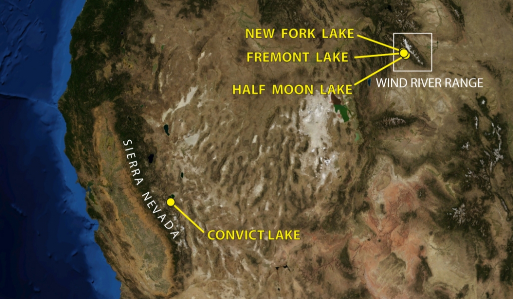
- Figure 1. Regional map of the western United States. Yellow dots show study locations in the Wind River Range, Wyoming, and Sierra Nevada, California. The extent of former Great Basin lakes can be inferred from the vast light-colored regions between the study areas.
-
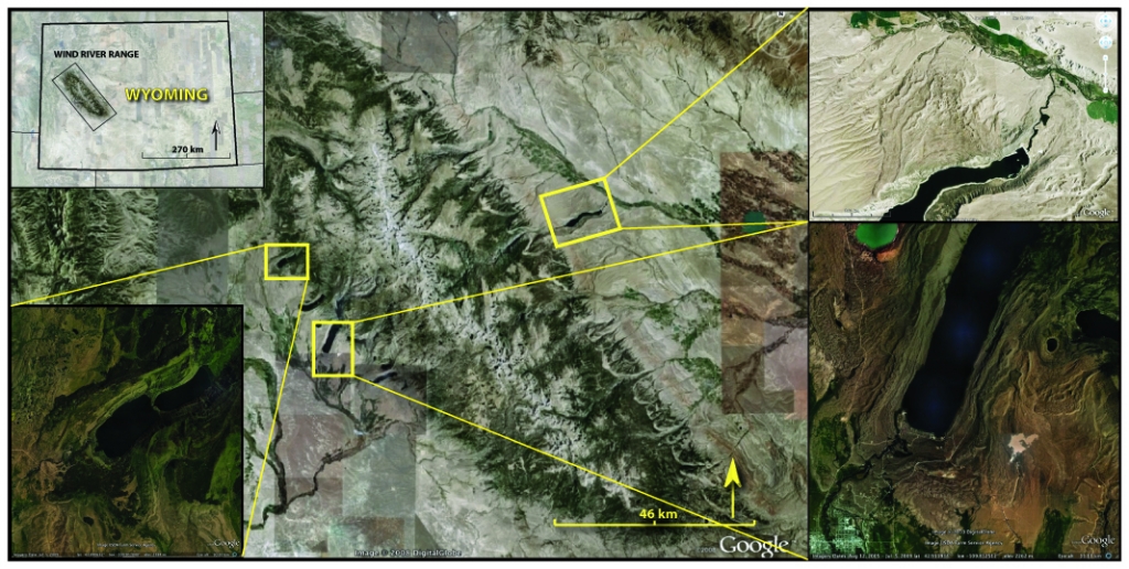
- Figure 2. Map of the Wind River Range, Wyoming. Study areas are shown in yellow boxes. Detailed views of select moraine systems are given as insets.
-
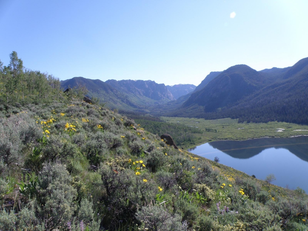
- Figure 3. View northwest up the New Fork River canyon, a valley carved by a former outlet glacier of the Pleistocene Wind River ice cap. Slope in foreground is the last ice-contact feature deposited during the LGM. Subsequent to formation of this slope, the New Fork glacier retreated high into the mountains without leaving any prominent moraines or deposits indicative of ice-margin stability. From this geomorphological assemblage we infer that deglaciation occurred rapidly after this last moraine was deposited. A key question is at what time this great warming that devastated the Wind River glaciers occurred. We are addressing this using 10Be surface-exposure dating and glaciological modeling. Photo: A.E. Putnam.
-
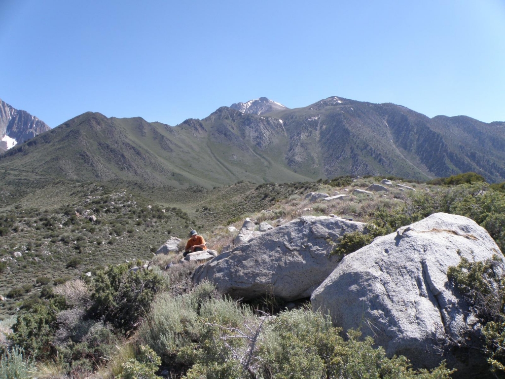
- Figure 4. View east toward the ice-contact slope of a prominent moraine forming part of the outer moraine belt at the Convict Lake moraine system, Sierra Nevada, California. We are interested in when the Sierra Nevadan glaciers achieved their LGM configurations, how long they maintained their LGM positions, and at what time they began to retreat. D.E. Putnam for scale. Photo: A.E. Putnam.
-
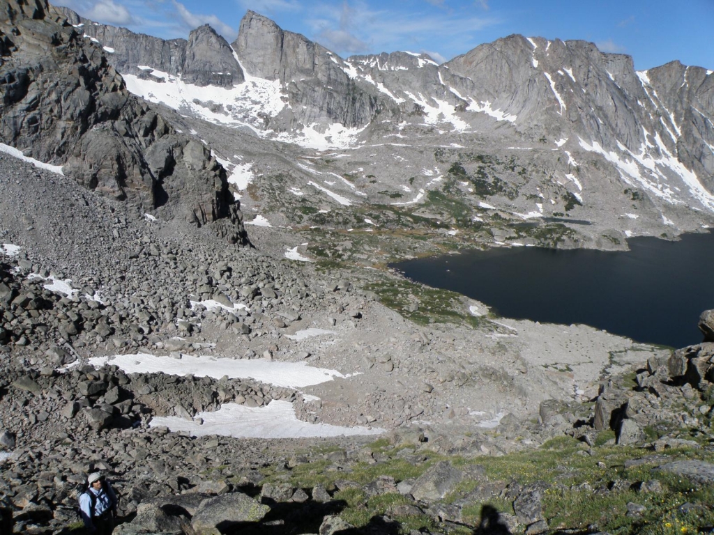
- Figure 5. View west toward the South Forks basin in the Wind River Range. Possible late-glacial moraines are defined by snowpack on slope in the background. Debris-flow deposits occurring along an active fault dominate the foreground. Glacier that deposited late-glacial moraines is obscured by spur in middle ground to left of photograph. S.D. Birkel for scale. Photo: A.E. Putnam.
-
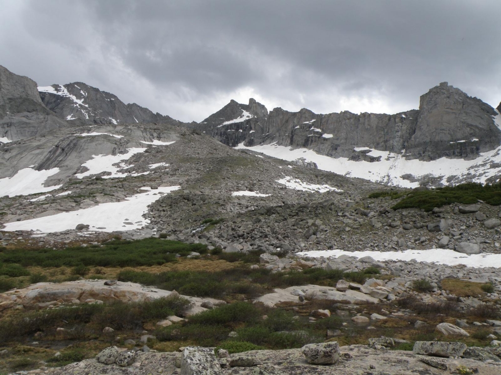
- Figure 6. View south toward head of the South Fork catchment. Moraine in foreground is the subject of our surface-exposure dating effort. Boulders on the moraine contain pitting, rind development, and lichen cover similar to boulders on the LGM (‘Pinedale’) ridges in the lowland. Those observations suggest that the moraine is of considerable age (perhaps late-glacial). Lying inboard of the moraine shown in this picture, but not visible, is a much-less weathered and non-vegetated moraine tentatively attributed to the culmination of the ‘Little Ice Age’ (ca. C.E. 1850 -1880). Photo: A.E. Putnam.
-
- Figure 7. Picture is taken looking north down the South Fork valley. In foreground, P. Quesada is measuring surface relief on a boulder that has been sampled for 10Be surface exposure dating, just outboard of the possible late-glacial moraine ridge. The age of this and adjacent boulders could elucidate how rapidly glaciers retreated from the lowlands into the highlands at the end of the last ice age. Deriving the rate with which the former glaciers retreated can help to determine whether a slow forcing (such as changes in sunlight due to Earth’s orbit, and/or CO2 changes) or a fast forcing (such as a switch in atmospheric circulation) dominated glacier mass balance in the Western US during the last termination. Photo: A.E. Putnam.
-
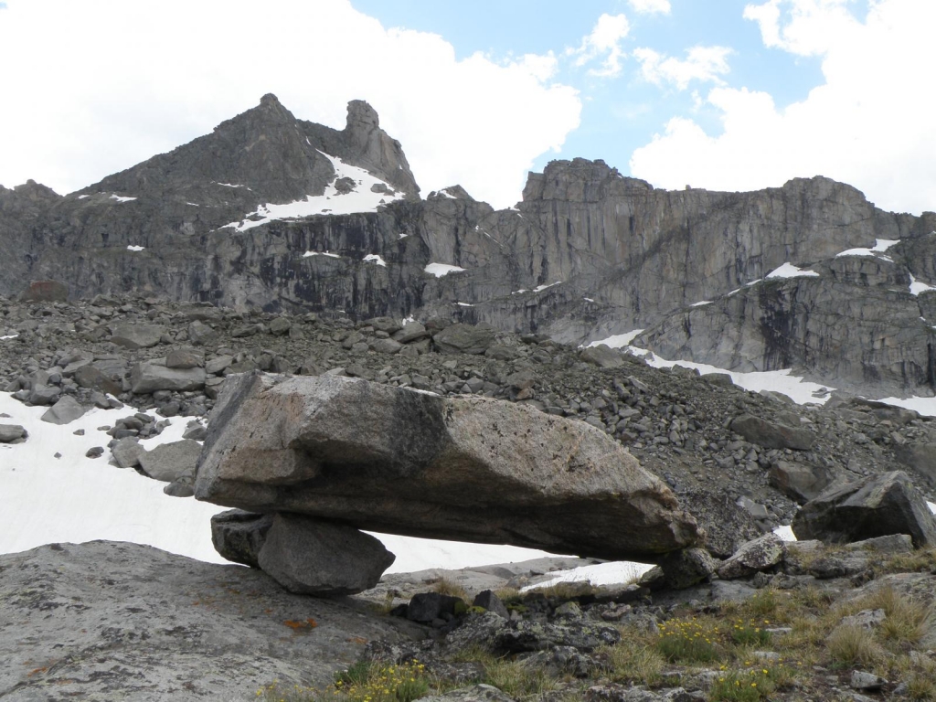
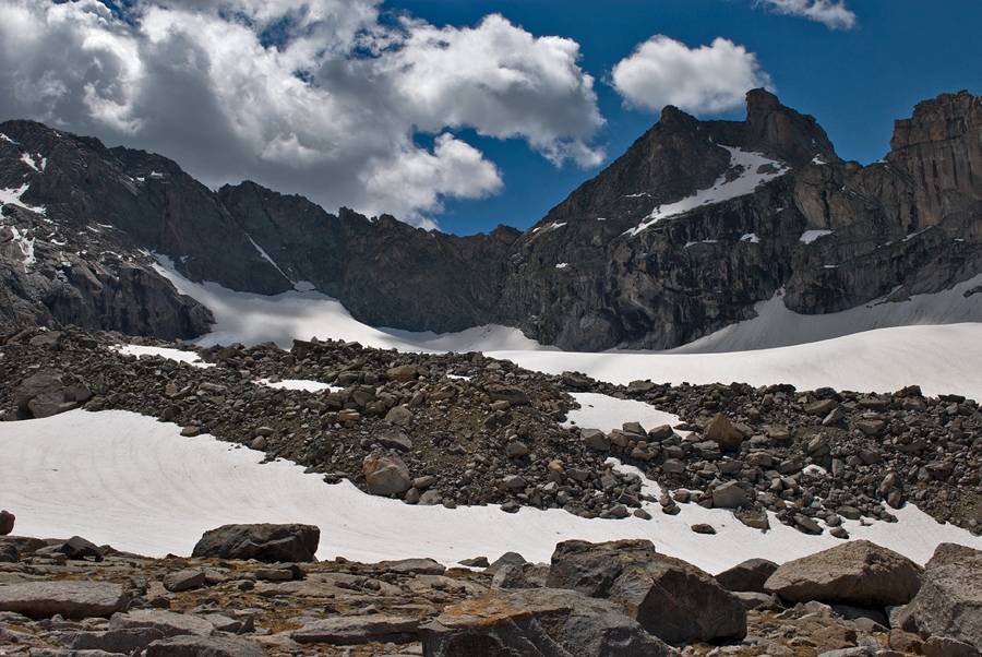
- Figure 8. View south toward the headwall of the South Fork glacier. Large, perched boulder is visible in foreground. Distal slope of Little Ice Age moraine dominates middle ground. There is a distinct difference in weathering between the outboard (weathered) boulder and the inboard Little Ice Age moraine (very fresh). Photo: A.E. Putnam.
-
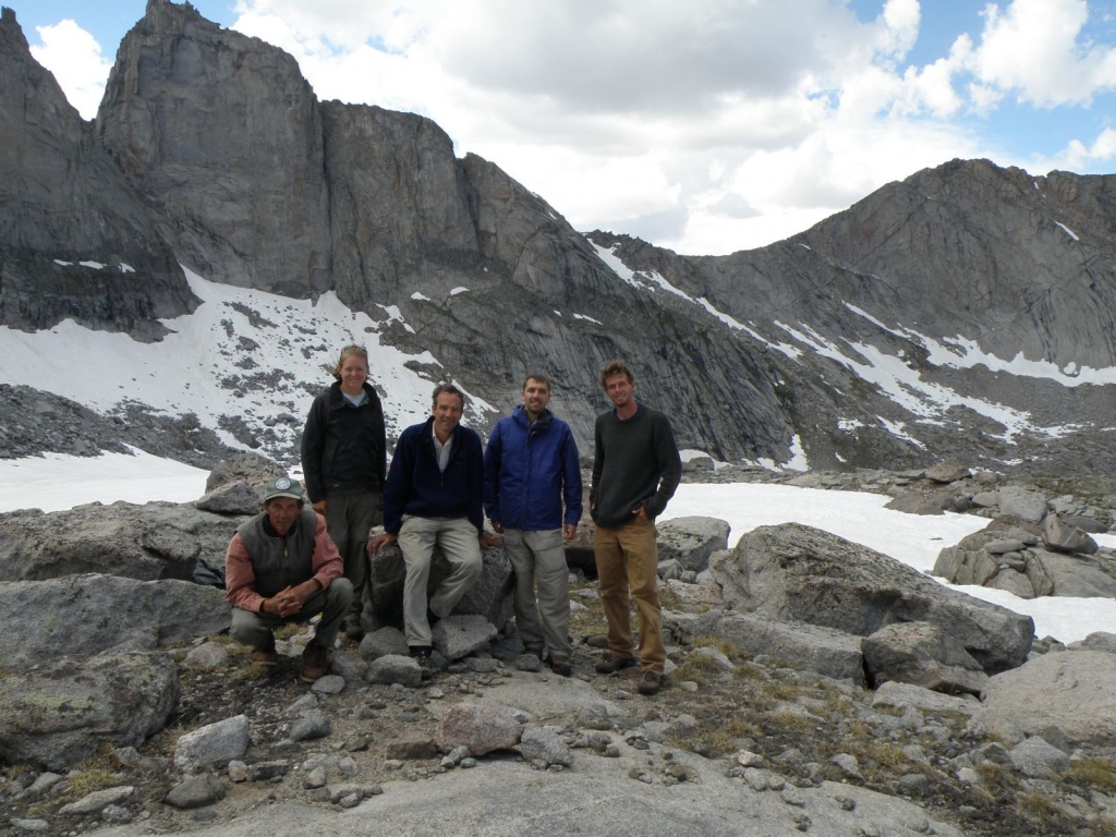
- Figure 9. Field team for summer expedition 2009. From left-to-right: D.E. Putnam (kneeling), K.L. Ladig, P. Quesada, S.D. Birkel, and A.E. Putnam. Photo: A.E. Putnam.
-
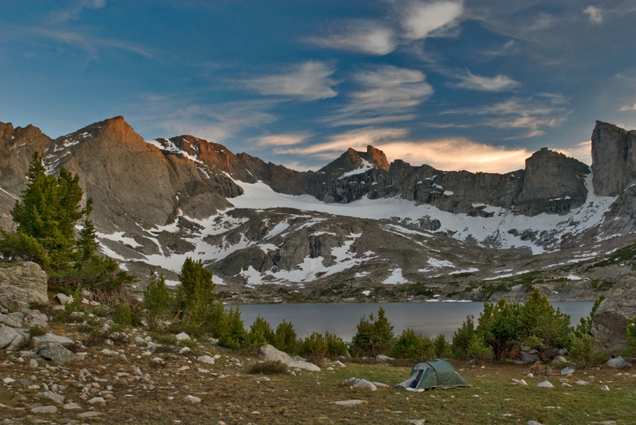
- Figure 10. UMaine campsite in Upper South Fork Basin. We examined moraines deposited by the unnamed glacier seen in the middle distance. Photograph by Sean Birkel.
-
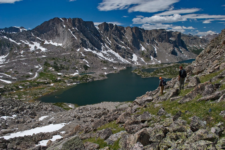
- Figure 11. View of Upper South Fork Lake. Moraines evident on left of frame; figures on right are Aaron Putnam and Katherine Ladig. Photograph by Sean Birkel.
-
- Figure 12. Closeup of Little Ice Age moraine adjacent to unnamed glacier. The field crew collected several rock samples from this area. Photograph by Sean Birkel.
-
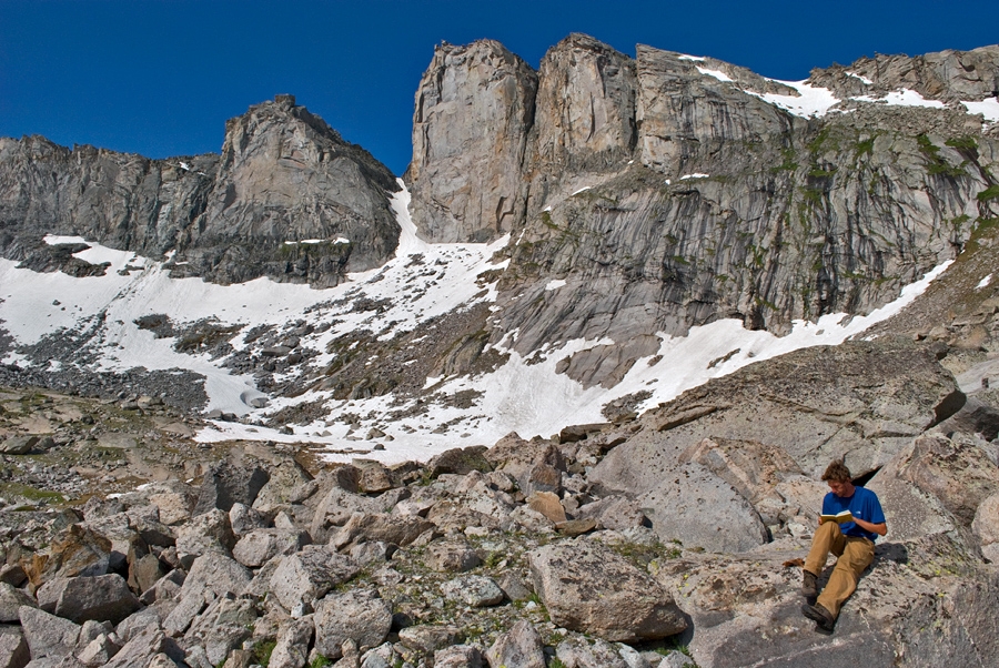
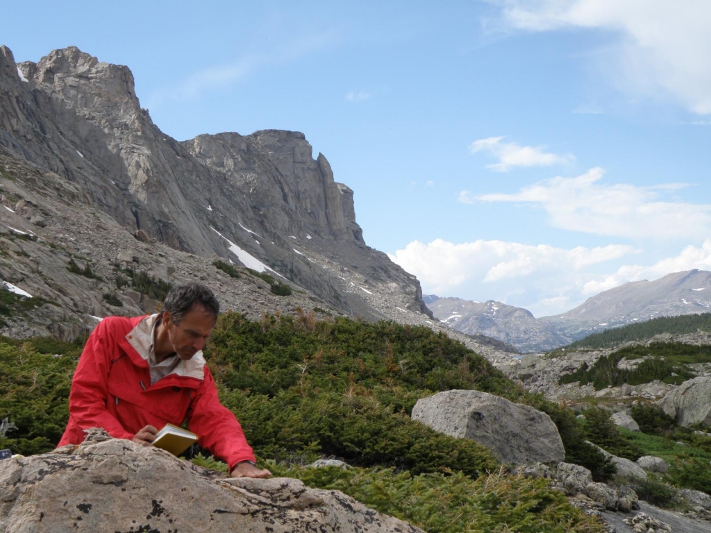
- Figure 13. Aaron Putnam writing field notes. Photograph by Sean Birkel.
-
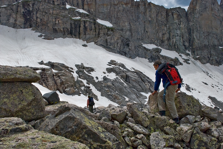
- Figure 14. Peter Quesada (foreground) and David Putnam (center distance) navigate over part of the Little Ice Age moraine complex. Photograph by Sean Birkel.
-
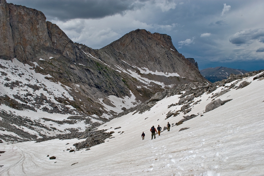
- Figure 15. A thunderstorm brews as the field crew descends from the glacier. The ridge at right is the innermost Little Ice Age moraine, meaning the foreground area was inundated by glacier ice in the recent past. Photograph by Sean Birkel.