
Los Morteros, Chao Valley, Peru 2012
Los Morteros, Chao Valley, Peru 2012
Geoarchaeological Explorations of an Early Mound, North Coast of Peru
Research Report Submitted to the Climate Change Institute at the University of Maine as a requirement for the Dan and Betty Churchill Exploration Fund
December, 2012
Introduction
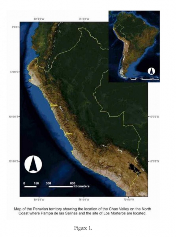
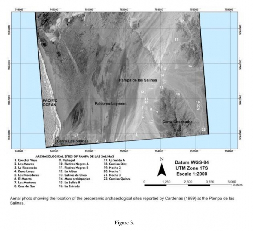
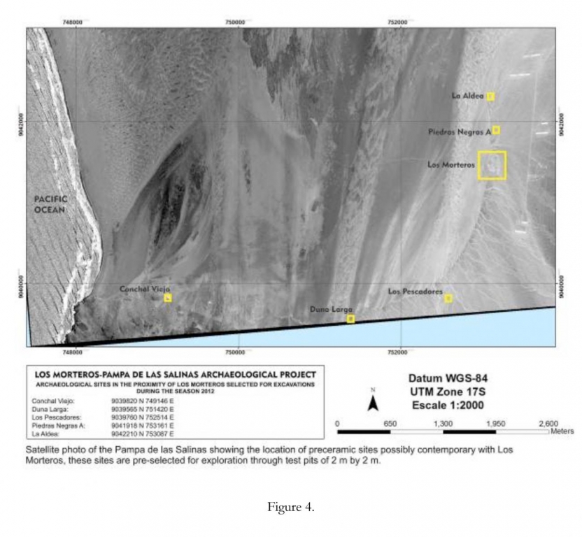
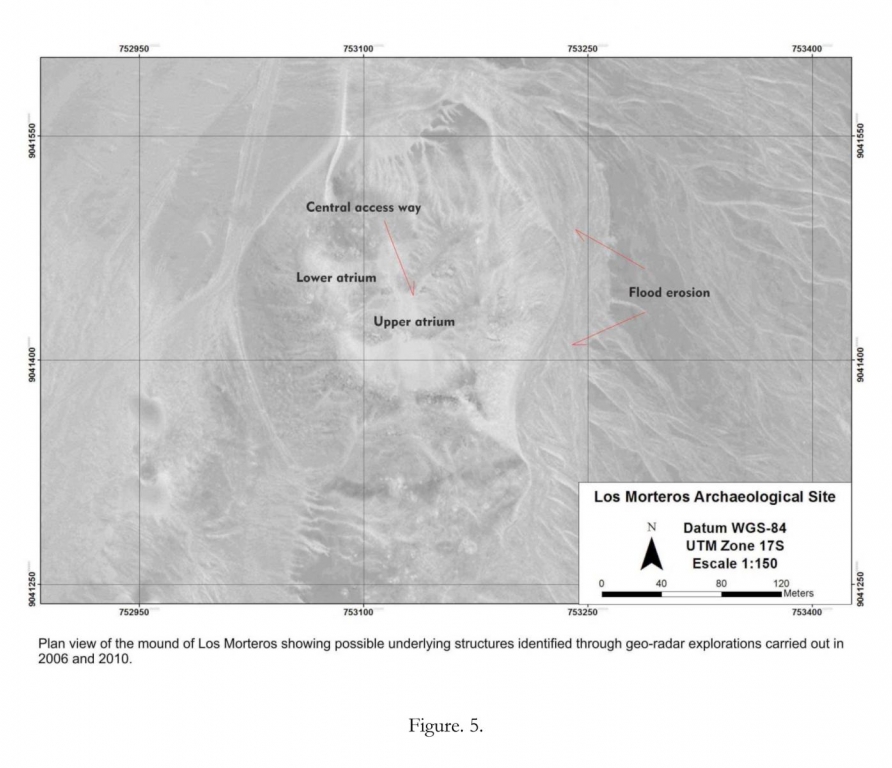
Los Morteros is a mound-shaped archaeological site located on the lower Chao Valley, North Coast of Peru (Figure 1 and 5). In 2006 and 2010 a crew of the University of Maine investigated Los Morteros using ground penetration radar, with the objective of explore the interior of the mound. This work indicated that the mound was not a natural feature but a building covered by thick layers of sand. In September 2012, I started a new field season, this time the mound was explored through archaeological excavations. This research carries out the study of Los Morteros within the frame of its natural and cultural environment. For this purpose the excavations at Los Morteros would be complemented with excavations in four possible contemporary neighboring sites: Conchal Viejo, Duna Larga, Los Pescadores, Piedras Negras and La Aldea (Figure 4).
The Chao Valley and Pampa de Las Salinas Area
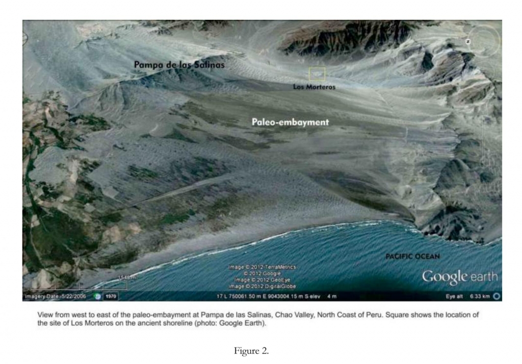
The Chao Valley is a relatively small and narrow coastal valley, located on the north coast of Peru, on the western flank of the Andean Cordillera. Its annual mean temperature is 16 °C and its annual mean precipitation varies from 7 mm minimum to 40 mm maximum. To date most of the land in the lower valley is under industrial cultivation by Peruvian and international companies that use waters of the Chavimochic irrigation project (brought from the Santa Valley, located to the south of Chao). This irrigation system provides water for agriculture to the Chao, Virú, and Moche Valleys. The Chao river basin has a longitude of approximately 76 km long. Los Morteros is located in the Pampa de las Salinas area, currently a hyper-arid environment in the lower Chao Valley. Pampa de las Salinas is a flat area, much of which is now covered by migrating barchans. This area is surrounded by Andean foothills to the east and the Pacific Ocean to the west. Small alluvial fans and quebradas cross the area as evidence of alluvial activity that could indicate the presence of El Niño. A particular characteristic of this environment is the presence of a paleo-embayment that contains a salt flat (Figure 2). Despite the aridity and apparent isolation of this milieu, Pampa de las Salinas seems to have been a very different environment judging from the evidence of an ancient and long history of human occupation. Only in the area of Pampa Las Salinas (~3 km x 6 km), 21 archaeological sites have been reported, all of which seem to be preceramic settlements (Figure 3).
Research Questions
Previous excavations at Los Morteros uncovered a series of human burials and domestic refuse that gave a calibrated date of 5572-4888 B.P. The geo-radar explorations carried out on the mound showed the existence of architecture underlain the sand cover. The potential antiquity and architectural characteristics of the hidden building at Los Morteros, as well as the natural and cultural setting of the Pampa de las Salinas, make this a very suitable area to study the formation process of early monumental sites and the factors involved in the development of social complexity on the Central Andes. Using principles of the historical ecology, environmental archaeology and geoarcheology as a theoretical and methodological framework (Crum ley 1994; Balée 1998), my dissertation research carries out the study of an early monumental site in the Chao Valley, from a comprehensive and historic perspective, in an attempt to understand Los Morteros as a historic process in which the natural setting, economic resources, and the hum an landscape are critical components. Therefore, the main objectives are to obtain a chronology for the mound of Los Morteros, make a first approach to the sequence of formation/occupation of the mound, and to expose the main architectural features of this early monument. On the other hand, in order to understand the processes of human settlement and the environment that allowed this early development, I propose to study Los Morteros in relation to its prehistoric setting, reconstructing the natural and cultural transformation of this landscape.
This research involves two main components: archaeological excavations at the mound of Los Morteros and geoarchaeological explorations of the surrounding area, which includes test pits in selected local sites. The first component of this study considers the excavation of trenches and square units at the mound of Los Morteros with the objectives of analyzing the construction phases, exposing the main architectural features and obtaining materials for radiocarbon dating. The second component of this research includes geoarchaeological explorations of the Pampa de las Salinas. This part of the study seeks to understand Los Morteros in relation to other local preceramic sites, to have a broader understanding of the human occupation of the area. The presence of a paleoshoreline could indicate that this was a tidal embayment that could have hosted coastal marshes or lagoons along its littoral. Wetlands and coastal lagoons could have been important environments during the development of permanent settlements (Lawler 2011). Therefore, I will search for suitable places for sediment coring oriented to understanding the kinds of environments that existed along the ancient shoreline.
Field Season 2012
In September 2012 I started a season of archaeological excavations that concentrated on the mound of Los Morteros. To date, I have excavated two trenches and four excavation units uncovering remains of stone architecture, mud-brick structures, midden deposits, hearths, and human burials.
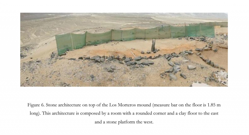
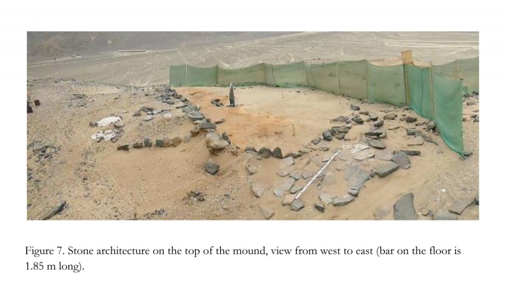
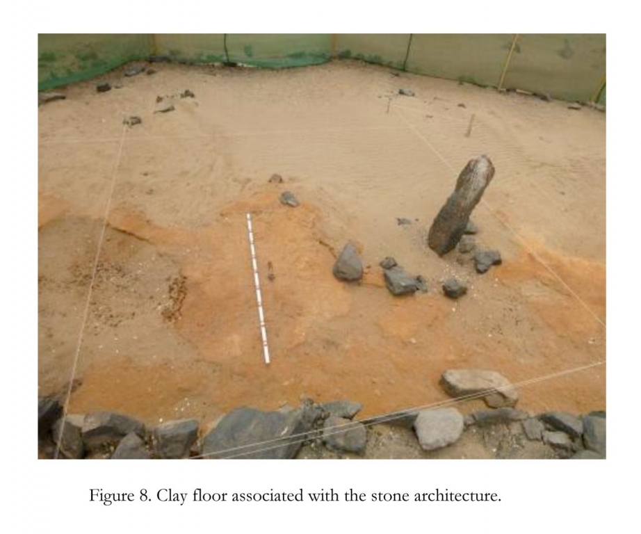
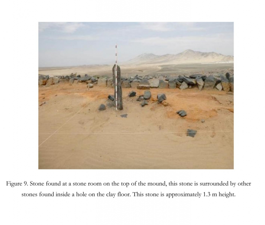
The excavations of these units at the mound of Los Morteros have shown different moment of the human occupation of the mound. The latest occupation corresponds to stone structures found on superficial levels of the top of the mound (Figures 6, 7, 8 and 9). This architecture is composed by a room of approximately 18 meters long and 10 meters wide which has an attached stone platform whose preserved extension was 2 meters long and 1.5 meters wide (Figure 7). The main function of these structures was domestic judging from the amount of shells, animal bones, and seeds found on the clay floor or inside the hearth and trash hole found in this room.
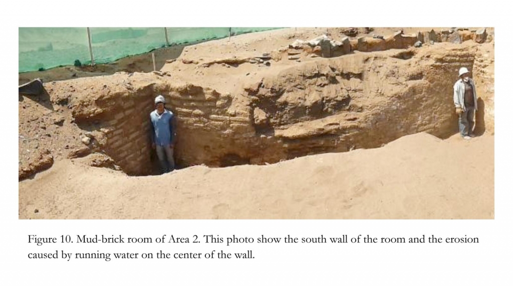
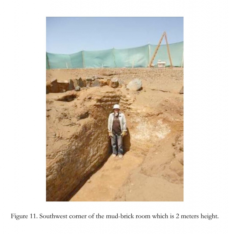
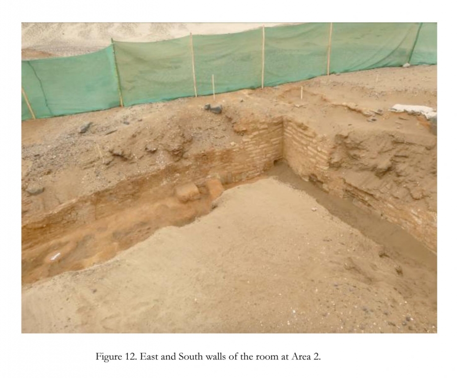
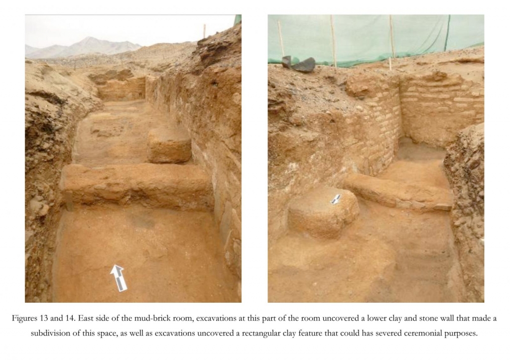
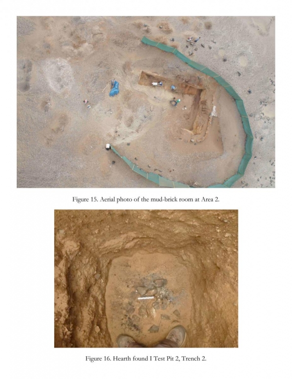
An earlier occupation of the mound was found digging Unit 2, at the northwest end of the mound (Figures 10 to 15). The evidence of this phase was a room that has 10.4 meters long (N-S) and 7.1 meters wide (E-W), this room has walls that were at least 2 meters height and 0.2 meters wide. These walls were made of rows of mud-brick keep together by thick layers of clay and have a plaster of clay. The foundations of these walls were quarried stones with flat surfaces facing the interior of the room. No materials were found directly associated with this room. Only midden deposits composed by shells, animal bones, pieces of mats, seeds and other organic remains were part of the fills that were covering this structure.
The possible earliest evidence of human activity found during this season 2012 was in Trench 2. This evidence was a hearth found digging a test pit inside Trench 2, this hearth was more than 3 meter from the surface of the lowest part of the mound (Figures 5 and 16). Some shells (Argopectem sp.) were found placed inside this hearth. The dating of this feature will determine the real antiquity of this evidence of human activity and its position within the occupation history of the mound.
Currently, I am digging Unit 4, which explores the north edge of the top of the mound looking for evidence of architecture underlain the sand cover on this area. The excavation of this unit and the excavation of the test pits proposed for the neighboring sites mentioned above as well as the coring of the paleoembayment will be done during January and March 2013.
The analysis of the materials and radiocarbon dating will be done after the end of the field season. All the analysis but radiocarbon dates will be carried out in Peru.
The evidence of different phases of human occupation of the mound of Los Morteros shows that the site had a complex formation process that might have taken several hundred or thousand years. The excavation and dating other sites that are located along the paleoshoreline will complement the understanding of the preceramic history of the Pampa de las Salinas and the nature of the human occupation of this area, which potentially could be one of the oldest preceramic areas of the Central Andes.
Acknowledgement
I am very grateful for the generous support from the Dan and Betty Churchill Expedition Fund, The Graduate Student Government of the University of Maine, The NSF funded Project “Long-term Human Ecodynamics in Coastal Peru: A Case Study of Polar-Tropical Teleconnections”, The Waitt Grant of the National Geographic Society, and The French Institute of Andean Studies.