Abrupt Climate Change, Patagonia
Abrupt Climate Change, Patagonia
Paul Mayewski, Andrei Kurbatov, Erich Osterberg, Daniel Dixon, UMaine
Charles Porter, Patagonia Research Foundation and UMaine
Mike Ellis and Scott Mason, Stonehaven Productions, Canada
February 20 to March 22, 2005
Research conducted by Climate Change Institute members in Antarctica over the past few years has resulted in new theories concerning the role of the Southern Hemisphere in abrupt climate change. To test these new theories and to expand the network of climate information over the Southern Hemisphere we are searching for sites from which we can collect ice cores that capture detailed histories of past climate and environmental change. Our first reconnaissance season will be used to investigate potential ice core sites in the Cordillera Darwin and Southern Patagonian Ice Cap because of the proximity of these sites to our research sites in West Antarctica.
February 20th to the 24th Travel
The team departs Bangor, Maine on Sunday, February 20th flying through Boston, New York, Miami to Santiago, Chili and continue on to Punta Arenas. In Punta Arenas, they catch a ferry to Puerto Williams, the southern most year round settlement in South America.
February 25th to 28th
At Puerto Williams, the team will meet up with Charlie Porter and his boat, the Ocean Tramp. They will load gear on the boat and purchase any last minute supplies.
On the 26th the film crew should meet up the rest of the team. They plan to spend a couple of days resting and finishing preparations for sailing.
March 1st: Set sail
The Ocean Tramp will sail from Puerto Williams for the fjord of Cordillera Darwin. Expected sailing time is about a day and a half.
March 2nd to the 9th
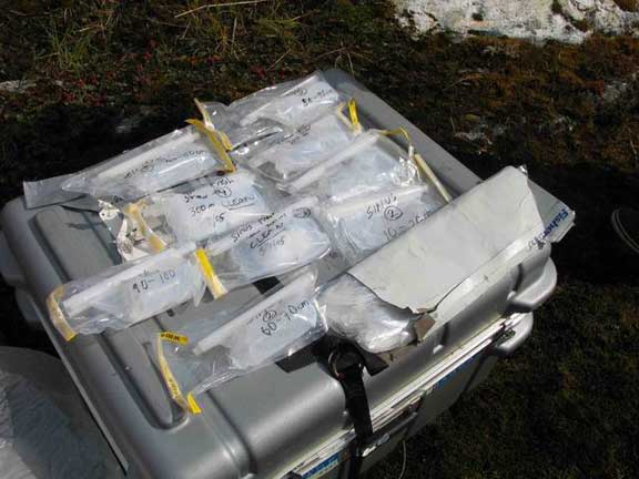
Unload gear from the Ocean Tramp, haul it to work site. We hope to spend about 5 days on top of the glacier taking samples and packing them for shipment. Pack all the gear and samples and haul it back to the Ocean Tramp.
March 12th to the 13th
Sail back to Puerto Williams. Unload gear and make arrangements for the return trip.
March 14th to the 21th
Return to Punta Arenas. Make travel arrangements for return. Spend a few days doing reconnaissance for future field work.
Date: Tuesday February 22nd 2005
Time: Midday
Location: Punta Arenas
Temperature: 16°C 60°F
Wind speed: 5 mph
Wind chill:
Water Temperature: N/A
Altitude: 18m
Weather: sunny, blustery, scattered cloud and brief periods of rain
Distance Sailed: 0 miles

¡Hola!
The flight down to Punta Arenas was fairly uneventful, no cancellations, serious delays, or missed flights. Our one mishap was lost luggage; when leaving Maine we had 17 checked bags and after our rendezvous with Erich in Boston our bag total reached 22. However, at the baggage claim in Santiago only 7 bags appeared! There was not much we could do so we carried on with our flights. Thankfully, at the baggage carousel in Punta Arenas there appeared several of our lost bags. Now we have 15 of our 22 bags and we are waiting patiently for the other 7 to arrive at the airport.
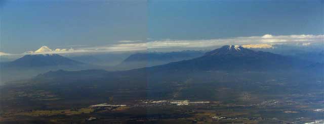
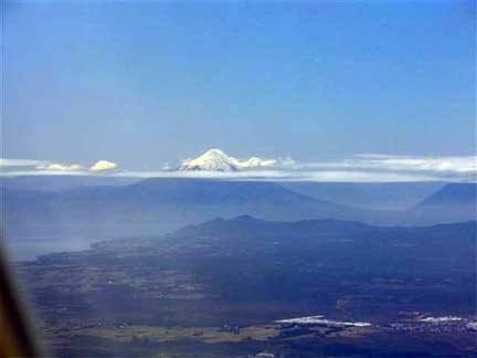
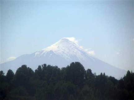
Aside from the lost bags, our flights went well. The Chilean airline food is exceptionally good. As we flew south from Santiago the Andes came into view and there was a mad rush over to the left hand side of the plane to look out of the windows, if we had been in a boat we would have tipped over! The further south we flew, the more spectacular our view became. We were due to land at Puerto Montt to drop off some passengers and just before landing we were treated to a spectacular view of two enormous volcanoes. Osorno is the name of the tall, snow-capped, conical volcano. During our time on the ground a thick cloud bank rolled in and spoilt our view for the remainder of the journey, a pity because we flew almost directly over our second proposed field site. During the approach into Punta Arenas airport the clouds cleared enough for us to see an enormous icecap looming on the horizon. By the time we landed it had disappeared from view, could it have been our first proposed field site, the Cordillera Darwin?
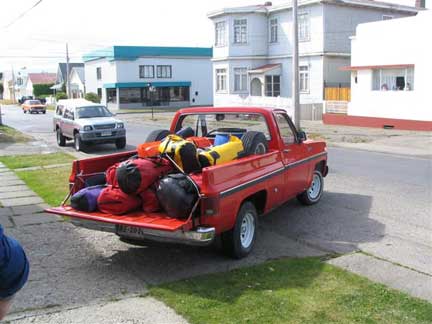
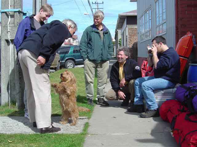
The people here in Punta Arenas are extremely friendly and the food is very good. This morning we loaded the fifteen bags that we have into Juan’s pickup truck; Juan is the owner of our cozy little hotel and he has a friendly little dog that does tricks. Together with Juan we drove all our gear and many boxes of food that Charlie had already acquired to the ferry terminal and packed them into a shipping container ready for our ferry journey to Puerto Williams on Thursday. After unloading the food and gear, we went to the supermarket and bought 20 more boxes of food!
It is getting fairly late in the day now, time for some tea and then a short walk to the beach, after that dinner. Tomorrow our only jobs will be filling all of our fuel bottles and buying more food. Then we can take some time to look around this beautiful city at the bottom of the world.
¡Adios!
Date: Thursday, February 24th 2005
Time: 9:44 am
Location: Punta Arenas
Temperature: 14°C 57°F
Wind speed: 10 mph 8.7 knots
Wind chill:
Water Temperature: N/A
Altitude: 18m
Weather: sunny, blustery, scattered clouds and brief periods of rain
Distance Sailed: 0 miles
Yesterday we spent the whole morning shopping for last minute items. After our highly successful shopping spree we took a break for some lunch. Shopping for an expedition is quite hard work! For lunch we all had a Churrasco, an extremely delicious Chilean sandwich.
After lunch we hailed a cab back to our hotel and securely packed all our last-minute fuel and food in boxes ready for the ferry ride. Juan, the hotel owner, kindly allowed us to fill the back of his pickup truck again and then drove us to the ferry terminal. As we pulled in to the terminal main office, we saw that the shipping container with all our gear in it had disappeared! We were relieved when Juan told us that it had already been loaded onto the ferry.
After driving aboard the ferry and unloading the remainder of our gear, Juan offered to take us out on a tour of the city. We gladly accepted his offer.
Punta Arenas is a beautiful city with a modern shopping and business area
downtown. The suburbs are very picturesque, with thousands of quaint-looking and colorful houses. The charming thing about the suburban areas is that each house is unique, no matter where you go you can never find two houses that look the same! Another interesting feature of the suburban areas is the raised trash receptacles at the corner of each street. This is undoubtedly an attempt to prevent wild dogs from rummaging through people’s rubbish. There are many wild dogs roaming the streets of Punta Arenas, it is not uncommon to see packs of five or six dogs roaming freely. It is unclear whether these animals actually belong to anyone, but they can be quite a problem; several times while driving through the city we were forced to slam on the brakes so as not to hit a roaming mutt without any road sense.
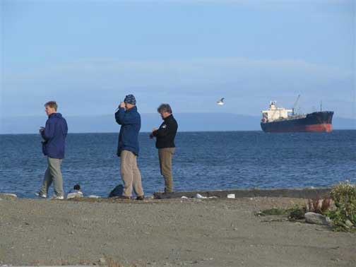
Juan’s tour included a drive along the coast; we saw many fishing boats and several enormous old wrecks. After chatting for a while with Juan over a cup of delicious Chilean coffee it was time for dinner. We ate our dinner at a restaurant that was highly recommended to us by Juan, the food was lovely and we spent a long time afterwards discussing details of our plan for the coming weeks.
This morning we ate breakfast and then settled down in front of Andrei’s laptop computer to examine some satellite images of our field areas. Gordon Hamilton of the Climate Change Institute provided the images for us. We spent several hours looking for the ideal ice-coring sites and plotting the safest routes.
We vacated our rooms at the hotel and it is now time for lunch. After lunch, we will head to the ferry terminal. This time we will board the ferry and set off
for Puerto Williams. Charlie flew to Puerto Williams ahead of us yesterday. He will be preparing his boat, Ocean Tramp, ready for the next leg of our voyage.
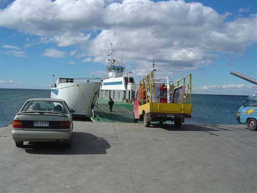
The ferry trip to Puerto Williams takes 24 hours and will take us through the Magellan Strait, briefly into the Pacific Ocean, right past Cordillera Darwin, and then down the Beagle Channel. Puerto Williams, our destination, is approximately 100 miles north of Cape Horn. It should be a spectacular trip, let’s hope for some good weather!
Date: Saturday, February 26th 2005
Time: 11:45 am
Location: Puerta Williams
Temperature: 7°C 45°F
Wind speed: 50 mph 43.4 knots
Wind chill: 17°F
Water Temperature: N/A
Altitude: 10m
Weather: Constant wind and heavy rain
Distance Sailed: 0 miles
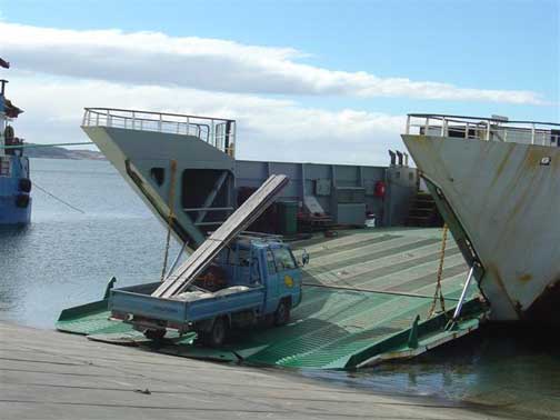
We have just arrived in Puerto Williams after a 40-hour ferry ride! The ride was only supposed to be 24 hours long, but strong winds and heavy seas made our progress very slow. The ferry itself is very wide and open to the elements, much like a cargo vessel. There is only one private passenger cabin onboard; everyone else is squeezed into a long thin room full of plastic-covered seats. The reason for the plastic seats became clear once we were underway; the bathroom is located at the far end of the cargo deck and the combination of breaking waves, sea spray, and driving rain guarantee you will be thoroughly soaked by the time you have answered the call of nature.
The food onboard was just as impressive… slightly stale wonder bread, processed cheese slices, and processed ham, all nicely warmed in the ships microwave. We had this delicious feast for breakfast, for lunch, and for dinner! We did get something more original when the seas calmed down a bit. It must be difficult to cook when you are being thrown around. The cargo deck of the ferry was very colorful, it contained everything from cars and trucks, bales of hay, chemical containers, building materials, food, and even a number dogs who whined loudly as the ferry slammed against the waves.
Needless to say, we were very relieved to arrive at Puerto Williams. Charlie Porter greeted us with a smile as we walked off the ferry. It takes a few hours before the unloading of the ferry begins so we headed to the dock to see Charlie’s boat: Ocean Tramp.
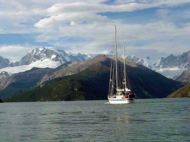
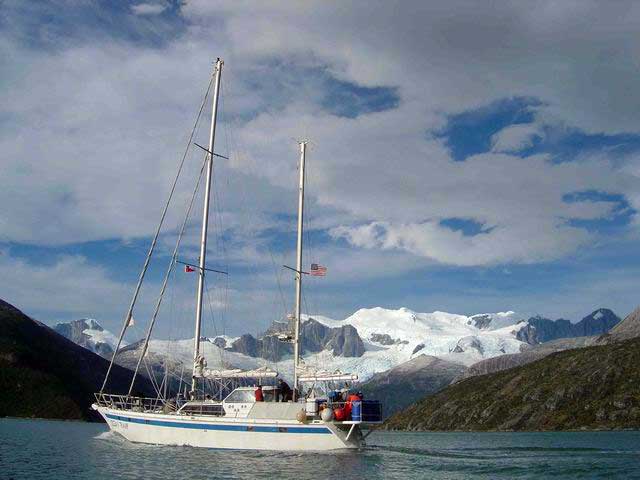
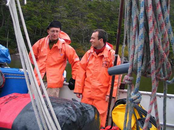
Ocean Tramp is a lovely-looking custom-designed vessel; it is one of only two of its kind in the world. The aluminum hull is reinforced for polar exploration with a double-thickness bottom. It is 21m long with a 6m beam and only draws 2.1m. It is a cutter rig ketch design with an added pilothouse. It’s water tanks can hold 5000 liters and it carries 4000 liters of fuel giving it a 4000 nautical mile range. The power plant is a 230 hp Perkins diesel with a 32 inch prop. It has a roller furling jib and genoa. It also has 3 radars, 2 echo sounders, 3 gps units, 3 zodiacs, and four 15 hp outboard motors. The boat is designed to sleep 15, but that might be a bit of a squeeze. We will be traveling with ten on board: Charlie Porter (Captain), Juan (First Mate), Paul, Andrei, Eric, Dan (Science Crew), Scott, Mike (Film Crew), Martin and Klara (Cooks). It is very spacious onboard and the only time that you realize there are ten people around is at meal times when you are all squeezed around the table.
After meeting everyone onboard Ocean Tramp over a hot cup of tea, we returned to the ferry to unload all of our gear. Thankfully, Charlie owns quite a large truck so we were able to move all our gear in only two trips. Back at the dock we began the long slow process of fitting all our gear inside Ocean Tramp.
Date: Saturday, February 28th 2005
Time: 11:00 am
Location: Puerta Williams
Temperature: 8°C 46°F
Wind speed: 10 mph 8.6 knots
Wind chill:
Water Temperature: N/A
Altitude: 2 m
Weather: Constant wind and heavy rain
Distance Sailed: 20 miles
Yesterday we spent most of the day packing our gear into the boat. We also spent a long time repacking the food that we brought from Maine and bought in Punta Arenas. We decided to pack our food into daily bags with all perishables (meat and cheese) packed separately. We re-assembled the sleds, checked the drills, and did a bit more shopping for chocolate and batteries. We ate ravioli for lunch and chili-con-carne for dinner. The night was beautiful and clear with a big, bright moon lighting up the clouds from behind.
Puerto Williams is a very picturesque little town with beautiful snow-capped mountain views all around. The weather is usually windy and rainy, but when the sun shines it seems unreal.
This morning we finished packing the boat and we had some time free to wander about town. We discovered free computer access in the local library but the computers were so old that they did not even have USB! Andrei, Erich, and I had the bright idea of washing a few of our dirtier clothes at the local laundry. Two twelve-year old girls run the local laundry from the front room of their parent’s house. We walked in, dropped off our bags of clothes and were told to pick them up at 7 pm. Meanwhile, Charlie had finished dealing with all the red tape at the port authority and we now had a departure time of 7:30 pm. It is a good idea to be on board at least an hour prior to departure, so at 5:30pm Scott, Mike, and I ran back into town to rescue the laundry. Some of it was still wet, but at least it was all clean.
We left port at 7:30 pm, the Sun was out and the cloud height had increased to reveal the mountaintops all around us. There was barely a breath of wind… an absolutely perfect day. We motored for a couple of hours and eventually dropped anchor in a protected bay not far from Puerto Williams. We ate another delicious meal prepared by Martin and Klara, drank a glass of red wine and retired to our bunks.
Questions from Ms White’s 7th grade class:
- What was the dog’s name?
The dog’s name is Punky or perhaps Punchie? - What makes a good site to collect ice cores?
A good core site needs to have a low (less than -5°C) mean annual temperature and
good annual layer preservation. - Are there volcanoes in the area where you will travel? If yes, are
they active?
There is a non-active volcano very close to Cordillera Darwin but the nearest active volcano is beyond Punta Arenas. - Will you have any native guides?
No native guides (unless you count Juan on the boat!). We assume you mean a guide on land. - What season is it?
The season is late summer. - How many hours of daylight do you have now?
About 15-16 hours of daylight. - What is a churrasco made of?
The main ingredient in a Churrasco is beef steak, we also had avocado, lettuce, and tomato – YUM!
Date: Wednesday, March 2, 2005
Time: 11:00 pm
Location: S 54.77307 W 69.67661
Temperature: 13°C
Wind speed: 5 mph 4.4 knots
Wind chill:
Altitude: 2 m
Weather: Mostly sunny
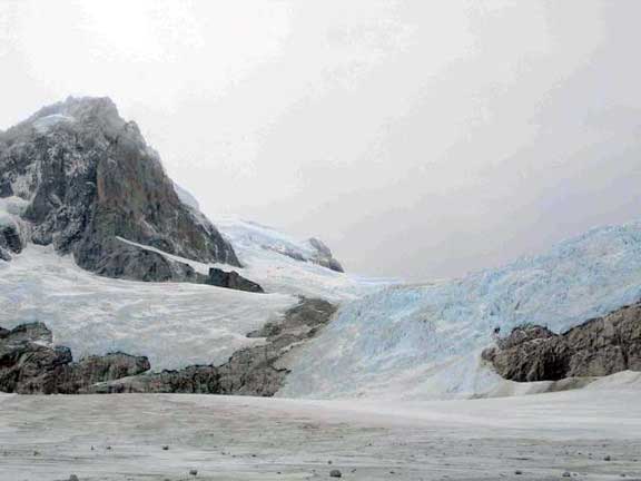
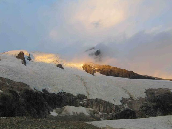
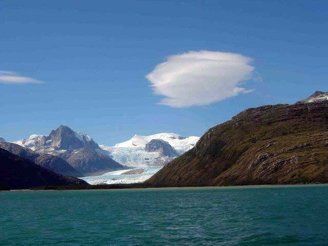
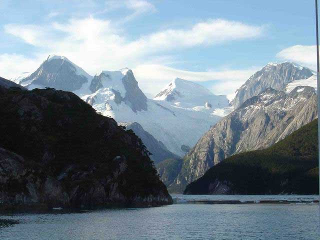
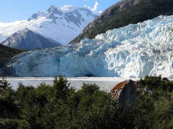
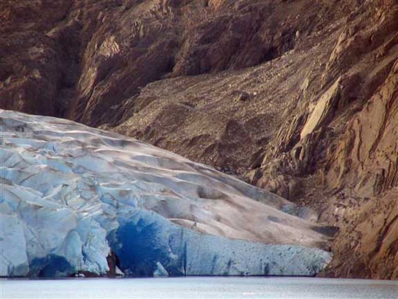
Yesterday (Tuesday) was a rare day indeed, warm sun, cloudless sky, no wind, and the sea was virtually flat. The scenery we sailed past was absolutely breathtaking; no matter which way I looked, my eyes were greeted by ever more-beautiful landscape views. The only sound when sitting on the bow of the boat was the gentle lapping of the water as Ocean Tramp sliced gracefully through. Large glaciers flowing slowly towards the sea punctuate the snow-capped mountains; each bay reveals a stunning new ramp of heavily crevassed white snow and blue ice. Every now and then, a perfectly white plateau of snow appears in the distance and looms for a while as if watching over these enormous mountains of rock and ice. While sailing down the Beagle Channel we spotted several groups of small penguins and lots of sea birds. By 6 pm we had made it to our fjord through scenes of ever-increasing beauty. As we moored the boat a pair of large condors circled overhead, gliding effortlessly on invisible updrafts.
The fjord anchorage that Charlie chose was perfect; steep-sided valley walls, perhaps 300-400 m high, with a waterfall that spills over the top of the cliff and winds its way down to within 20 m of our boat.
Charlie, Paul, Mike, and Scott took off in a Zodiac to check on the condition of our proposed route up the glacier. As it turned out, things had changed quite a bit from previous reports. The ice edge had moved and cut off our planned route to the top of the glacier. After dinner, we had a meeting to decide what our next plan of action should be; Charlie and Paul will do some more reconnaissance tomorrow to see if they can find an alternative route. Hopefully the weather will stay fine enough for the rest of us to do a little exploring also.
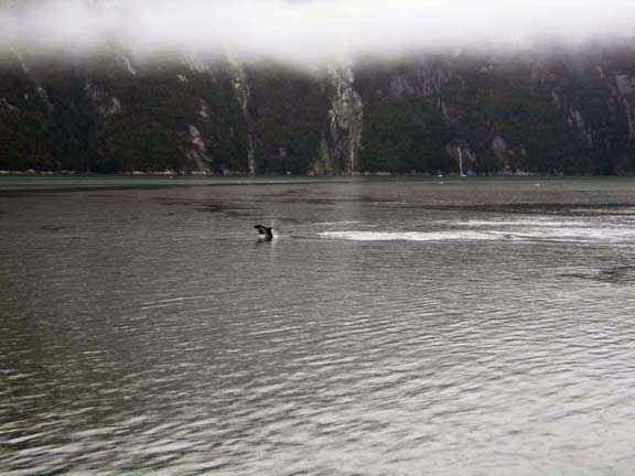
Today (Wednesday) started off rather cold and overcast, thankfully, it developed into yet another spectacular day. Paul, Charlie, Mike, and Scott went out in the Zodiac again to do more reconnaissance. They headed to the next-door fjord to check for back routes to our intended drilling spot. Andrei and Erich went out for an exploratory hike while Juan and I did a little boat maintenance; repairing the “Ocean Tramp” sign on the port side bow of the boat. After a little bite of lunch, Martin, Klara, and I went out for a little hike of our own. The landscape around here seems virtually untouched, I almost felt guilty for treading upon such virgin soil. There are many small songbirds fluttering about, and lots of insects too. There are small bushes bearing delicious little pink berries all over the place. The berries taste sweet, but also a little tart, across between a cranberry and a blueberry. There are lots of dolphins in our fjord, they like to come and play close to the boat. The reconnaissance team returned with some good and bad news; there is another way up to our planned site, but it will probably be too difficult with all the gear that we have. It would involve climbing up a steep slope that is heavily wooded and very boggy. However, Paul and Charlie came up with the idea of drilling on the Ellis glacier. The advantage of drilling on the Ellis glacier is that the approach should be relatively easy compared to our originally planned route. All we can hope for now is good weather and easy travel.
Date: Friday, March 4th 2005
Time: 10:00 pm
Location: S 54.77378 W 69.59059
Temperature: 6°C 43°F
Wind speed: 15 mph
Wind chill:
Altitude: 12 m
Weather: Rain, Rain, Rain
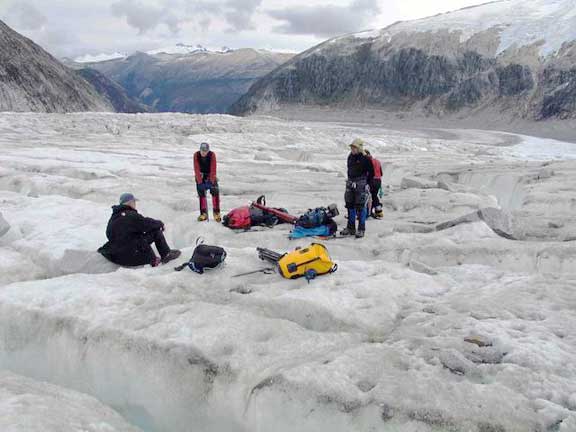
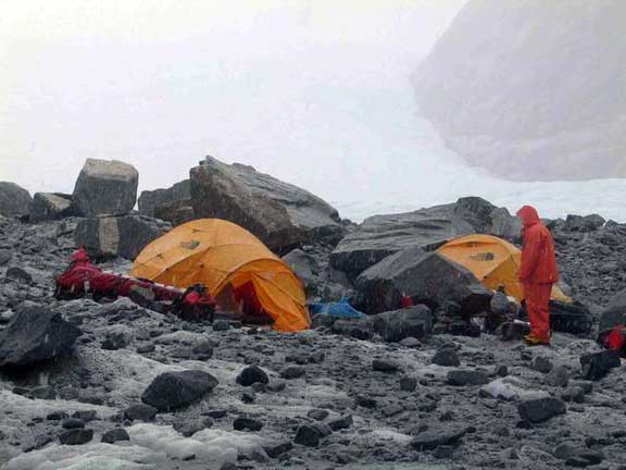
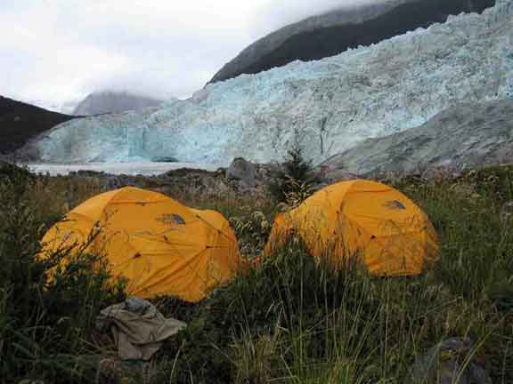
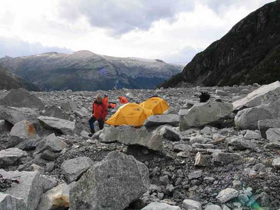
Yesterday we moved all our gear from Ocean Tramp to the base of the Ellis glacier; we were very lucky to have a cloudless, sunny sky for the whole day. We moved to the glacier by loading Charlie’s zodiac with bags, motoring to the beach nearest the glacier, unloading our bags onto the beach, and finally carrying our bags to a good camping spot on the moraine close to the snout of the glacier. This process required three fully loaded zodiac trips to get all our gear to the beach and the hike to our camping spot was difficult because we were moving through long grass that camouflaged rocks and boulders of all shapes and sizes. I think that by the time we were done lugging gear, we all had bruised and bloodied shins! After a brief recovery period, Paul, Andrei, Erich, Scott, and I carried the first load of gear up the glacier and made a cache at 300 m elevation. Mike stayed at base camp to finish setting up the tents and a cooking rock. By the time we got back down to base camp the light was fading, it was a relief to see all the tents up and ready and a pot of water boiling on the stove.
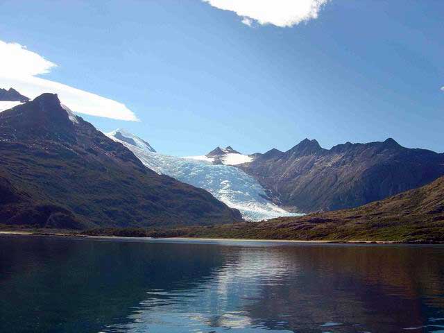
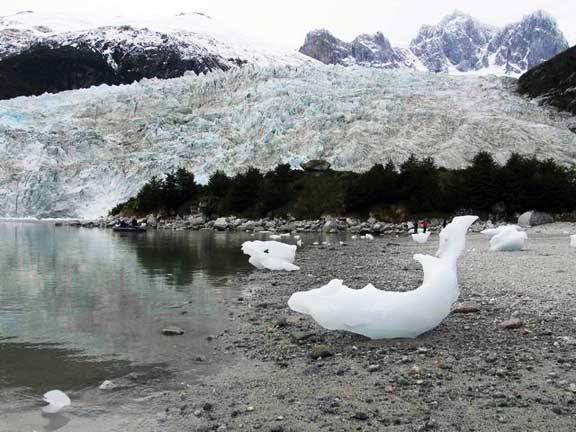
Our base camp is situated about half a kilometer away from a second huge glacier snout that completely dwarfs the Ellis. This other huge glacier is very active and it calves huge ice blocks into the fjord every 10 -15 minutes. When this occurs we are treated to a loud thunder-like cracking sound, something like a large canon! This sound is followed by roaring splashes as the enormous ice chunks hit the water and splinter into millions of pieces. As we drifted off to sleep that first night, the sounds of calving seemed oddly calming.
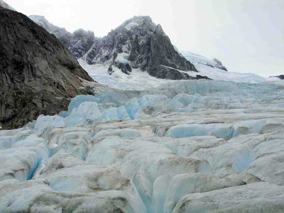
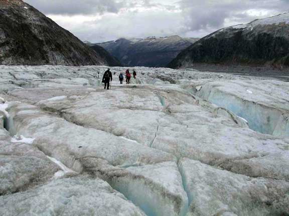
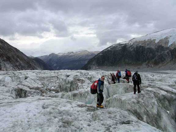
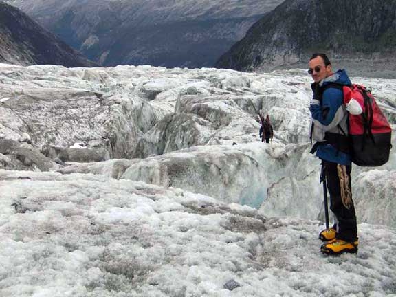
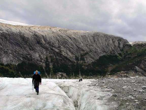
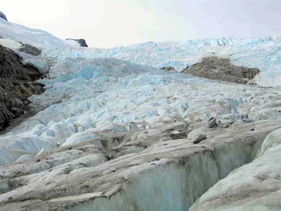
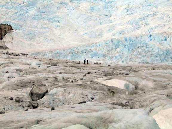
The Ellis glacier itself is stagnant, this means that its flow rate has slowed considerably and most of its mass is lost through melting. The lower portion of the glacier is composed of freshly broken, angular pieces of granite, some similarly shaped igneous rocks, and solid ice. The rocks range in size from finely ground flour to boulders bigger than a house. These sharp rock fragments litter the surface of the glacier, which is far from smooth. Differential melting causes the surface to become scarred and scoured, covered by ridges and hillocks, add to this crevasses and moulins and you have a recipe for some rather difficult terrain. Moulins are holes melted into the glacier surface that extend downwards and link up with the network of meltwater channels within the glacier that form its primary drainage. Moulins range greatly in size from a few centimeters to something you could drive a train into! Standing on the surface and looking around reminds me of the surface some strange, far-off extra-terrestrial planet or moon. Hard plastic mountaineering boots and crampons are required for travel because these are the best things for keeping a grip on the hard, wet, jagged surface.
Today we carried another load of heavy gear up to the 300m cache site. About 10 minutes into our journey the rain began to fall, and it didn’t stop. By the time we reached the 300m site we were thoroughly soaked. We had originally planned to carry the gear up to 600 m but the weather was getting so bad that we dropped the gear at 300 m and returned back to base camp. To rekindle our damp spirits Andrei cooked up a delicious rice curry for dinner. Unfortunately, the lid of the hot red pepper fell off as he was adding it, so it ended up being extra, super, duper, hot and spicy!!! Delicious!
Date: Saturday, March 5th 2005
Time: 11:00 pm
Location: S 54.78676 W 69.56073
Temperature: 10°C 50°F
Wind speed: 10 mph 8.7 knots
Wind chill:
Altitude: 300m
Weather: Sunny and Clear
While we ate dinner last night we had a visit from a naughty grey fox, the fox approached within about 5m of us before we scared it away. We most likely set up our camp right in its den. The naughty fox came back during the night and tried to chew its way into our food bin, luckily, it couldn’t chew through. It did manage to make a bit of a mess with our trash though.
The rain stopped at about 09:00 this morning and the sun began to shine, soon everyone had all their wet gear out and draped over nearby rocks and trees, it looked just like a laundry! By the time we were all dried out we had made the decision to pack up the base camp and move to the 300m site. It was a very slow climb as we were all carrying very heavy loads. We arrived at the 300m site by around 18:00 and began to set up camp immediately. Setting up tents on rock-covered ice is not easy, we had to dig out rocks with our ice picks, smooth out the ice surface as much as we could, and re-route melt water pathways away from our tents. We lay down space blankets beneath the tents to try and keep the floors from getting wet, but within minutes of setting them down they were soaked through anyway. We kept our spirits up with a nice hot cup of tea and some biscuits with cheese; we even cooked ourselves up some delicious bacon and ham.
Despite the surface conditions, this must be the most spectacular campsite that I have ever seen. As I prepare for bed I can see the Milky Way stretching clearly across the sky above me. I can hear the sound of waterfalls cascading down the steep rock face behind me and the occasional rumbling thunderclap of the calving glacier on the opposite wall of the valley. We were very lucky that it did not rain all day; I just hope that the weather holds out for our trek up to 600m tomorrow.
Date: Sunday, March 6th 2005
Time: 10:30 pm
Location: S 54.78676 W 69.56073
Temperature: 10°C 50°F
Wind speed: 10 mph8.7 knots
Wind chill:
Altitude: 300m
Weather: Sunny and Clear
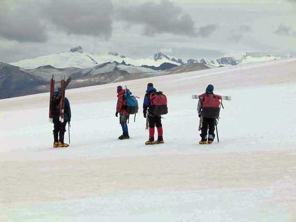
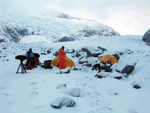
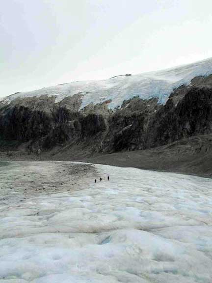
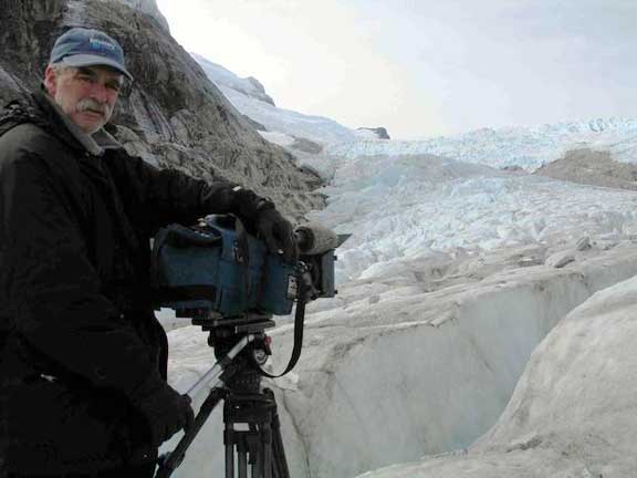
Today we got an early start; we packed light and hiked up to 600m elevation with the camera equipment, drilling gear, and sampling apparatus. The weather was very kind, as we did not get a drop of rain or flake of snow all day. We filmed the drilling and recovery of a reconnaissance core, collected a few surface snow samples and then hiked back down to the 300m camp.
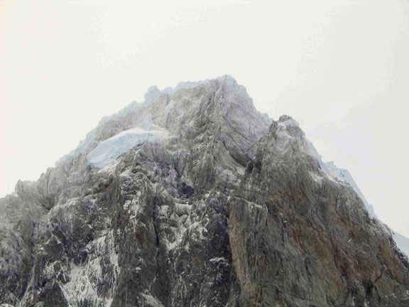
We encountered some serious crevasse fields on the way up that required a lot of doubling back in order to find a safe route, luckily we packed light! This kind of travel does not sound like much fun, but the sheer magnitude of this place is truly awe-inspiring. The drilling site was spectacular, situated at the base of a large icefall and flanked either side by towering snow-capped peaks (one of which was Mount Darwin) that sent deep rumbling echoes down the valley every five minutes or so (as a result of the frequent avalanches).
Tomorrow we plan to move the 300m camp back down to the old base camp site. It will probably take us at least a few days to get all the gear back down. As I finish writing this day’s log, the temperature is dropping and some rain is starting to fall, what will tomorrow’s weather bring?
Date: Monday, March 7th 2005
Time: 10:00 pm
Location: S 54.78676 W 69.56073
Temperature: 0°C 32°F
Wind speed: 20 mph 17 knots
Wind chill: -25°C 20°F
Altitude: 300m
Weather: Snowy and Grey
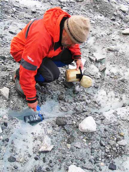
It rained all night long and turned to heavy slush at 09:00 this morning. By 12:00 the slush had turned to heavy snow and was accumulating fast. Erich and I took turns collecting fresh precipitation samples every few hours and everyone else spent the majority of the day either holed-up in their tents or pottering around camp in rain gear boiling water for tea. Visibility was down to less than 50m, far too risky to attempt the descent back to base camp, better to sit the storm out and wait for a brighter spell.
The snow and hail was relentless all day. At one point we thought it was clearing up, we spotted a patch of blue sky and then it was snowing again. The newly forming moulin surfaces froze overnight and are now building up a layer of snow on top. This makes them hard to see and quite hazardous to travel.
Moulins are typically formed as meltwater on the glacier surface plunges down a preexisting hole, crack, or crevasse. Holes form as melt water collects into pools on the surface of the glacier. The pools melt deeper and deeper into the glacier, becoming quite wide in the process. We threw a large boulder into one to see how deep it was and the boulder fell so far that we lost sight of it. Eventually, the pools melt deep enough into the glacier that they join up with subsurface melt water channels, draining in the process and leaving large, deep holes.
Date: Tuesday, March 8th 2005
Time: 10:00 pm
Location: S 54.77378 W 69.59059
Temperature: 12°C 54°F
Wind speed: 5 mph
Wind chill:
Altitude: 12m
Weather: Sunny
Woke up this morning to the sound of precipitation on the tent, I waited a while until it stopped and then went out to brush my teeth. To my surprise, there was about 6 inches of snow on the ground. This is not good as it will make the trip down more hazardous than usual. Everyone roused early and packed up the camp ready for descent, we left one tent up with some food in it as an emergency precaution for the second trip back up to collect the rest of the gear. We loaded ourselves up with back-breakingly heavy loads and set off down the glacier. The lead person used poles to probe the snow in front of him and everyone else followed in single file. After a few hours of staggering down the glacier, we arrived back at base camp. To our astonishment, our local grey fox had paid the campsite a visit in our absence and left us with several nasty surprises where our tents had been!
We rebuilt our camp in a clean new spot and said goodbye to Mike. Charlie had turned up in the Zodiac to transport him, his camera, and his personal gear back to Ocean Tramp. Paul, Erich, Andrei, Scott, and I are staying at base camp in order to make another trip up to the 300m site in the morning to collect the drill, tent, and remaining gear.
Later on in the afternoon the sun started to shine with gusto, soon the trees and rocks had sprouted loads of wet gear! I even plucked up the courage to take a quick dip in the glacier outwash stream. The dip seemed like a good idea to begin with, but after less than 30 seconds in the outwash water I had lost all feeling in my feet; it was so cold! It took me three or four dips to get all clean. Thankfully, the sun continued to shine and it warmed the feeling back into my poor little feet.
Date: Wednesday, March 9th 2005
Time: 11:45 pm
Location: S 54.77378 W 69.59059
Temperature: 8°C 46°F
Wind speed: 20 mph17.3 knots
Wind chill: 4°C 39°F
Altitude: 2m
Weather: Rain and Snow
One last mission to the 300m site was required to retrieve all our remaining gear. We hiked up amidst snow and rain, reached the 300m site within an hour (record time) and then hiked down with the remaining gear in less than two hours (another team record) thanks to Andrei’s expert route-finding ability.
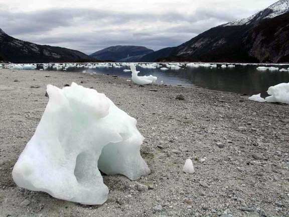
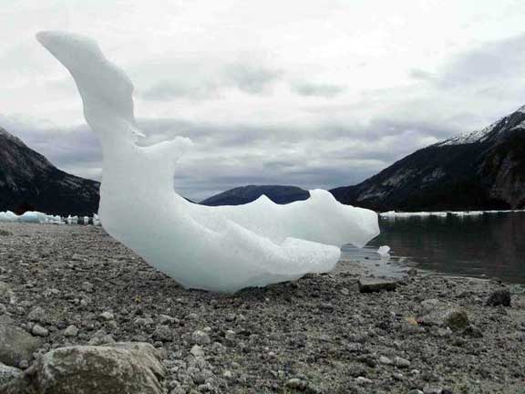
Back at base camp we had to dismantle the tents, pack up all the gear and then carry it all over to the beach ready for the arrival of Charlie in the Zodiac. Scott went back with the first load of gear and the rest of us waited on the beach amongst the stranded icebergs. Eventually, Charlie returned to pick us and the remaining gear up. The Zodiac ride back to Ocean Tramp took about an hour; we were accompanied the whole way by playful dolphins that kept trying to splash us. Charlie had also prepared his own special surprise for us, a piping hot chocolate drink with a touch of pisco added – the perfect warmer-upper on a cold, wet day.
Back at the boat we unloaded the Zodiac and dried ourselves off ready for dinner. Klara and Martin had prepared a lovely feast of steak and mash and after eating we all took turns to have warm showers, absolute luxury! We plan to head back to Puerto Williams tomorrow, but right now we are all focused on one thing only – a good nights sleep, sweet dreams!
Date: Saturday, March 12th 2005
Time: 02:00 am
Location: Puerto Williams
Temperature: 11°C 52°F
Wind speed: 16 mph 13.9 knots
Wind chill: 8°C 47°F
Altitude: 1.5m
Weather: Intermittent Sun and Rain
Yesterday we traveled back to Puerto Williams, the weather was pretty miserable; cold and wet for the entire journey. Despite the weather, the trip back was lovely; plenty to see and talk about along the way. We arrived at Puerto Williams around 19:00 and immediately set off to the local shops for some essential supplies. Mike and Scott managed to book tickets on the early morning flight to Punta Arenas and had to set about packing all their gear. Klara and Martin prepared a delicious curry for dinner, after eating we watched some of the spectacular footage that Mike and Scott had collected over the previous days. We are hoping that we get a day or two of Sun soon so that we can dry out all our wet gear.
This morning, we held a meeting after breakfast to decide what our next course of action should be. We decided that we had accomplished all that we could from the boat and that the rest of the trip would have to be conducted without Ocean Tramp. Our ideal sites would require more time to access than we presently have and the access would be better by helicopter. Ocean Tramp had provided us with a superb view of the coastal section of many glaciers, but our future work would definitely be best conducted by helicopter travel. There are many promising sites that most probably contain fantastic records for comparing to the Antarctic and we will definitely be returning in the near future. All in all, it was a very successful reconnaissance season. Our plan now is to return to Punta Arenas and ship the majority of our gear back to the United States. We will keep our tents, backpacks, and some light hiking gear in the hope of exploring part of the Southern Patagonian Ice Field for future ice coring sites.
After saying goodbye to Mike and Scott, the rest of the day was spent preparing for the trip back to Punta Arenas. Weather wise, we were somewhat lucky; the weather was intermittently sunny all day. However, mixed in with the periods of brief sun was plenty of rain. This made the task of drying out our stuff quite difficult. We spread all our gear out on the boat dock in order to catch as many of the sun’s rays as possible and we used several space blankets to cover everything up during the frequent rain showers. When the rain stopped we quickly peeled the space blankets back to expose all our gear to the sun. After several hours of messing around in this manner we finally had all our gear re-packed (only slightly drier than before) and ready to go. Paul spent most the day arranging transport back to Punta Arenas for our gear and us. The ferry did not have any room for passengers, but it did have room for our gear. The only problem was that it was not docking until midnight. Luckily, Paul managed to secure the last four seats on tomorrow’s Twin Otter flight to Punta Arenas, so we all have to move extra fast to get ready. We all dropped off some of our dirty clothes at the local lavanderia (laundry), this time the mother was home and running things. We also checked our email at the local town offices and did one last bit of shopping in the local tourist shops.
At 22:30 we filled Charlie’s truck with our first load of gear and headed over to the ferry-docking ramp. The ferry ramp was completely deserted so we unloaded our gear into a neat pile halfway down the ramp in the hope that we could be the first in line. I waited with the first load of gear as the truck drove back to the boat for another load. The wind was picking up so I arranged the gear into a makeshift wall for some protection. It was a beautifully clear night and there were countless stars twinkling and shining overhead. The surroundings were so quiet that I felt completely alone, as if I were in a ghost town. The only audible sounds were those of the wind and water. I could see the lights of Ushuaia radiating brightly from across the channel and I almost drifted off to sleep, it had been a long day. Twenty minutes later I was startled by the sound of Charlie’s truck returning with the second load of gear. By now it was 23:30 and we could see the lights of the ferry coming down the channel in the distance, it was going to be on time! By 23:45 the word must have gone around town because there were suddenly crowds of people surrounding the ramp in cars, trucks, bikes, tractors, you name it. Even though we were halfway down the ramp (near the water’s edge), there were still people driving their cars in front of us and pushing ahead of the queue. It was total chaos, a stark contrast to the serene scene I had experienced just an hour before. Once the ferry had docked safely we set about transferring our gear into the shipping container on board. By loading the truck fully and carrying two bags each, we were able to load up our stuff in one go.
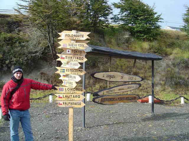
After a final count of our bags and boxes we left the bustling scene of the ferry behind and headed back to Ocean Tramp. Along the way we stopped off to explore the yacht club bar. The bar is housed in the upper deck and bridge of a sunken old military supply ship, the Micalvi, which also doubles as the yacht club jetty. The Micalvi is a popular stopover for sailors who visit Antarctica across the Drake Passage. Being only 100km north of Cape Horn and also providing hot showers and a mean pisco sour, I can see why.
Date: Sunday, March 13th 2005
Time: 22:30 pm
Location: Punta Arenas
Temperature: 13°C 55°F
Wind speed: 20 mph 17.3 knots
Wind chill: 10°C 51°F
Altitude: 1.5m
Weather: Sun and Rain
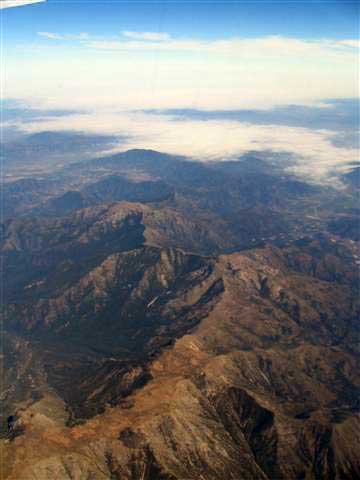
Our Twin-Otter flight to Punta Arenas yesterday was quite spectacular. Our carry-on luggage had to weigh in at less than 10kg because the plane was so full. Our pilot flew directly over the Cordillera Darwin and, as luck would have it, the skies were quite clear. We all managed to secure window seats and were treated to a wonderful aerial view of the glaciers and mountain peaks where we had just been a few days before. The flight ended with an impressive swooping dive landing into Punta Arenas airport, quite exhilarating!
After eating a delicious churrasco for lunch we tried to find the airline and cargo companies in town. Unfortunately, most Chilean businesses close at midday on Saturdays so we will have to wait until Monday. Mike and Scott were still in town and we arranged to meet up for some dinner at a local restaurant. After dinner we wandered around town to examine the local nightlife, as it turns out, the locals have a great love for karaoke.
The ferry arrived at 14:00 today with all our gear safely on board. The weather was fairly good with a fair amount of sunny spells. Erich and I unloaded all our bags onto the adjacent beach and proceeded to set up all three tents so that they could dry out. Several people were watching us from their cars and giving us looks as if they thought we were mad! Andrei and Paul joined us and helped unpack the rest of the gear over the beach, things were starting to look like a laundry again! The wind was quite strong and gusty, so we had to cover most of our gear with large rocks to stop it blowing away. We left things out for as long as possible, but then an advancing rain cloud forced us to repack everything in a hurry. Andrei managed to make a deal with a local bloke in a white van and soon we were heading back to the hotel with our mass of bags, barrels, and boxes. Tomorrow we will head over to the cargo company and try to ship all our heavy gear back home.
Date: Monday, March 14th 2005
Time: 22:00 pm
Location: Punta Arenas
Temperature: 12°C 54°F
Wind speed: 10 mph 8.6 knots
Wind chill: 10°C 51°F
Altitude: 1.5m
Weather: Rain and some sun
This morning Paul and Andrei left early to try and arrange gear shipping to the U.S. Unfortunately, we could not find a company that guaranteed sufficient speed and security through customs and consequently we will have to hand-carry everything back with us on the plane.
As a result of having to carry all our gear with us, we have to alter our reconnaissance plans; we will no longer explore the more northerly areas, but will instead rent a small room in our hotel for the gear and then explore the southern tip of the Southern Patagonian Ice Field, the Torres Del Paine. We re-booked our plane tickets and then booked bus tickets to Puerto Natales for tomorrow, this will be the first step of our journey to the Torres Del Paine. We also had to book a camping spot in advance so that we will be allowed to pitch our tents when we arrive.
Date: Tuesday, March 15th 2005
Time: 21:00 pm
Location: Torres Del Paine
Temperature: 10°C 50°F
Wind speed: 15 mph 13 knots
Wind chill: 7°C 45°F
Altitude: 50 m
Weather: Rainy
This morning we packed our backpacks light and brought two tents with us ready for a few days hiking. We moved all our gear into a small room at the hotel and then checked ourselves out. By 09:00 we were on the bus trundling towards Puerto Natales and the Torres Del Paine. The landscape outside of town was very flat with extensive fields covered by small, scrubby bushes. We passed by farms with sheep, cows, horses, and even emus/ostriches!! As we continued driving north, the plant life became more tree-like and eventually the landscape became littered by small copses. Every few kilometers along the highway there were small shrines set up ~1-2m from the road, most of these shrines contained crucifixes and some even contained freshly cut flowers and candles.
In Puerto Natales we were befriended by a local girl who showed us where to buy bus tickets for the next leg of our journey. After buying tickets, we found a place to eat and had a little lunch. The bus journey from Puerto Natales was basically a 3-hour ride down a bumpy dirt track. The roads were so rough that the buses spent as much time on the centerline as possible (because the edges were the roughest), this resulted in several games of “chicken” between buses traveling in opposite directions.
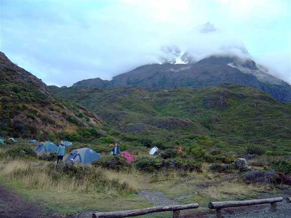
After much vibration, we arrived at the Torres National Park. We left the bus and crossed the Lago Pehoe by boat, eventually arriving at the Refugio Pehoe. During the trip across the lake the weather began to clear and we caught a brief glimpse of some spectacular mountain peaks towering over us. By now the light was beginning to fade, so we pitched our tents and headed into the Refugio to get some food.
Date: Monday, March 21st, 2005
Time: 23:00 pm
Location: Punta Arenas
Temperature: 14°C 57°F
Wind speed: 12 mph 10.4 knots
Wind chill: 12°C 54°F
Altitude: 1.5 m
Weather: Bright and wet
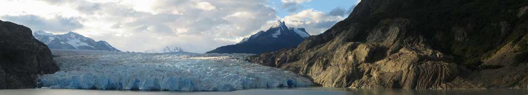
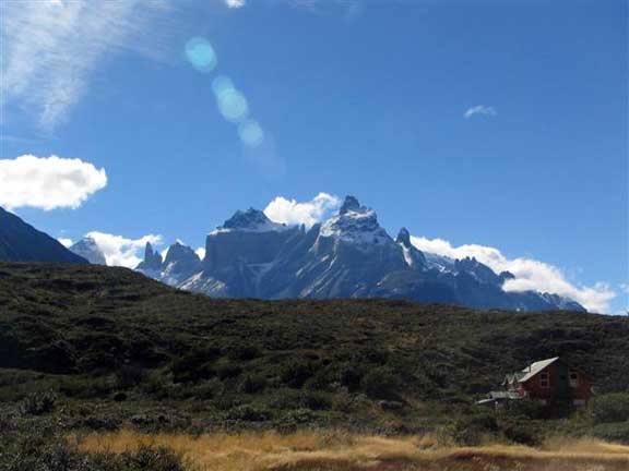
The Torres Del Paine became a National Park in 1975 and was recognized by the United Nations as a World Biosphere Reserve in 1978. It is internationally recognized as one of the most beautiful and unique places on the planet. Its position at the southern tip of the Southern Patagonian Ice Field results in numerous rivers, lagoons, and lakes formed by runoff from the ice field’s many glaciers, of which, one of the most spectacular is Grey Glacier. The name “Paine” (pronounced “pie-nee”) comes from a Tehuelche Indian word meaning blue. The “Torres” are named after three spectacular granite peaks, the highest reaching 2900m, which form part of the Cordillera Paine mountain range.
After spending several days hiking through the park and studying its glaciers, we saw several promising sites that we may attempt to access during future trips to the area. We will have to obtain and study recent high-resolution satellite imagery in order to determine which of these sites is the best.
Upon returning to Punta Arenas, we began preparing ourselves for the journey home. We dried out our tents and then unpacked and re-packed all our bags one last time to make sure that we were not carrying any fuel, food, or matches. In the evening we all went out for our last Chilean meal, I ordered Congrio a la Plancha con Arroz (oven baked conger eel with rice) and it was absolutely delicious! Tomorrow we will catch our plane in the morning and then travel for two days before getting back home to Maine. Lets hope that all our luggage makes it this time.
When we get back to Maine, we plan to visit the classes that have been following us on our adventure; there will probably be many questions to answer. We look forward to answering all the questions and showing the many beautiful photos that we have taken along the way.