
Late-Glacial Chronology of Moraines in East Greenland
Late-Glacial Chronology of Moraines in East Greenland
Thomas Lowell (University of Cincinnatti)
Meredith Kelly (Lamont-Doherty Earth Observatory)
Brenda Hall (University of Maine)
August 14, 2004 to August 31, 2004
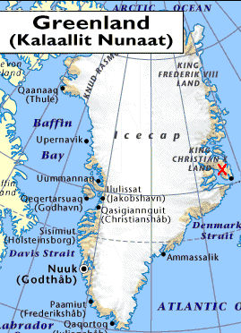
After the successful mission of the Turmoilto Scoresby Sund, eastern Greenland, in 2003 it was decided that shock troops were needed on the ground to verify several working ideas developed from aerial surveys. The basic problem is the extent of glacier ice during the Younger Dryas and how much of a climatic change that extent represents. This separates into two problems 1) which of the numerous lateral moraines are truly Younger Dryas in age and 2) how large of a climate cooling is needed at that time. As is typical of many field problems the challenge is to demonstrate the age of the moraines.
For this first effort a relatively small, simple glacier draining off the southeastern side ofthe Stauning Alps was selected. The river flowing in this valley is the Gurreholm. It turns out David Sugden and Brian John had visited this area in the mid 1960’s and studied the emerged deltas at the valley mouths. From their work and others it was deemed a safe bet that marine shells were in sufficient supply to verify or modify the existing uplift curve. A second, independent dating approach is necessary and for this exposure age dating of 10Be accumulating in quartz crystals was selected.
The team was three: Meredith Kelly, a newly appointed post-doc at Lamont, Brenda Hall, a newly appointed Assistant Professor at the University of Maine, and Tom Lowell an old fart from the University of Cincinnati. Meredith did the work of planning and obtaining all the necessary permits from the Danish Polar Center, a job ending up larger than  expected. She willbe responsible for generating the exposure age dates subsequent to the field season. Brenda was asked to draw upon her Antarctic experience and develop a new uplift curve from the radiocarbon dating of emerged shells. Tom was to carry the gun, pound rocks, and dig pits.
The team flew into Constable Pynt on 14 Aug 2004, moved to Gurreholm that night and began field work the next day. During the next two weeks we worked out of three camps along the valley sampling shells, rocks, and mapping moraines. Eventually we were able to collect some 40 shell samples, some 36 rock samples, and obtain preliminary measurements on former snowlines from three different moraine sets. It will take some time to get the chronological data back to verify the age of the moraines, but all indications are that we bracketed the Younger Dryas moraine(s) and can thus produce an estimate of the climate change around the Stauning Alps.
14 Aug 04 – Arrive Constable Pynt and put in Camp 1
Brenda missed her flight on the 12th but arrived just in time for the flight to Constable Pynt the morning of the 14th. She spent a total of 2 hours in Iceland. We took a charter flight from Reykjavik to Constable Pynt and arrived in the late morning. Constable Pynt airport was bustling with a group of French passengers who were going onto the Tara, a French sailing ship. Finally, we met the security officer, Klaus, and he introduced us to the Danish Polar Center logistic coordinator, Aka. We had plenty of time to get our gear organized and packed because the helicopter ops could not begin until shuttle service from Constable Pynt to Scoresby Sund was completed. We also had the luck of getting a large block of cheese to take with us from the friendly cook at the station. At 19:00 we departed Constable Pynt and had the first views of Jameson Land and the Stauning Alper from the air. The first camp was located between Gurreholm Dal and Holger Danskes Briller (71°23.3 N, 24°44.6 W, 180 m.a.s.l). We discovered rings of boulders that showed that others camped there before.
15 Aug 04 –– The calibration walk
We began the day examining moraines west of Camp 1. We discovered that a tributary glacier had almost reached the well-defined moraines in the Holger Danskes Briller valley. First rock samples of the season were taken from boulders on outer moraines in Holger Danskes Briller valley. The last sample, acknowledged to be a “very hard rock” proved the need for a means to sharpen the chisels after use. This was our first experience conducting a “deep etching project” to retrieve the sample. Our first wildlife sighting was a lone musk ox on the valley floor. By early evening we needed to find an alternative stream crossing to return to camp. This was found at 23:20 well downstream from moraines. The distance on the air photograph did not seem like much, but it turned out to be 17.6 km and 1275 m of relief that we walked. Although we missed supper on this day, we got the benefit of two suppers the next day.
16 Aug 04 – The first shells – Gurreholm Slugt
Since supper was so early in the morning we had a later start toward the Gurreholm Slugt. We interpreted one area to be a moraine bank and found the first shell samples on a terrace along the river. At this site we also found a death assemblage – a collection of bones from small to large mammals. From there we followed the stream down and sampled shells at four sites. We began to realize the importance of colluvial processes in the region – where exactly are the shells coming from? Later in the afternoon we saw an arctic fox on the present outwash plain. It had been T-shirt weather early in the day, but we needed long sleeves by evening. We walked 11.6 km and 840 m of relief. The second supper of the day was later in the evening ~23:00, but at least on the same day.
17 Aug 04 – The long walk into Holger Danskes Briller
Since we now had the air photograph calibrated and a good stream crossing identified we decided to undertake a long walk to the moraine/ice-contact delta in the Holger Danskes Briller valley. The landform is classic in shape, but we could not find shells on it so we sampled three boulders on the ice-contact slope. Once the delta is dated, we can use these samples to cross-check the exposure technique. The last rock sample was relatively easy to dislodge. However, Tom?s hammering skills proved to get the best of the sample before it was finally retrieved. We had heard a strange noise that we thought was the call of a bird until we realized a fox on the delta was barking at us. The racket of our hammering had obviously upset him. He barked at us and followed us carefully until we left his territory. The return trip uncovered an extensive shell deposit about 68 m a.s.l. We saw a total of 5 mosquitoes, which we jokingly complained about, realizing the situation could be much worse. The stream crossing on the return to camp was much simpler with rubber boots. We walked 19.7 km and 980 m of relief. Supper was fashionably late, again on the same day.
18 Aug 04 – The southwest laterals of Gurreholm Dal
The morning weather was overcast with low clouds and light winds. We planned to sample boulders on the lateral moraine set on the southwest side of Gurreholm Dal. The downslope portions of these moraines are very dissected and difficult to trace, but well-formed at elevations of 350 m a.s.l. We walked to the upvalley limit of the outer moraine at about 410 m a.s.l., where the moraine becomes a small fan deposit. This elevation may approximate a former ELA position. The three main moraines range over some 60 m in elevation. We retrieved four rock samples on the upper moraine, one on the intermediate moraine and one on the lower moraine. These samples will form a sequence for this side of the valley. Six samples turns out to be a record number of samples in one day for Meredith and we are now claming it as a record for Scoresby Sund. An early dinner at 22:00 – we are starting to get the schedule moved back toward normal. We walked 10.7 km and 680 m of relief. It was a full day of hammering on rocks and the arm muscles are developing nicely, but the need for chisel sharpening is getting dire.
19 Aug 04 – More shells – Konglomeratelv
We descended from camp along the east side of Konglomeratelv to collect shells to define the uplift curve. Weather in the morning was partly overcast, but turned sunny in the afternoon. At 105 m a.s.l. we started to find shells and continued to do so down until 36 m a.s.l. We found multiple shell samples from stream exposures but only rarely did we observe shells in their stratigraphic context. We spent considerable time discussing this problem. The species of shell varied with elevation – Mya truncata at higher elevations and more varied at lower elevations. A total of 14 samples put the shell tally in the lead of the rocks. Supper was at 20:30, with time even for hot chocolate. We walked 14.3 km with 780 m of relief.
20 Aug 04 – A big boulder – Gurreholm Slugt
We returned to the area identified as a moraine bank and to the Gurreholm Slugt to measure relic shorelines and sample boulders on the moraine bank. Brenda found the best example of a relic shoreline at about 128 m a.s.l., which may or may not correspond to a sea level of 134 m suggested by Sugden and John in 1965. The general surface texture was observed to change at about 128 m a.s.l., with a smooth surface below and a glacial signature above. On the moraine bank we employed our extensive rock climbing skills toscale the “big boulder” and retrieve a rock sample. Since bigger is better, this was a no-brainer sample that Meredith had been dreaming of for a couple of days. The top was weathered a bit but with a moderate amount of work we got the prized sample. The rock and shell samples from the moraine bank should allow us to date the same feature with two different techniques, providing a cross-check of the methods. We retrieved a total of three rock samples for the day. Since we got home “early” Tom decided to core the small lake above camp. He only got about 15 cm of section with the improvised corer, and it most likely is too young to help this project. We walked 7.7 including the boulder). The evening clouds had the look of snow.
21 Aug 04 – On to Camp 2 – The outer laterals of northeast Gurreholm Dal
We scheduled a camp move for 10:00, but the morning fog forced us to wait until around noon. Camp 2 (71°25.2N, 24°38.7W and 182 m) was located on the shoulder between Gurreholm Dal and Muslingeelv with a good view to bedrock cliffs of Karstryggen. The helicopter measured a temperature of 9°C and the afternoon was warm. We examined the moraines above camp and discussed tentative correlations and the nature of deglaciation. We also examined boulders on a kame terrace below the lowest prominent moraine and discussed a strategy to date the outer moraines in northeast Gurreholm Dal. We walked down into the valley and discovered that bedrock and unconsolidated deposits are difficult to understand. Only 5 km of walking, an easy day. A file to sharpen the tools arrived- what a good idea.
22 Aug 04 – Shells along the “Staircase” – Muslingeelv
The long awaited trip to the famous “Staircase” is today! Last night a light frost left traces around camp and scattered clouds had the look of snow squalls. But a persistent north wind kept the flies away. We worked down to Muslingeelv (which Brenda thinks means shells) stopping first at the highest deltas. We did not have much luck finding shells in the coarse sediments directly associated with the deltas, but we did find them in adjacent fine grained sediments. More thought is required to connect the shell dates with a specific former sea-level elevation. This point was discussed at some length in the field. Another topic for discussion is where the shells are coming from. We typically found them where active slumping is bringing them to the surface. In the end, 16 sites yielded shells. We walked 16.4 km and 830 m relief.
23 Aug 05 – Wildlife day – the “animal” moraines
Return to, examine, and hammer rocks on the moraines above Camp 2 was the day’s plan. Another frost overnight but high clouds in the morning gave way to completely clear skies by evening. During the course of hammering rocks, the wildlife count for the day was a record: 6 geese, an arctic fox, 4 musk ox, 5 arctic hares and two snowy owls. Given that the various types of animals appeared to prefer certain moraines, we informally named the moraines the Owl, Fox, Rabbit, and Musk Ox moraines (from innermost to outermost). We examined moraines and drift outside of the Musk Ox moraine that should be older than the “animal” moraines. These drifts contained limestone clasts indicating that a glacier lobe from Schuchert Dal intersected the glacier in the Gurreholm Dal. Two samples were retrieved from large boulders on a limestone bedrock surface east of Muslingeelv. These samples should help us identify the last time the two lobes merged. Two boulders on the Musk Ox moraine were sampled as well. We walked 12.2 km and 660 m of relief. We decided that very few boulders in the field area are ideal as samples for surface exposure dating and that compromises are necessary.
24 Aug 04 – Shell clean up – Gurreholm Slugt
We made another trip to the “Staircase” (the western side this time) to cover the area. We did not have much luck with the shells along the way but worked down to the active outwash stream below the deltas. There frozen delta sediments are exposed and undercut where the stream is eroding the lower levels of the delta systems. We worked up along Gurreholm Dal and noted the various types of drift which appeared to be mostly at depth. We had extensive discussions about the evidence for former sea levels. A flat-topped deposit of sorted sediment was observed well up valley from where the most likely grounding line is defined. If this deposit is a delta it confirms the idea of former sea levels at about 130 m a.s.l. elevation. No shells were found near the deposit. We continued on to the Owl moraine (the innermost of the animal moraines) and located a granitic boulder associated with striated sandstone bedrock. This “very hard rock” was a two day project but we got a good start on it in the evening. We walked 15.7 km and 615 of relief.
25 Aug 04 – Boulders on the “animal” moraines
Since we had a start on one sample we decided to hammer boulders along the Owl and Fox moraines. The forecast called for increasingly wet weather during the day, but it turned out to stay pleasant all day until the wind picked up in the evening. This was a day to pound rocks so we did. The rocks lost this round as we ended up with 6 samples. The other data we gathered was that the Fox moraine suggests a former ELA level of about 400 m. Since the Fox and Owl moraines are the lowest moraines on the northeast side of Gurreholm Dal, this ELA estimate should bracket a maximum ELA drop. On the return trip to camp, we walked along the Rabbit moraine searching for potential samples and surprised a small herd of musk ox. Actually, in this situation it was difficult to tell who was more surprised. On our return to camp, we discovered that a musk ox had walked through our bear wire, breaking it on one side on its way in and on the other side on its way out. We walked 8.9 km and 750 m of relief. Of course it is hard to cover much ground when one pounds on 6 rocks in one day.
26 Aug 04 – The rain starts – some rocks
Weather finally had some influence on the work today. Heavy rain and high winds had begun on the prior evening, and we decided to collapse the cook tent to avoid losing it. That plan worked, but it was a challenge to get the tent back up in the morning. The horizontal mixed precipitation continued throughout the day, and we decided to continue sampling on the Rabbit and Musk Ox moraines. We got two rock samples on the Rabbit moraine but found the boulders on this moraine to be much more eroded than those on the Fox and Owl moraines. Spreading the samples out over the various moraines should allow us to document retreat and to check that the exposure ages fall in a consistent stratigraphic order. It took some 8.7 km of slogging around in the rain and 1050 m of relief to get as wet as we did. When the clouds began to clear in the evening, fresh snow could be seen at higher elevations. Brenda and Meredith had a hunch that the “space heater” noted on Tom?s list of supplies for future work was prompted by the recent weather.
27 Aug 04 – Rocks at Gurreholm Slugt, shells at Muslingeelv, and striated limestone bedrock
The weather started out windy and rainy so we warmed up by sampling two boulders near Gurreholm Slugt. These boulders are on a deposit that is an apparent continuation of the moraine bank on the southeast side of Gurreholm Slugt. The samples can be combined with samples from across the river and should give a exposure age on the moraine bank. After a warm-up lunch back at camp, we descended into the Muslingeelv valley. Previously we had spotted what we thought might be small deltas in the upper parts of the Muslingeelv, so they were worth a look. The features in question did have some shells but they did not appear to be deltas because diamictons were exposed at the surface. Four shell samples from these deposits will help define the sea level curve. The limestone forms the cliffs above the Muslingeelv. The bedrock surface above these cliffs was intriguing because of its glaciated appearance and the presence of numerous perched boulders. We had to climb up and look around – if just out of pure curiosity. The surface showed beautiful striae and roche moutonnee forms, carved by a glacier out of the Schuchert Dal. We examined these features and discussed how this area might be suitable to conduct additional sampling to get at the questions of erosion on boulder surfaces and exhumation of boulders from within drift. If we can obtain a field-based estimate for these it will improve the surface exposure age calculations. Because limestone was a theme for the day, on the return to camp we traced drift containing limestone. This “limestone” drift gives us the maximum extent for the Schuchert Dal glacier, an important consideration when we start reconstructing the glacier geometry. We walked 17.1 km and 1760 m of relief. Clear weather had settled in by the evening.
28 Aug 04 – On to Camp 3 – The upper Gurreholm Dal laterals
The general objective was to move camp to the upper part of the Gurreholm Dal, near the prominent lateral moraines and the Little Ice Age deposits. When the helicopter picked us up at Camp 2 the temperature was 9° C but when it left us at Camp 3 it was 2°C. Why are we moving toward the snow? Brenda looked the situation over carefully and decided that she had better get back to teach class, so Meredith and Tom had to carry on. Camp 3 (71° 31.9 N, 24°52.9 W, 640 m a.s.l) was located on a terraced boulder field above the highest well-developed lateral moraine on the northeast side of Gurreholm Dal. We hiked up valley to the end of the laterals to measure an estimated ELA of 752 m a.s.l. On the way back, we collected 4 rock samples along the moraine crests. One of these was on a “big boulder”. Sampling boulders is much more fun when there are only two people to hammer. We walked 9.0 km and 800 m relief (mostly tallied in two good sized gullies cutting the moraines). While cooking dinner back at camp, we had a visit by an honored guest. A young fox walked right into camp and decided to investigate our tents, but was scared off when the plastic under one of the tents bit him back.
29 Aug 04 – Little Ice Age
The weather improved some, but clouds hung around the high peaks all day. Tom?s brilliant idea that he came up with in a nice warm sleeping bag was to attempt to get to the Little Ice Age lateral moraine/trimline to measure the representative ELA. The plan seemed “simple” – walk over the Little Ice Age drift and investigate the nature of the drift, then continue either around the side of or on the largest tributary glacier in this system to where the lateral moraine/trimline of the Little Ice Age starts. On arriving at the glacier margin we saw that the fresh snow extended down to the current glacier margin. We recognized this as an important clue that the ablation season for this year is over. We continued along the margin of the glacier until it was a low enough slope for us to get onto the glacier surface. After being stymied by a persistent supra-glacial meltwater stream and observing some refrozen ice on the glacier surface, we made strategic retreat at 900 m elevation – still about 3 km away from where the Little Ice Age lateral moraine/trimline starts. One important observation was a small piece of a terrace that appears to be continuous with the well-developed laterals below Camp 3. The ELA measured yesterday needed to be re-measured to include this terrace. It was also observed that the Little Ice Age drift is at least two different ages so we will have to be careful in picking which one to use as a base for ELA differences to older drifts. The day was almost finished when one final stream which had boulders covered with algae provided an interesting crossing. We walked 17.3 km and 1140 m of relief, again through the two gullies.
30 Aug 04 – Finish up and pull out
Scheduled the final helicopter pick up for late in the day – just in time so that the Constable Pynt airport staff did not need to work overtime. The weather started out hazy with a solid frost overnight. Later in the day it cleared with a north wind, but clouds built later. On the moraines below camp we sampled three more boulders, totaling at least 5 on the upper lateral moraine. After the helicopter pick up we flew up valley and made first approximate elevation measures of the Little Ice Age ELA, the ELA of the well-developed upper lateral moraines, and the elevations of some high (last glacial maximum?) trimlines. From this exercise it would appear that the ELA depression represented by the lateral moraines below Camp 3 is 270 m. The ELA depression represented by the moraines near Camp 2 is about 700 m. The last day was a record easy day with only 2.8 km of walking and 280 m of relief.