Glacial History and climate reconstruction from the South Island, New Zealand
George Denton, Marcus Vandergoes
January 1, 2004 to February 28, 2004
The goals of this project are to produce detailed reconstructions of glacier history and climate change during the last 30,000 years (Late Quaternary). Mapping of glacial deposits to determine past ice limits will continue along the West and Eastern margins of the New Zealand Southern Alps (G. Denton). Lake sediment samples and lake cores will be collected (M Vandergoes) and used to develop high-resolution records of temperature change through the analysis of the fossil remains of non-biting midges. These records will allow interpretations of the timing, structure and magnitude of climate change in New Zealand during the Last Glacial Maximum and deglaciation (c. 30,000-10,000 years before present), and be used to test hypotheses related to the cause and global distribution of ice ages and rapid climate change.
Marcus has sent us some postcards:
“Hi all, well here it is a postcard from New Zealand. While you guys have been freezing back in Maine we have been enjoying a South Pacific summer of mixed climate ranging from 29°C hot, dry days to torrential rainstorms and high velocity winds. All this has lead to an interesting field season so far.
“Well that’s about all so far. All in all things are going well. At the beginning of the season we set out to collect a minimum of 25 samples from varying lakes and tarns at different altitudes. Today we collected our 31st sample. I hope to send another update soon. Until then it’s goodbye from N.Z.”
Week 1 Postcard
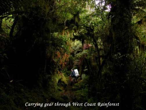
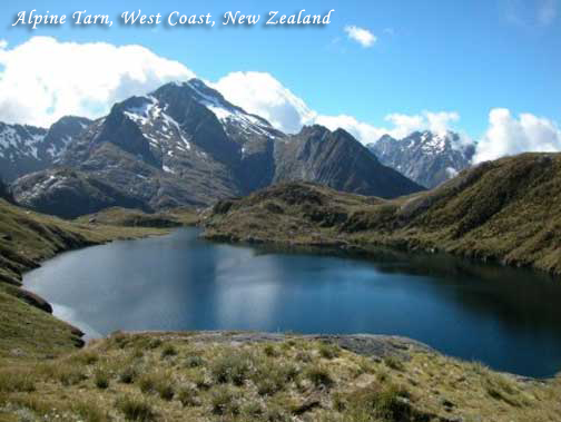
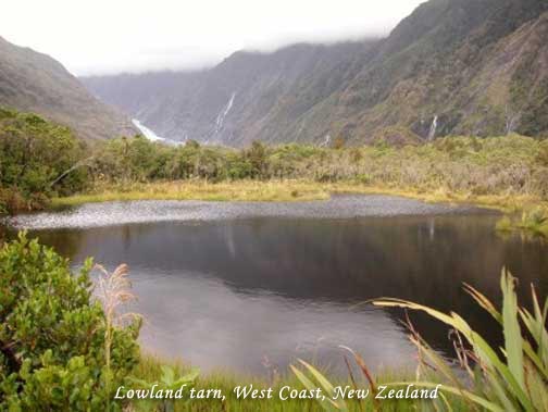
Started off on the western side of the South Island where we were greeted in true West Coast style by 2 days of torrential rain. This halted our plans to fly into some sites so we concentrated on collecting samples from low altitude tarns that had road or foot access. As we worked our way down the West Coast to glacier country the rain eased but continued to persist enough to stop us from flying into the higher altitude sites in the mountains. As a result we spent two days walking to lowland tarns through thick, wet rainforest. Normally this is a nice experience but when you are walking along overgrown tracks carrying an inflatable boat and a pack full of coring gear the appeal of the forest seems to disappear. Finally the rain stopped enough to allow us to fly into the mountains and sample sites above 1200 m. However, this was short lived as 2 days later the clouds came in again so stopped all flying.
Week 2 – 3 Postcard
From there it was back to the eastern side of New Zealand’s Southern Alps to begin some sampling in the drier side of the mountains around the Rakaia Gorge. Hear we met up with George Denton’s glacial mapping field team. Between flying into higher altitude tarns above 1600 m we also spent time coring swamps within the moraine ridges of Late Glacial and Last Glacial Maximum ice advances. This is to provide material for paleoclimate reconstructions using pollen and chironomids as well as dating material for minimal ages for ice recession in the area. The coring at each site was a success but tested the endurance of the field team, the equipment and resulted in some interesting four-wheel drive and off road experiences.
Week 4 Postcard
Week 4 brings us further south along the eastern side of the Southern Alps to the inland district of glacial Lakes Pukaki and Tekapo. We sampled a number of tarns in this area last summer and our main focus this time around is to fill in some gaps in the data set and try to collect material from tarns above 2000 m. This is not always successful (as we were about to find out), as many of the tarns above 1900m do not hold fine sediment from which we take our bug sample. Unfortunately we spent a day visiting a number of sites that were not suitable for sampling. The bonus was we got to see some amazing mountain scenery and glacial landscapes. High winds kept us grounded for a few days and gave us the opportunity to re-core a Late Glacial site we are currently working on and do a spot of fishing.
Week 5 Postcard
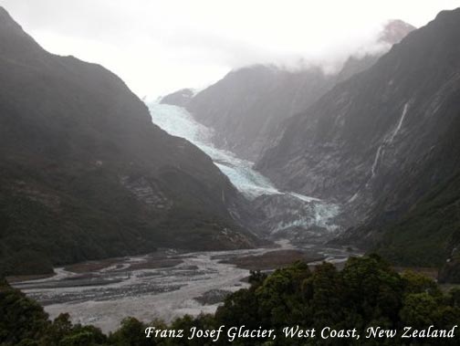
Moved back over to the West Coast to Franz Josef Glacier to join up with George Denton’s mapping team to survey and sample some moraines in the area. We spent a day digging at the base of a moraine extracting wood for radiocarbon dating. The wood obtained from this site will hopefully provide additional, more precise ages to constrain the timing of Late Glacial ice advance in the region. We are also spending the next few days finishing the sampling of higher altitude sites in the area that we were unable to do earlier on in the season due to weather conditions.